Recently, reader Gregg D'Albert wrote to tell me about the "hypercities" project at ucla.edu. This is an archive of historical maps of Los Angeles city and county that you can view in their original form, and also view as overlays on today's Google maps. Got a few minutes to explore a little? Whenever you're ready, begin by opening the URL below into a new browser tab or window:
The site does have some limitations. For one thing, it can't be used with Internet Explorer. The interface is also a bit confusing at first. Here's how to view the maps and overlays.
First, go to the upper right of the map, and change the view from Satellite to Map. While you're up there, click the X box in the upper right of the sidebar to reveal the map selection menu.
Next, click the green button at upper left. Then, browse the available maps in the sidebar. Mouseovers of each menu item show the area covered by that map.
My favorite one to start out with is the 1898 "Official Map of the County of Los Angeles California." Click on that item in the sidebar, then wait for the map to load at left. (This can take awhile if you have slow DSL like I do.)
Now notice that there is a slide control inside the map's sidebar item. Move that back and forth to adjust the transparency of the historical level.
With the 1898 map, though, I recommend first just inspecting it as is for awhile. Zoom in there for a close look (remember to be patient as the historical map loads). The details are really fascinating! Find where you live now and see it as it was just over 100 years ago, and be amazed at the changes that have occurred here in the span of only 1-1/2 lifetimes...
Another one that's fun to explore is the 1897 Maxwell's City Directory street map. See Wilshire Boulevard when it was only 4 blocks long!
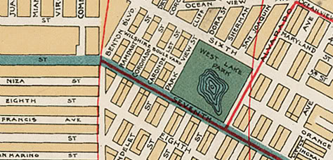
From 1897: The new Wilshire Boulevard at upper center (ats.ucla.edu).
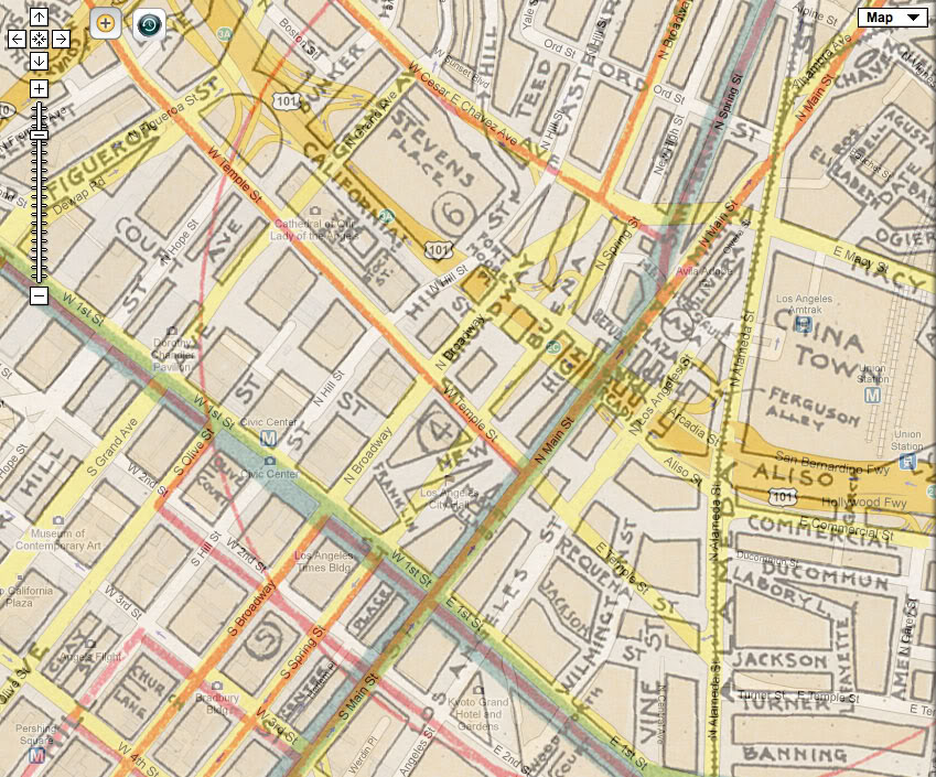
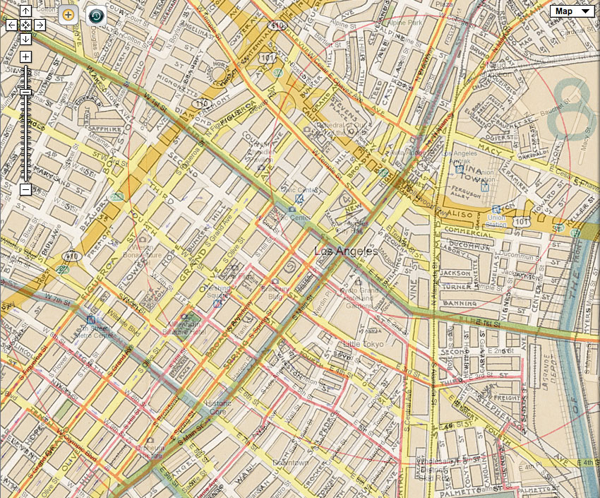
Here, also, are two much better overlay "then and now" maps of the streets of Downtown than I presented in this post.
I hope the folks at ats.ucla.edu won't mind me reproducing this small portion of its wealth of old maps! That hypercities site really is quite addictive, I must say.
1 comments:
Years ago I bought a box of L.A. city maps ranging from the '20s (Bekins) through the '40s to the '60s (mostly oil co maps), on ebay. I'd always been interested in finding out, among other things, the exact location of Berkeley Place, which the Santa Monica Fwy took out. Those maps helped, and with tracing the development of the city in many other ways. But the UCLA project is, of course, a much easier and more comprehensive way to explore the old city. Thanks for bringing it to my attention. Back to Berkeley Pl for a minute--the first photos of it I've ever seen are in Houses of Los Angeles 1885-1919. Have you ever done any research on Berk Pl? If not, I think it's a project that has your name all over it.
Post a Comment