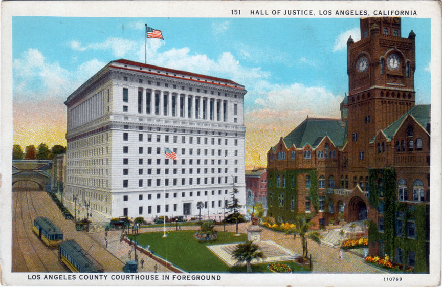
In the top one, the intersection in the foreground is Broadway and Temple, and we're looking roughly north. At left, where the Broadway Tunnel and those trees are – that's where the 101 freeway "slot" is today. You'll recognize the 1922 Hall of Justice, of course, and the red sandstone building at right is the old Los Angeles County Court House (1888).

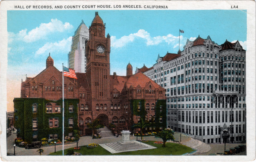
Now turn 90 degrees to the right, and see the familiar 1928 City Hall rising behind the Court House, and the Hall Of Records (1910) at right.

Judging by the similarity in the ivy growth on the Court House, I'd say that the two postcard photos were taken within a year or two of each other. The cars in the top one definitely look '20s-ish, and the presence of the new City Hall in the bottom image means it can't be earlier than 1928. So 1928-1930 seems a good guess for when this point in time existed in Los Angeles's past...
2 comments:
So this is Poundcake Hill... if I'm following the peregrinations of the high school correctly. Do we know the derivation of the name?
It was shaped like a poundcake.,
Post a Comment
Note: Only a member of this blog may post a comment.