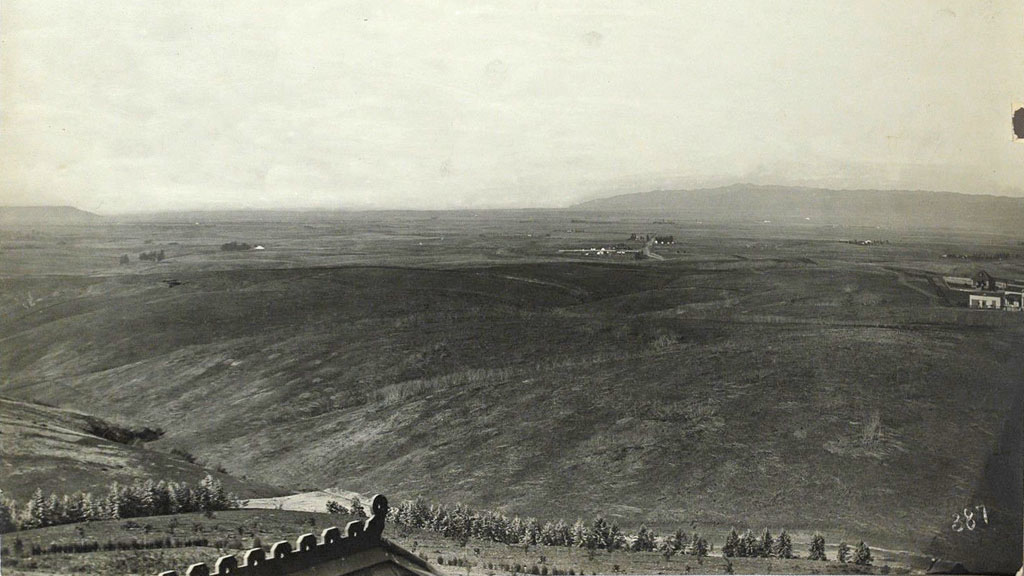
This has to be one of the more remarkable images of historical Los Angeles that I have ever seen. The year is around 1886, and we're looking south toward what would become Long Beach from the present site of Belmont High School, near the intersection of Beverly Blvd. and Glendale Blvd. In the far distance at right is the still-recognizable profile of the Palos Verdes peninsula, at left, the Santa Margarita Mountains by San Clemente, and in between, what today is solid cityscape was then nothing but sparsely-settled open rangeland as far as the eye could see.

Click image to enlarge.
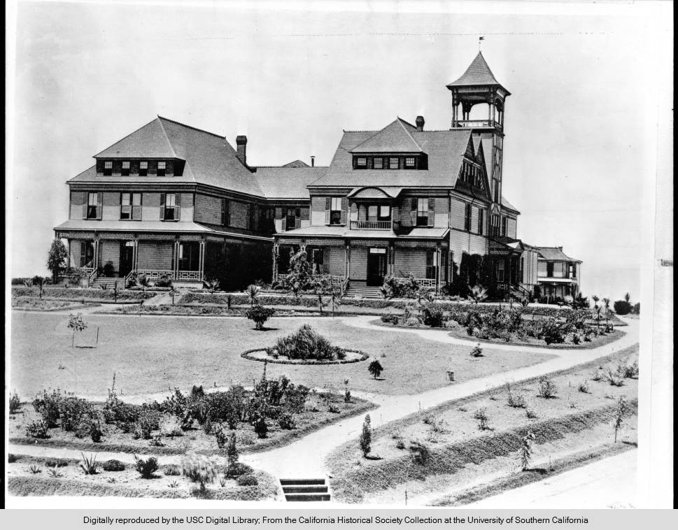
The photo was taken from the roof of the Belmont Hotel, which was located atop Crown Hill at the end of the old Second Street Cable Car line.

Courtesy U.S.C. Digital Library, California Historical Society.
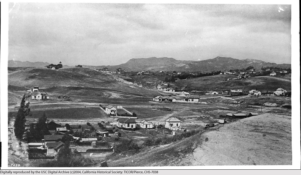
The contemporaneous photo below shows the Belmont Hotel (upper left) as seen from Bunker Hill. The vantage point is near what would later become Hope Street overlooking Third Street (the road at the extreme left edge of the photo is Third). Today, the Harbor Freeway (I-110) runs left/right directly through this little valley. The familiar hills overlooking Hollywood can be seen in the distance.

Courtesy U.S.C. Digital Library, California Historical Society.
To learn more about the historic Belmont Hotel, click here.
I love this! I lived in this area when I was a child; brings back memories!
ReplyDeleteSo you were the one who bought/outbid me on Ebay for this photo, ha. I'd check on the PV you mention, it might not be. Could be the slope of hill at Westchester above Ballona/Venice.
ReplyDeleteNo, I got the image file from the noirish Los Angeles thread on Skyscraperpage.com. As far as the POV is concerned, all one needs to do to verify it is to look closely at the wood trim on the peak of the roof of the Belmont Hotel in the photo immediately below, and compare it to what is seen in the extreme foreground of the panorama. They are a perfect match.
ReplyDelete