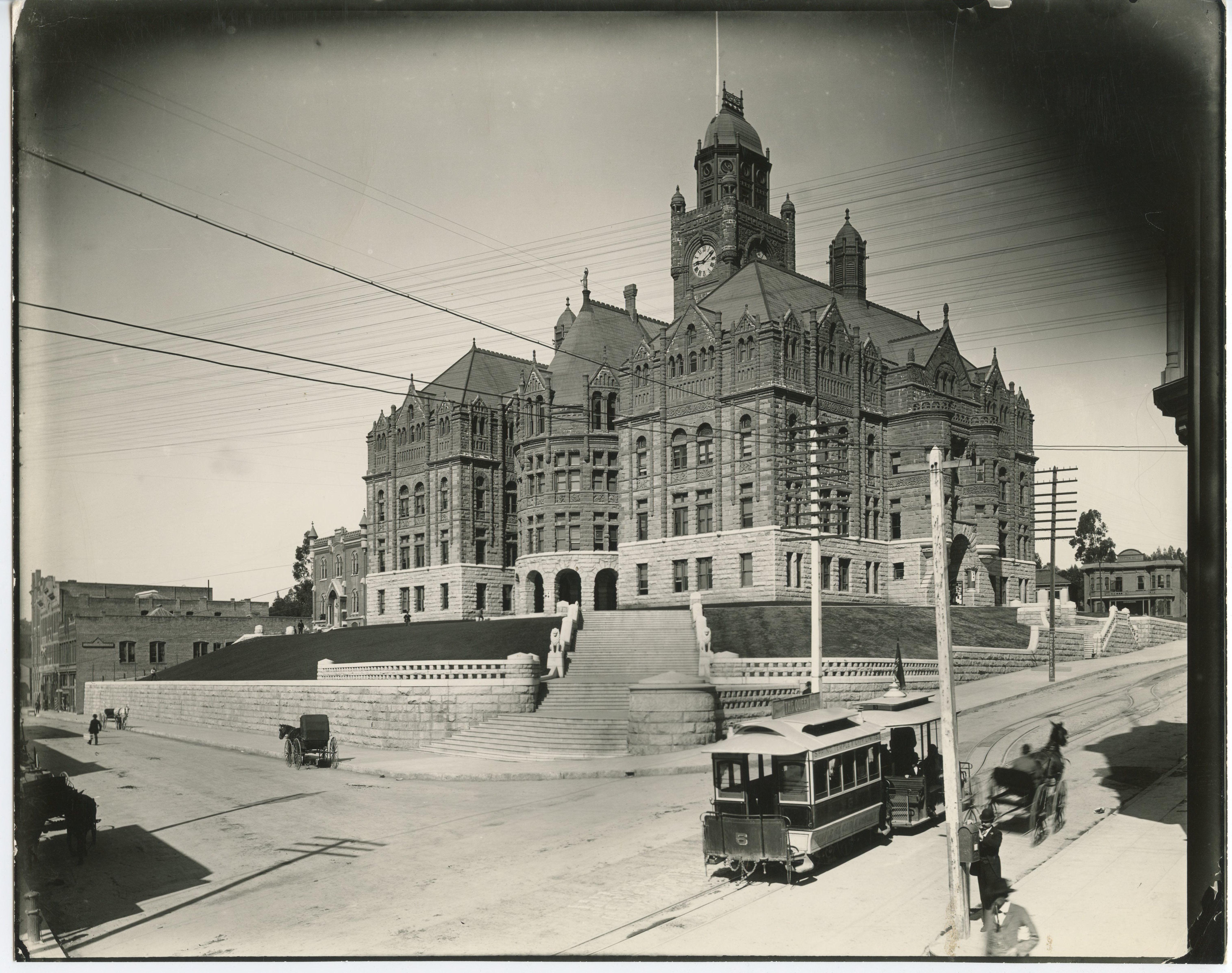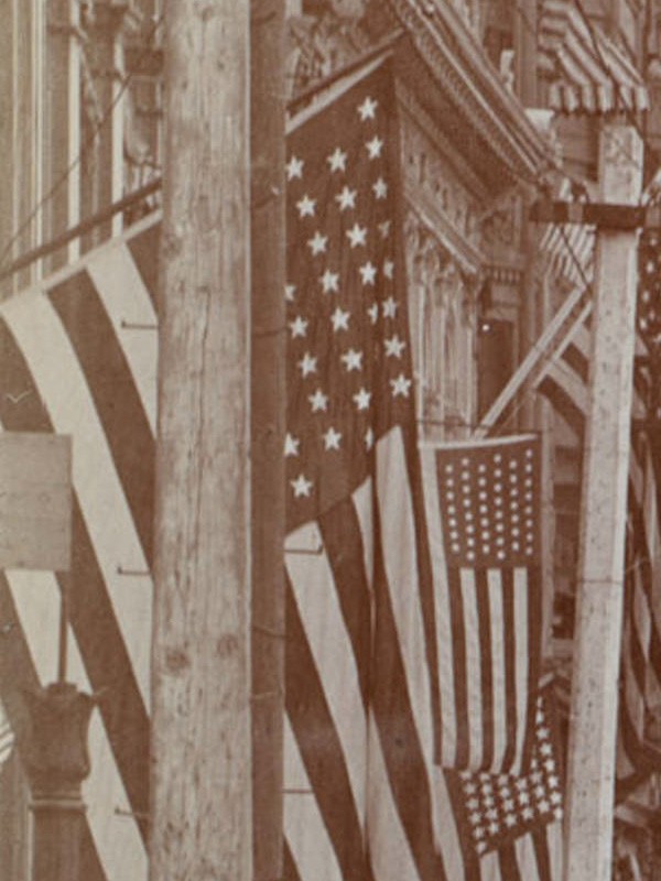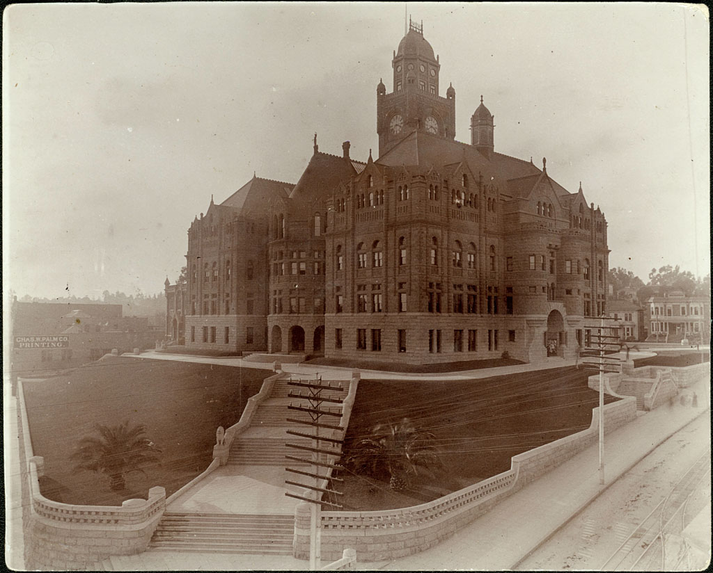
View looking southwest from near today's intersection of Temple and Spring Streets. Courtesy U.S.C. Digital Library.
Recently, I found quite a bit of new information on the cornerstone of the old Los Angeles County Court House, which expands upon my post here from last year.
This newspaper article describes the ceremony of the laying of the cornerstone when construction began in the spring of 1888.

THE TIMES, LOS ANGELES, THURSDAY, APRIL 26, 1888.
THE NEW COURTHOUSE.
–––––––––––
Laying of the Corner-stone Today–
All Ready.
An event of considerable importance to the community at large will take place this afternoon, when the corner-stone of the new courthouse will be laid, under the auspices of the Grand Lodge of Free and Accepted Masons of California, Grand Master Hiram Nathan Rucker officiating.
The ceremonies promise to be both impressive and imposing in character, and arrangements have been made to accommodate some thousands of spectators. The members of the Darius Lodge will assemble at their lodgerooms at 1 o'clock, and appear in the procession as members of the Grand Lodge.
Cœur de Lion Commandery No. 9, Knights Templar, will assemble at its asylum at the same hour, and will act as escort to the Grand Lodge.
Delegates from all the Southern California lodges will be present, and it is expected from 300 to 400 of the Masonic brethren will be in line when the procession leaves the Masonic Temple. From thence they will wend their way down First street to Main street, Main street to Temple street, Temple street to Castelar street, and counter march on Temple to courthouse site.
A platform will be erected surrounding the stone to be laid, upon which the grand officers of the Grand Lodge, the office bearers and the Masonic choir will be accommodated.
The attendant ceremonies will be initiated by the band playing an appropriate selection. The Very Rev. Grand Chaplain of the Grand Lodge will offer prayer, after which an ode will be sung by the Masonic choir. T. E. Rowan, chairman of the Board of Supervisors, will then invite the Grand Master to lay the corner-stone, and the Grand Master, on behalf of the fraternity, will express his acceptance of the invitation and his readiness to perform the service proposed.
The ceremony of laying the stone will then be proceeded with and laid according to the ancient usage, with Masonic honors.
The Grand Master and his officers will then return to their seats while the choir sings another ode.
An oration will then be delivered by the Grand Orator, after which the entire assemblage, accompanied by the band, will join in the "Old Hundred," and the ceremonies will be terminated with a benediction by the Grand Chaplain.
The processions having reformed will return along Fort street to Third street; Third street to Main; Main to First street, and along First to the Masonic Temple.
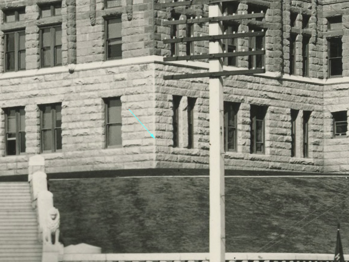
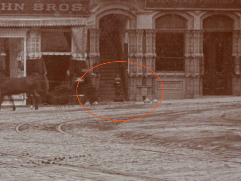
The monumental edifice – clearly built to endure for the ages – was torn down after standing for only 48 years. When it was being demolished, the highlighted section below containing the cornerstone (outlined in white) was left intact.
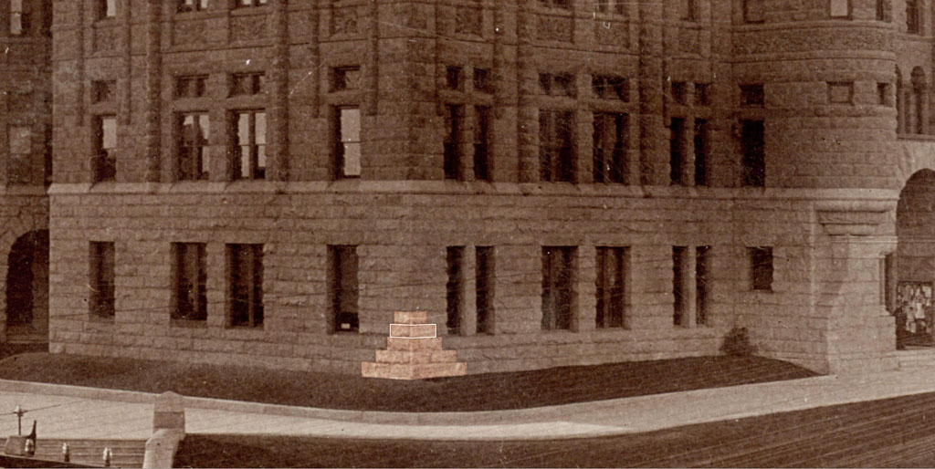
Courtesy U.S.C. Digital Library.
The red circle shows the same grouping on the day the time capsule inside the cornerstone was opened on May 12, 1936.

Courtesy Los Angeles Public Library.
The following day, the Los Angeles Times ran this front page article on the ceremony. The writer's somewhat bemused tone here differs from the more formal presentation of the earlier article. He makes light of just about everything and everyone. I had to chuckle, myself, when I read about the bottle of old whiskey that was rumored to have been placed in the cornerstone!
COURTHOUSE SEAL OPENED
––––––––––
Old Cornerstone Relics Found
––––––––––
Thousands Attend Ceremony Which Yields Papers Printed in 1888
––––––––––
BY THOMAS TREANOR
Yellow as great-grandmother's letters, a bundle of historic papers was lifted into the shimmering sunlight yesterday after forty-eight years in a slab of rock.
Some 2000 persons stood on tip-toes and peeped over one another's shoulders as Marshall Stimson, president of the Historical Society of Southern California; Joseph Mesmer, president of the Pioneer Society, and an overalled workman with a chisel cracked the cornerstone of the old County Courthouse and pulled out a little copper box.
BANK BOOK DRAWN OUT
They were gathered at the red sandstone ruin at Temple street and Broadway, kicking up a haze of white mortar dust, and pushing aside a cordon of deputy sheriffs to crowd round the platform and watch Mesmer reach inside the box, draw out a sheer of paper and shout:
"Bank book of the public schools of the city of Los Angeles."
"For what year?" called out an elderly lady.
"For the year 1888, the year this cornerstone was laid," answered Mesmer at the top of his voice.
BLANK PAPER
He reached into the box again and pulled out another surprise–a blank piece of paper.
"The letterhead of the county of Los Angeles," he said.
He reached in again: "A bird's-eye view of the Santa Ana Valley." And again: "A copy of the Los Angeles Times, Thursday, April 26, 1888."
He coughed and his voice cracked. He shook his head defiantly and shouted again:
"A medical prescription by Dr. Kurtz. I don't know what for."
STIMSON NEXT
His voice wavered again and he grinned and turned to Stimson who reached in for the next surprise and shouted so he could be heard across the street:
"Program of the Sixty-second Anniversary Ball of the International Order of Odd Fellows. Does that stir up old memories?"
For half an hour he reached in, plucked out a paper and shouted until towards the end his voice was beginning to scratch too. Finally he gave the last shout:
"A brown 2 cent stamp."
CROWD DISPERSES
The crowd dispersed. Such a crowd will never gather again in this city. There were men and women there many of whom had not seen each other for forty-eight years, men and women who saw the cornerstone, which was opened yesterday, laid with pomp and great ceremony.
As The Times of April 26, 1888, put it: "An event of considerable importance will take place this afternoon."
One of the oldest was A. C. Shafer, 92 years of age, who was elected a City Councilman in 1888.
"To tell you the truth I don't remember much about the laying of the cornerstone," he said. "I didn't care much for that sort of thing in those days. There were other things I liked better."
RECOLLECTIONS VAGUE
The pioneers were not especially gregarious. Most of them found a seat early, sat there throughout the ceremonies and paid scant attention to their contemporaries. Each was surrounded and ministered to by a little bodyguard of friends and relatives.
Their recollections were surprisingly vague.
A considerable fright was thrown into the arrangements committee when S. W. Duncan, father of the Topsy and Eva Duncan sisters, went to Stimson and reported the wrong stone had been located.
"That stone on the northeast corner that you plan to open isn't the one at all," he said. "You ought to be opening a stone in the arch. I know. I put the mortar in myself."
BOARD MEMBERS CALLED
This was Monday night, about sixteen hours before the great ceremony was to take place. Stimson called all the members of the Board of Supervisors.
"I'm not sure which one it is," said each one.
He called on this friends.
"We don't know," they said.
Finally he called Attorney Ray Howard, who said:
"I was there at the time. The cornerstone is in the arch, I'm pretty sure."
"Ray," said Stimson, "how old were you at the time?"
"Eight years old," said Howard.
"Well, I'm going to get up at 6 o'clock in the morning and find out for sure. I'm not taking the word of an 8-year-old boy."
At 6 a.m. Stimson and a workman were on the scene, tapping stones. Not a stone in the arch rang as if it had a hole in the center. So they decided on the stone in the northeast corner that bore the date, 1888.
"Let me tell you, I was glad it was the right one," said Stimson after the ceremony yesterday. The other cornerstone, long rumored in tradition will be carefully watched for by workmen for it is said to contain rare old whiskey, packed in as a prank.
CROWD GATHERS EARLY
The crowd began gathering early. By 11:30 a.m. the platform reserved for old-timers was crowded and some of the most elderly had no seats.
"I told them they should have built it twice as big," grumbled Stimson.
The supposed cornerstone with 1888 carved on it sat in a fragment of wall the wreckers left standing. After a preliminary speech by Edwin A. Meserve, representing Ramona Parlor of the Native Sons of the Golden West, presentation of nearly fifty persons who were present at the laying of the stone, introductions of Miss Frances E. Mullard and Miss Frances Marshall, veteran county employees, and presentation by Paul Dougherty of Long Beach of the chisel used in fitting the stone in place, the boss workman shouted, "Let her go, Red."
STONE MOVED
Red, sitting in a crane, pulled a lever and with a great clatter of machinery a wire cable girdling the cornerstone tightened. The stone rose into the air and swung over the heads of onlookers to the platform where it was lowered without a hitch.
The copy of The Times taken from the cornerstone contained eight pages. This morning's contains forty-four pages, showing its growth with the city.
Among the old-timers who attended the laying of the cornerstone and were invited for its opening yesterday, almost all accepting, are:
Senator R. F. Del Valle, Charles H. Shaffner, Boyle Workman, S. W. Duncan, Attorney Ray Howard, Paul B. Dougherty, Julius Krause, architect and engineer, who worked on the building for fifteen months; Miss Mary E. Foy, T. R. Griffith, Mrs. T. D. Barton, George Cordier.
William M. Stevens, Arthur Potts, Elizabeth Hale, William W. Jones, Fred W. Beau de Zart, Dr. Robert W. Miller, F. L. Benedict, Mrs. Mulvina Lott, Frank Leplat, Albert F. McDonald, Mrs. Hattie M. Goodrich, Mrs. Albert A. Eckstrom, A. C. Shafer, I. B. Wood, Milton R. Levy, O. E. Bly, Morris Albee, Refugio Bilderrain, W. A. Spalding, then an editor of The Times; I. B. Dockweiler, Adolph Ramish, Will Anderson and Herman C. Lichtenberger.
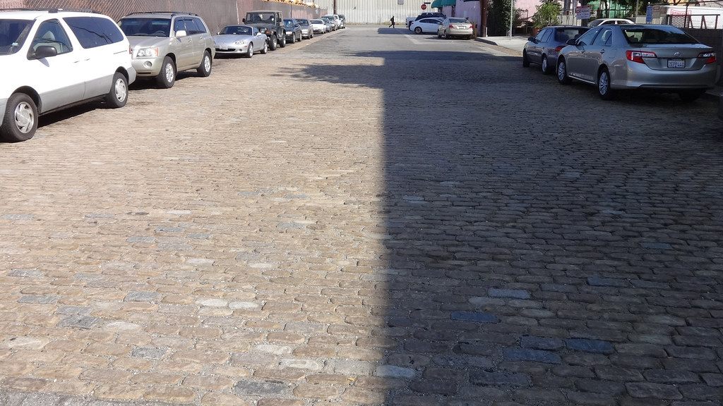
Today, the cornerstone resides in front of the Clara Shortridge Foltz Criminal Justice Center at the intersection of Temple and Spring Streets, only about fifty feet away from its original placement in the 19th century courthouse. Photo taken September 20, 2014.

Photo by J Scott Shannon on Flickr.
Newspaper article transcriptions ©Los Angeles Times, Tribune Publishing. Used with purchased license.