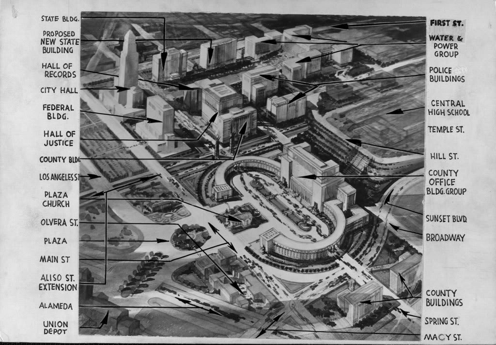
At first glance it almost looks like something out of Stalin's USSR, or maybe even the Third Reich. Then parts of it start to look familiar. It's actually the Los Angeles Civic Center – at least someone's idea of what it should look like in the years after 1940.

Courtesy U.S.C. Digital Library.
Look at that completely absurd County government
building palace in the foreground. It looks like Las Vegas in downtown L.A.! Thank goodness
that monstrosity never got built...
I wish I knew the story behind this proposed but never-implemented plan, but I don't. Given the grandiose nature of that County building, though, it almost had to be the County's idea.
;-)

2 comments:
I want the County Courthouse back! That palace in the foreground looks like some sort of mashup of the forecourt of St Peter's and the Victor Emmanuel monument. And what is going on behind it to the west? Also--the "Aliso St Extension" appears to be below grade. How far along was the planning for the freeway now there?
That terraced area looks to me like something built to re-route Hill Street and create a large flat parcel on what was Fort Moore Hill for a downtown Los Angeles Mega-High School. The below-grade Aliso St. Extension looks prophetically like the Slot that would be built along the same route later in the 1940s, so my guess is that planning for the present freeway was actively underway at the time that drawing was made in 1940.
Post a Comment
Note: Only a member of this blog may post a comment.