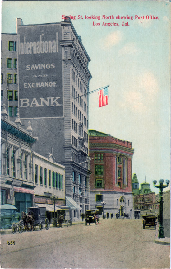
In fact, this portion of Spring's not only completely vanished, this exact vantage point is today located inside L.A.'s City Hall! (See position of red arrow below.)
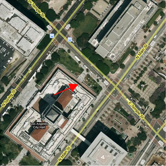
Google Earth.
Here's the backstory. Before 1927, when work on the new City Hall began, Spring Street north of First Street did not run parallel to Main Street and Broadway as it does today. Rather, north of First, Spring jogged east-northeasterly, following a diagonal course to the intersection of Main and Temple (the postcard view). This short diagonal portion (also in red, below) was actually the last vestige of an old indian footpath along the base of Bunker Hill which pre-dated the establishment of the Mexican pueblo itself.
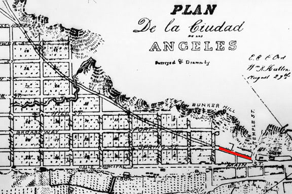
Detail from the 1849 Ord survey map.
Here are a couple of other postcard views of Spring Street as it was before 1927. This first one shows the intersection of Spring and First Streets, looking north, around 1915. You can see that Spring continues straight through past the intersection for about 30 or 40 feet, then it turns at an angle to the right. That's the beginning of the old diagonal alignment.
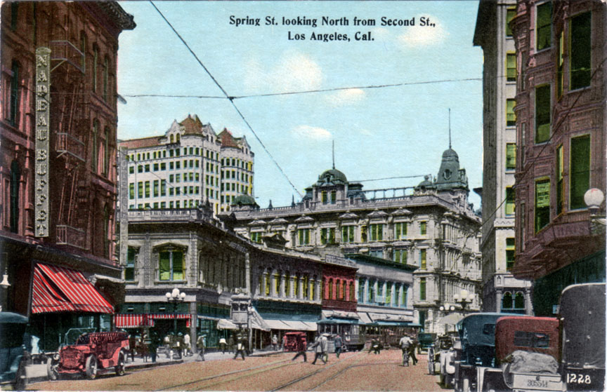
Now, if we were to go up on the roof of the building at the NW corner of Spring and First and look further up the street, this is what we'd see.
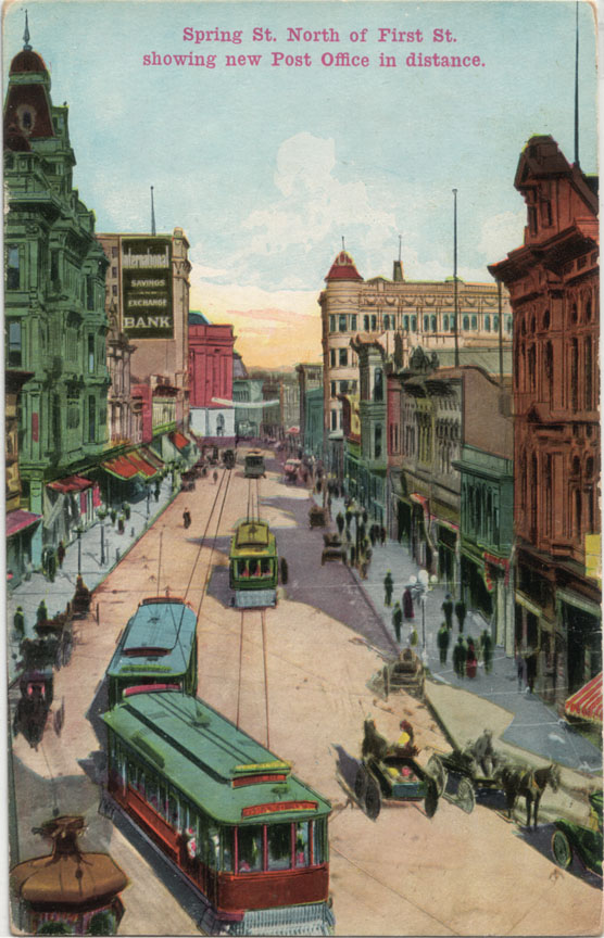
And there, near the end of Spring, is that International Savings and Exchange Bank building again, and the 1910 Post Office just beyond that.
A later perspective: here's a photo of the Civic Center in 1938, after Spring Street had been straightened. That structure just to the immediate right of City Hall is the same International Savings and Exchange Bank. Note the angle of the facade. That was the last visible evidence of the old diagonal alignment of Spring Street...
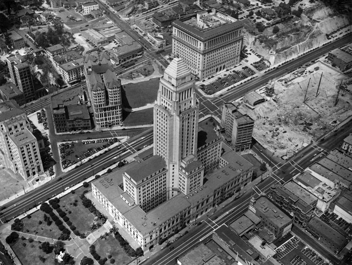
gsjansen on Flickr.
1 comments:
Looks like the Hall of Records still shows the alignment.
Great website.
Post a Comment
Note: Only a member of this blog may post a comment.