A vanished city lives again...

Showing posts with label temple street. Show all posts

Friday, May 16, 2014

Last Vestiges of Temple Square

City Hall is perhaps Los Angeles's most iconic and widely recognized landmark. Relatively few are aware, though, that for decades, one of L.A.'s earliest skyscrapers stood directly in the shadow of City Hall at the southeast corner of Spring and Temple Streets.

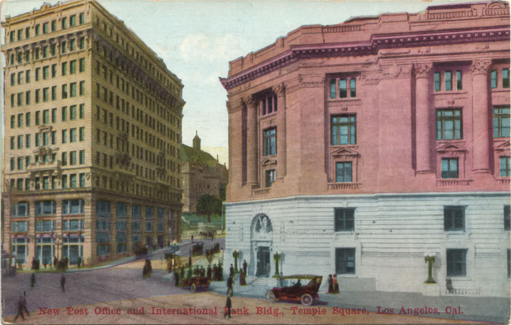
The International Savings & Exchange Bank Building was erected in 1907. When new, it towered over Temple Square and was among the most prestigious business addresses in the city.


"International Bank Building," Palmer Connor, photographer. From the Palmer Connor Collection of Color Slides of Los Angeles. Courtesy of The Huntington Library, San Marino, CA. Link to full-size image.


When construction of the present City Hall began in 1927, almost every structure on the site from Temple Street south to First Street was razed. For reasons that I've never been able to ascertain, however, the Bank of Italy Building, as it was then known, was spared demolition. This aerial view shows the Civic Center circa 1937. The now very much out-of-place bank building can be seen just to the right of City Hall, across Temple Street from the vacant lot where the old Post Office and Federal Building once stood.


Courtesy Los Angeles Public Library.


In contrast to the magnificent and monumental new City Hall, the dingy, aging Bank of Italy building became increasingly regarded as an eyesore. For years, it housed the city's Department of Public Health, but finally, in late 1954, the last remaining structure which stood along the old diagonal alignment of Spring Street was ordered taken down.

Here, looking far older than its actual years, the once-proud grand lady of Temple Square is succumbing to wreckers in January, 1955. The vantage point is the former site of the old 1888 Court House, at that time occupied by a cluster of wartime-era wood frame office structures.


"International Bank Building being demolished," Palmer Connor, photographer. From the Palmer Connor Collection of Color Slides of Los Angeles. Courtesy of The Huntington Library, San Marino, CA. Link to full-size image.

Going, going...
Tuesday, March 5, 2013

Courthouse Time Capsules

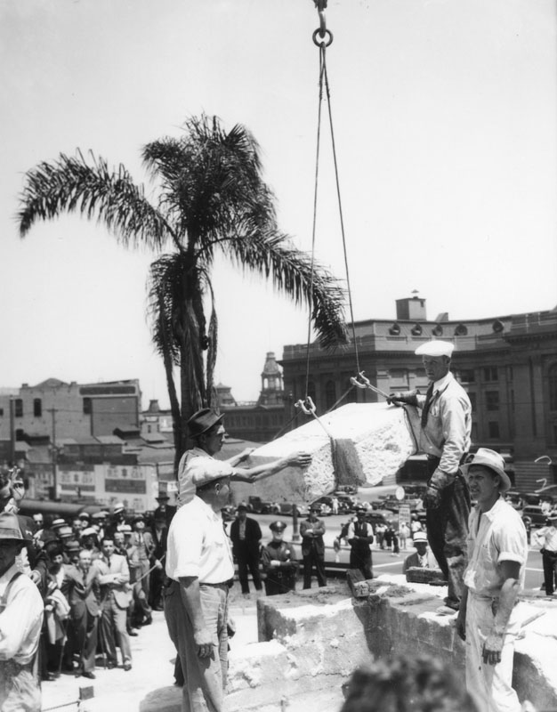
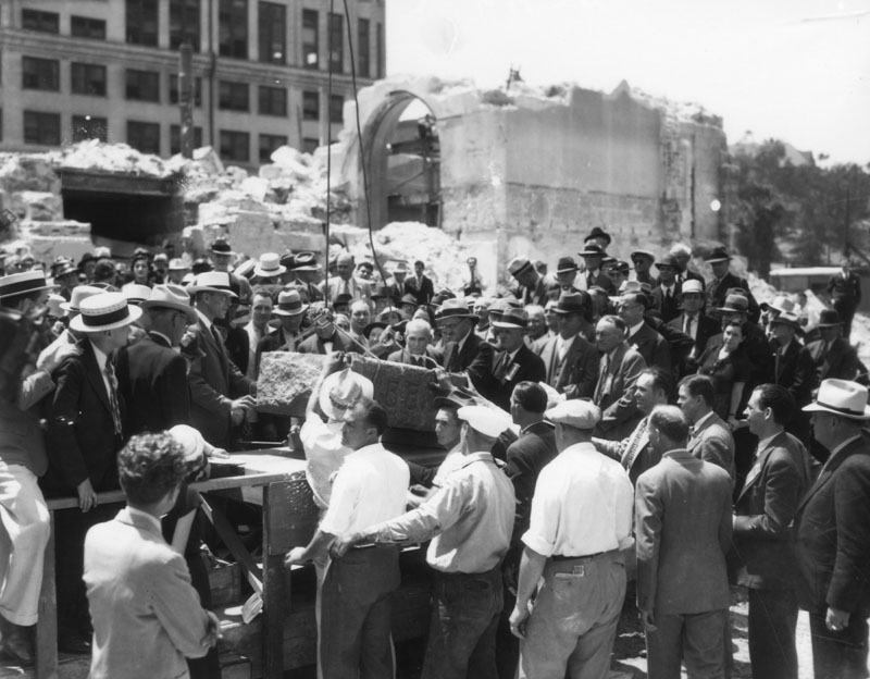
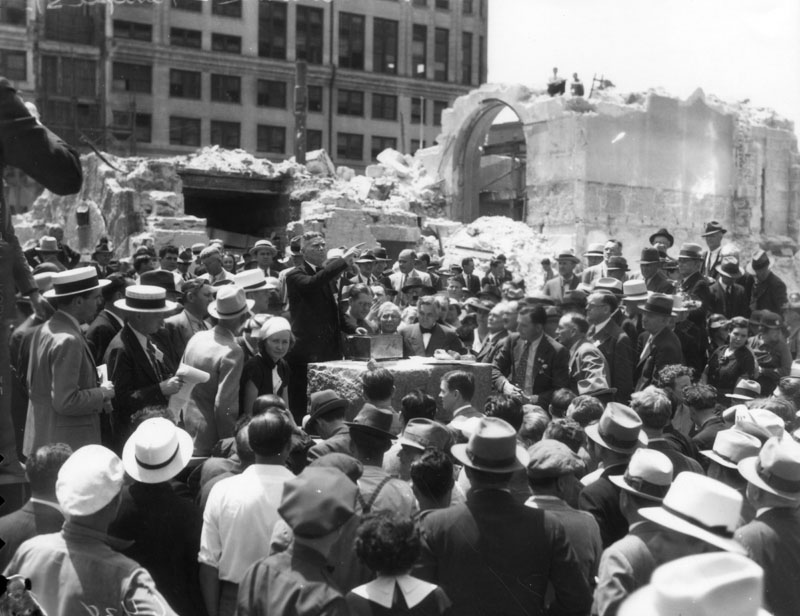
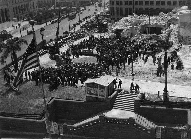
A set of photos of the removal of the cornerstone of the old Los Angeles County Court House, May 12, 1936.

The cornerstone ceremony as viewed from atop the Hall of Justice, across Temple Street. At this point, the cornerstone is still in situ in the small remaining section of wall standing by the crane at left of center.


Courtesy Los Angeles Public Library.

The cornerstone is hoisted free. In the background, at right, across Spring Street, can be seen the rear of the 1909 Federal Building, and to its immediate left, up Main Street, the Baker Block.


Courtesy Los Angeles Public Library.

Here, the granite block is being lowered onto a makeshift platform as the assembled crowd looks on.


Courtesy Los Angeles Public Library.

The time capsule – a small box which appears to be made from tin – is about to be opened by Marshall Stimson, president of the Historical Society of Southern California. Inside were various mementos, newspapers, cards and event programs from the Los Angeles of 1888. (Ref: Courthouses of California: an illustrated history, by Ray McDevitt, California Historical Society.)


Courtesy Los Angeles Public Library.

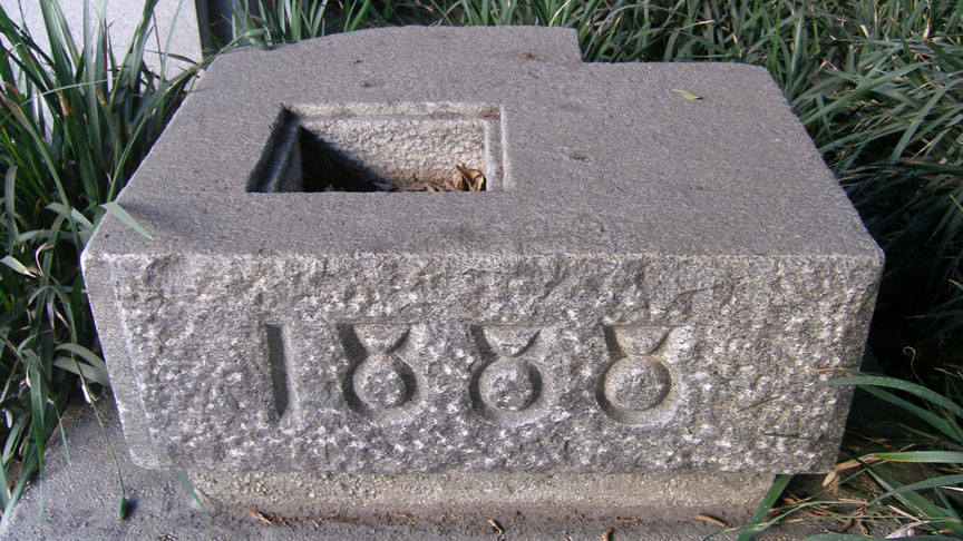
The cornerstone today, on display at the southwest corner of Spring and Temple Streets. It sits in the shadow of the Clara Shortridge Foltz Criminal Justice Center, which has occupied the site of the old Court House since 1972.


Photo by J Scott Shannon.

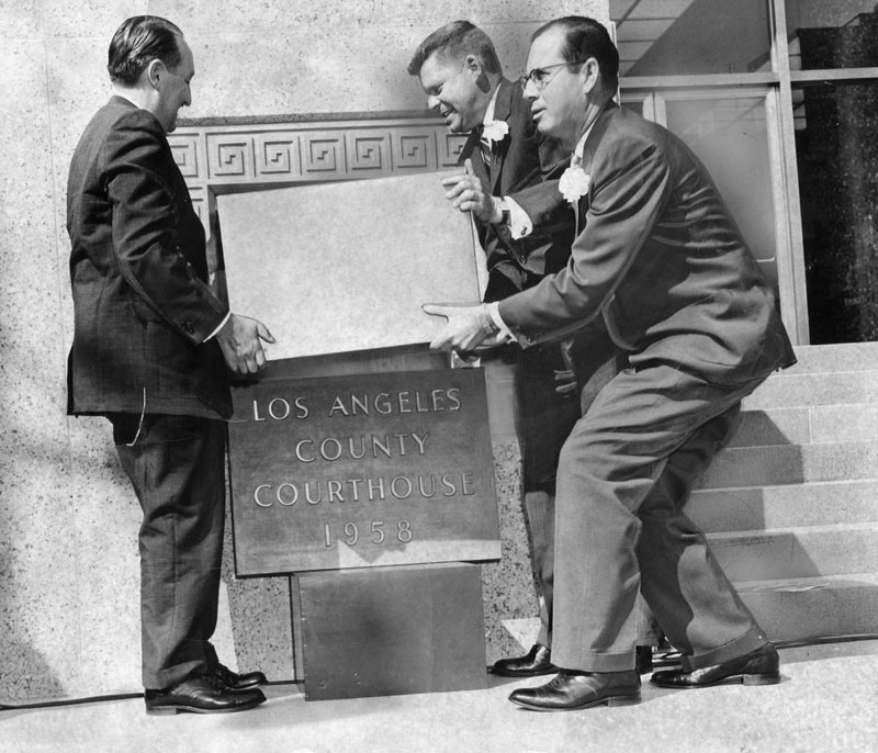
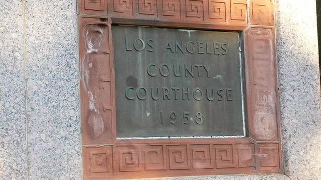
Here, Supervisors Frank Bonelli, Warren Dorn and Kenneth Hahn prepare to place a new time capsule into the cornerstone of the 1958 Los Angeles County Courthouse on October 31, 1958. Now to find out what is in this time capsule!


Courtesy Los Angeles Public Library.


Friday, August 3, 2012

More old Temple Square views

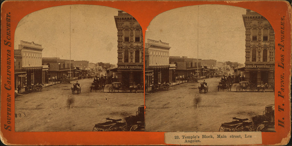
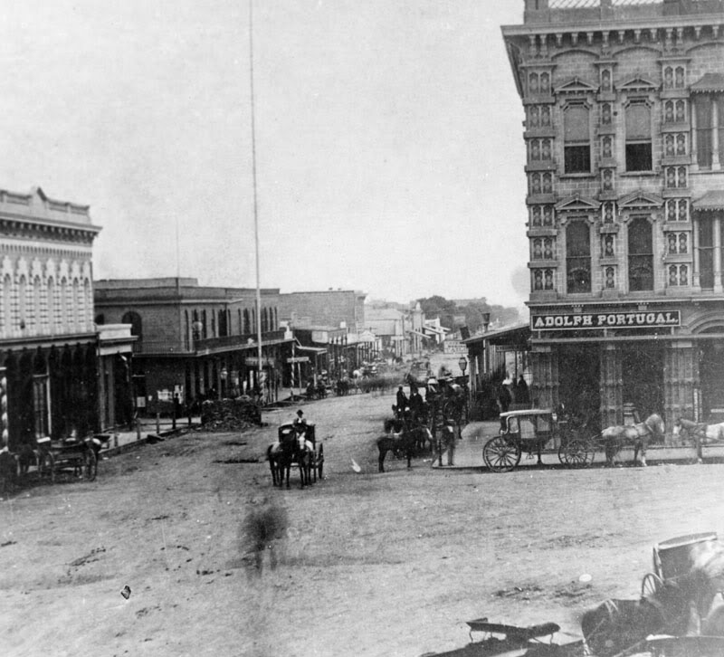
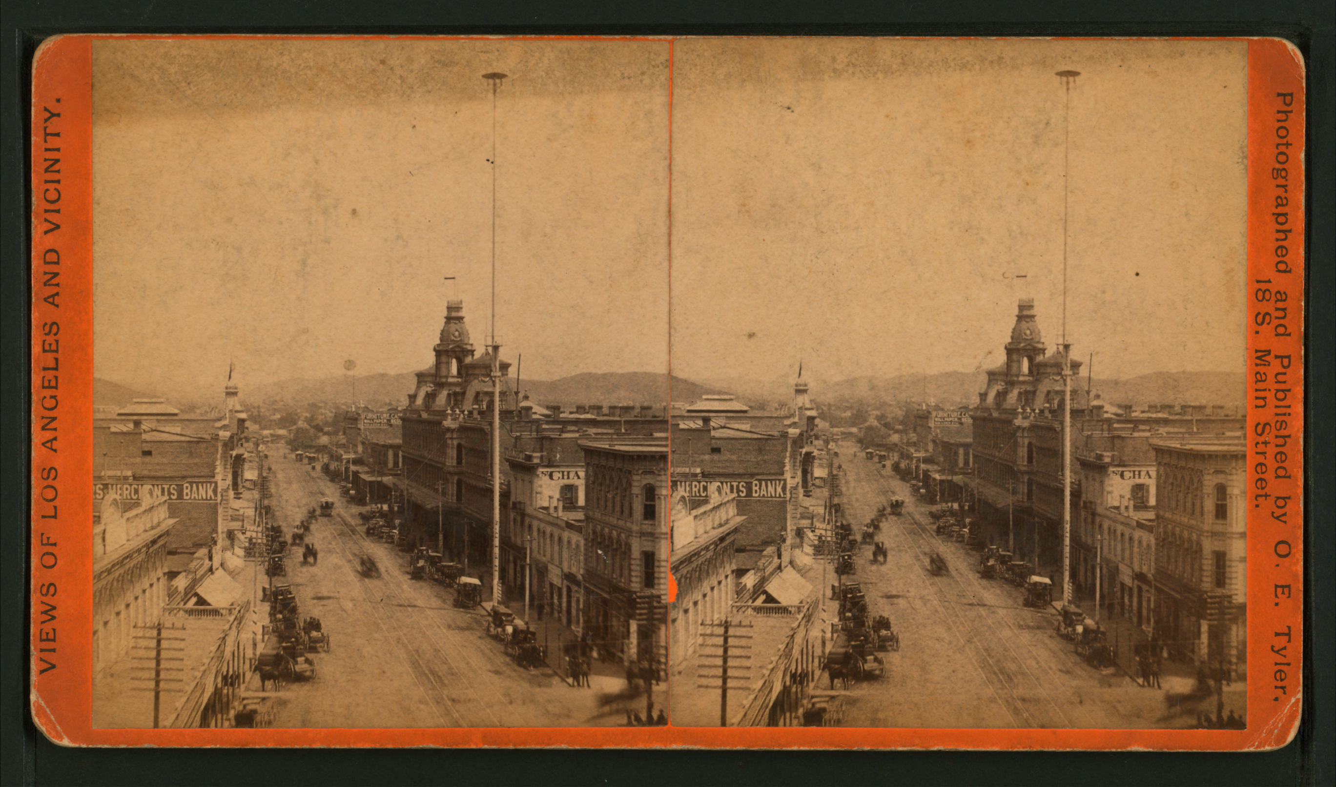
I appear to have found the original version of a previously-posted photo of Temple Square c.1879, looking south from the NW corner of Temple and Main Streets. In this stereoscope view, you can see the top of the United States Hotel's four-storey-tall flag pole, which, for many years after the Civil War, was the tallest man-made object in Los Angeles.


Wikimedia Commons. (A high-res 2737x1446 version can be viewed here.)


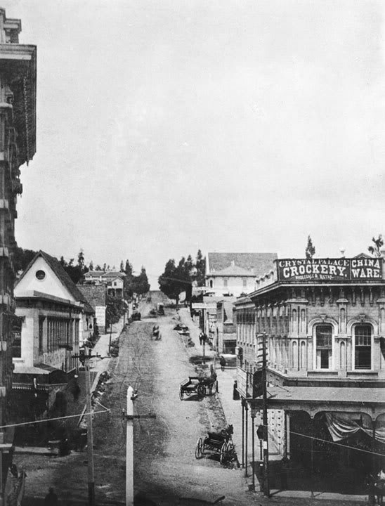
Now, if you were to go up to the top of the Temple Block (at right in the above images) and look northward, this is what you would have seen. The building with the three cupolas was the Baker Block. The tall mast at right was not a flag pole, but an arc-lamp street light. (An excellent illustrated history of street lighting in Los Angeles can be found here.)


Wikimedia Commons. (A high-res 2737x1613 version can be viewed here.)


Sunday, July 15, 2012

Court House cornerstone

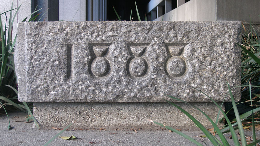
I'm in Los Angeles on my annual visit right now, and just a few hours ago, I made an astonishing historical discovery. Entirely by happenstance, I found the cornerstone of the old Los Angeles County Court House!


Photo by J Scott Shannon.

During my 2010 trip, I had noticed that the granite blocks that ring the Criminal Justice Center bore an intriguing resemblance to those that were used in the wall around the old Court House, which previously stood at that location. I didn't get a chance to investigate this further at the time, though, but I resolved to check on it on a future visit. (I couldn't do it last year because Michael Jackson's physician's trial was taking place there then.)

Well, today was the day, and while driving east on Temple past the front of the Justice Center, I was giving the granite wall a looksee, when my eye spied a chunk of carved granite behind the wall that had "1888" inscribed on it. Knowing the old Court House had been erected in 1888, I knew at once what that had to be: the long-gone building's original cornerstone!

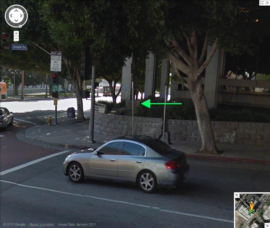
The green arrow shows its location on Google Street View.


Here's the old Court House, viewed from basically the same street corner before the turn of the last century.


Courtesy U.S.C. Digital Library.

And check it out – obviously there was a time capsule inside!


Photo by J Scott Shannon.

I wonder what it contained. I'm also curious to know where this cornerstone was for the 36 years between the demolition of the old Court House and the construction of the newer building in 1972*.

I'm still not sure if the wall stones are the same ones that used to be in the Court House retaining wall, though. I may never know. But I do know that, almost certainly, the 1888 cornerstone on display at the SW corner of Temple and Spring is the oldest remaining fragment of Los Angeles's Civic Center.

ADDENDA: Since this writing, I've learned that one of the clock faces from the Court House tower has been preserved. Hurrah! Additionally, although I have not yet been able to confirm this, it may be that some decorative pieces of red sandstone from the old Court House were used in the cornerstone of the Stanley Mosk Courthouse at First and Hill Streets.

*Here is the whole story of the Court House cornerstone, courtesy of ProphetM on the Skyscraperpage.com noirish Los Angeles thread.


Photo by formwerks on Flickr.


Monday, October 31, 2011

Court House revisited

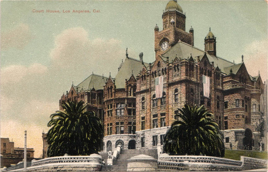
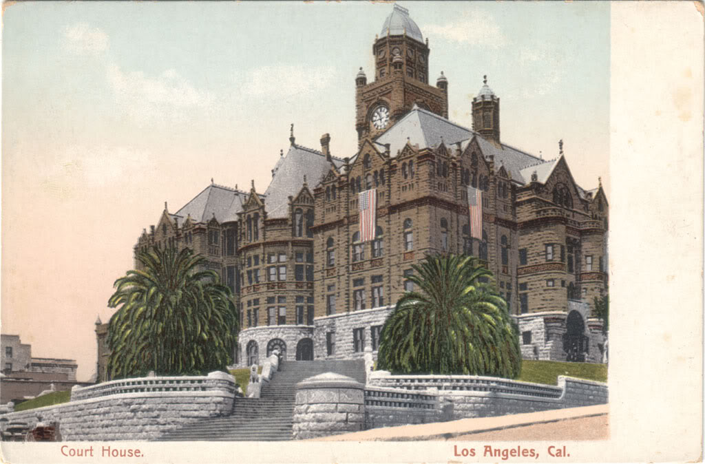
Nice postcard of the old County Court House circa 1909, viewed from what today would be the intersection of Temple and Spring Streets. At the present time, the trial of Michael Jackson's personal physician is underway at this exact location, though obviously not in this exact building.


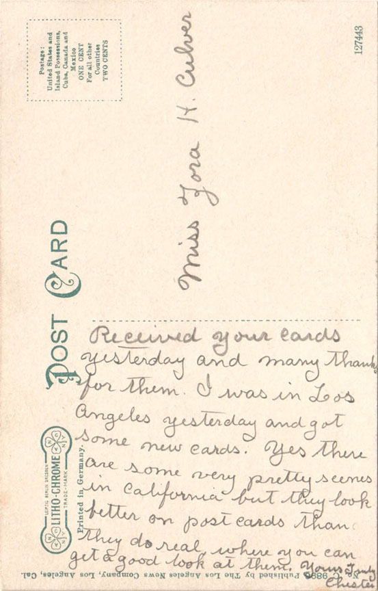
I'm amused by "Chester's" description on the reverse – how buildings typically "look better on post cards than they do real where you can get a good look at them." Presumably that was Chester's opinion with regard to the Court House in particular.


Tuesday, September 27, 2011

Main Street at Temple, Then & Now

Looking south on Main Street from Temple.

c.1879:  On the corner, the Temple Block.


Los Angeles Public Library Photo Collection.


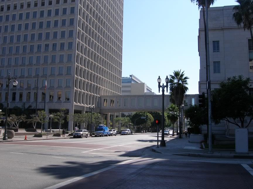
2011:  Now it's all City Hall.


Photo by J Scott Shannon.


Friday, August 12, 2011

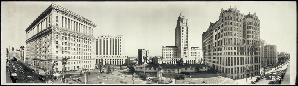
Civic Center panorama, 1946

The Los Angeles Civic Center, viewed from Broadway, March 11, 1946.


Source: Library of Congress.


Link to full-resolution TIFF file at loc.gov (4.6 MB).


Wednesday, March 16, 2011

Temple Square: Then, Then, Then & Now

Temple Square – the former junction of Main, Temple and Spring Streets – photographed from the roof of the Bella Union Hotel.

c.1870:


Los Angeles Public Library Photo Collection.


1876:


Los Angeles Public Library Photo Collection.


1888:


Link to image on Flickr.


And here is the view from the former site of the Bella Union in the present day...
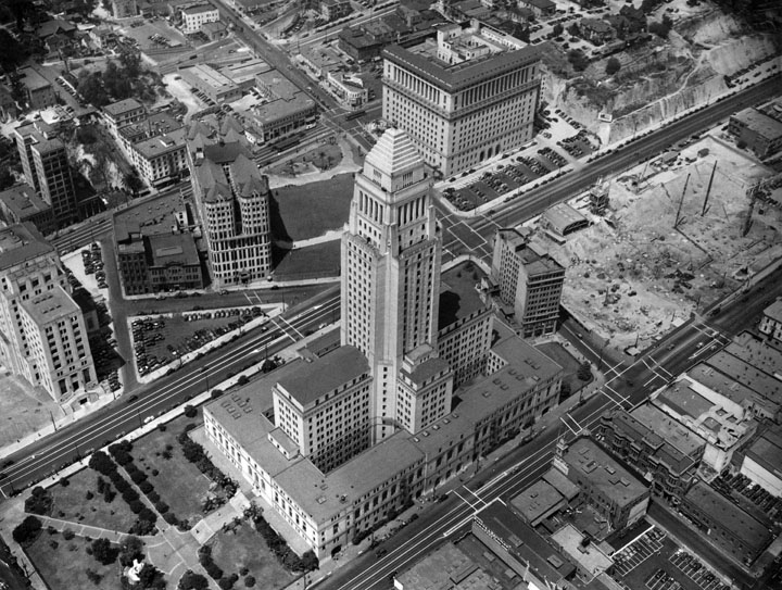


Photo by J Scott Shannon.


Sunday, July 4, 2010

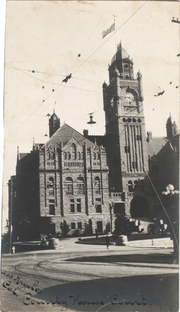
The County House

For Independence Day, 2010...
A perhaps unique postcard view of what was then Los Angeles's grandest civic building, depicted in its prime, almost exactly 100 years ago.



Sunday, November 22, 2009

Old Civic Center – south to City Hall

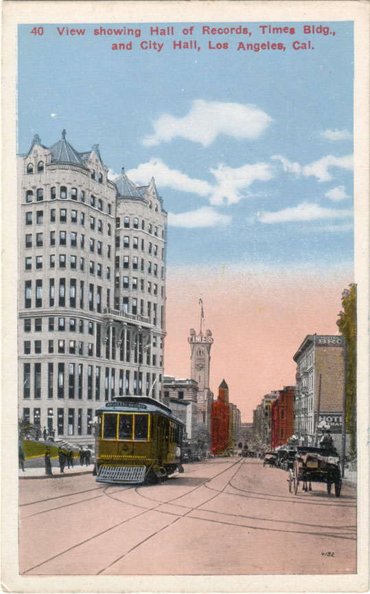
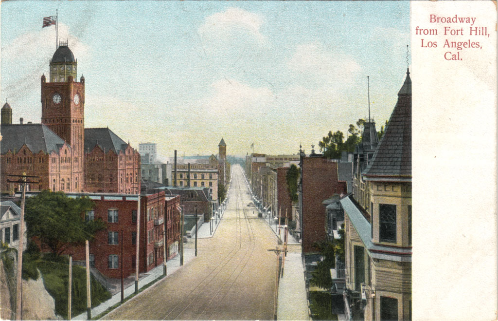
Broadway was the center of civil and commercial life in old Los Angeles. This was the view looking south on Broadway from the Hall Of Records in approximately 1915.


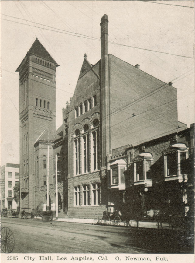
One block down, at the NE corner of Broadway and First, was the L.A. Times building, re-built after the 1910 labor bombing. In the distance, the structure with the pyramid-topped tower was the Los Angeles City Hall, erected in 1888 at 226-238 South Broadway. The postcard view below is from around the turn of the last century.


This grand Romanesque edifice of marble and red sandstone stood for only 40 years, however. It was torn down following the completion of the present City Hall in 1928.

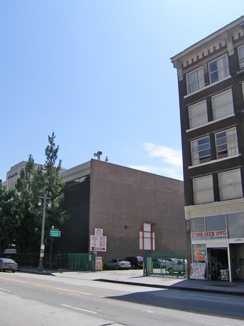
Today, there's nothing to show that this was once an important site in Los Angeles history. It's just for parking now.


Photo by J Scott Shannon.


Actually, the old City Hall isn't completely gone. The Hosfield Building at right was built in 1914 as an annex to house city departments. I'd much rather the Hosfield Building was the one razed for parking, though. It really was a crime to demolish that elegant old civic landmark...


Thursday, November 12, 2009

Old Civic Center

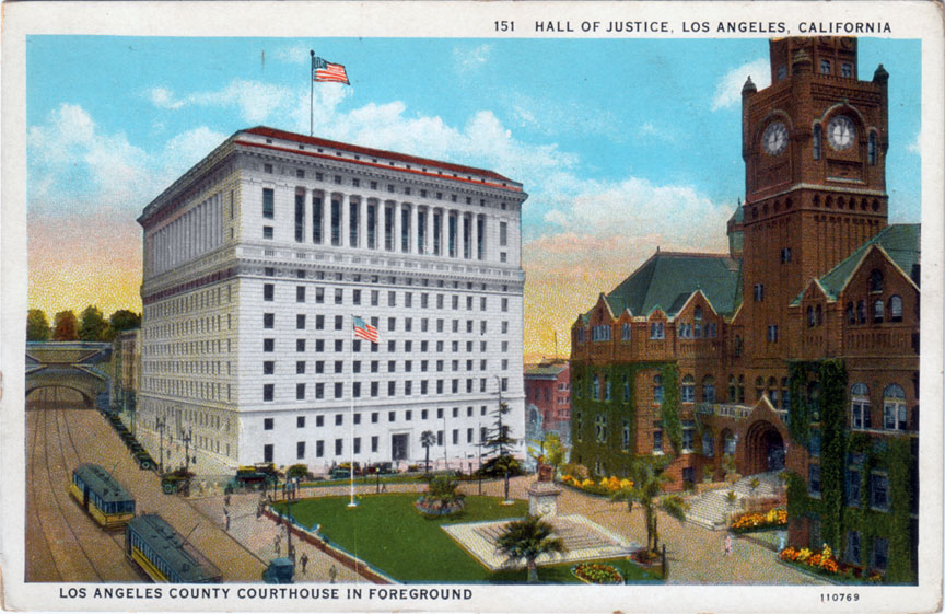
These two postcard views give a really good idea of what the old Los Angeles Civic Center looked like, and where the buildings were in relation to each other.

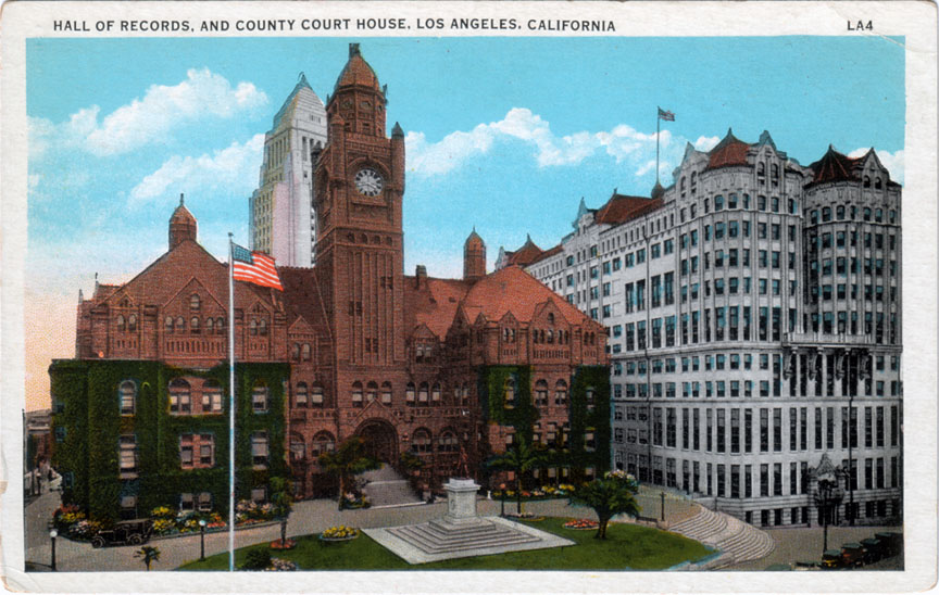
In the top one, the intersection in the foreground is Broadway and Temple, and we're looking roughly north. At left, where the Broadway Tunnel and those trees are – that's where the 101 freeway "slot" is today. You'll recognize the 1922 Hall of Justice, of course, and the red sandstone building at right is the old Los Angeles County Court House (1888).


Now turn 90 degrees to the right, and see the familiar 1928 City Hall rising behind the Court House, and the Hall Of Records (1910) at right.


Judging by the similarity in the ivy growth on the Court House, I'd say that the two postcard photos were taken within a year or two of each other. The cars in the top one definitely look '20s-ish, and the presence of the new City Hall in the bottom image means it can't be earlier than 1928. So 1928-1930 seems a good guess for when this point in time existed in Los Angeles's past...


Wednesday, November 4, 2009

Temple Square

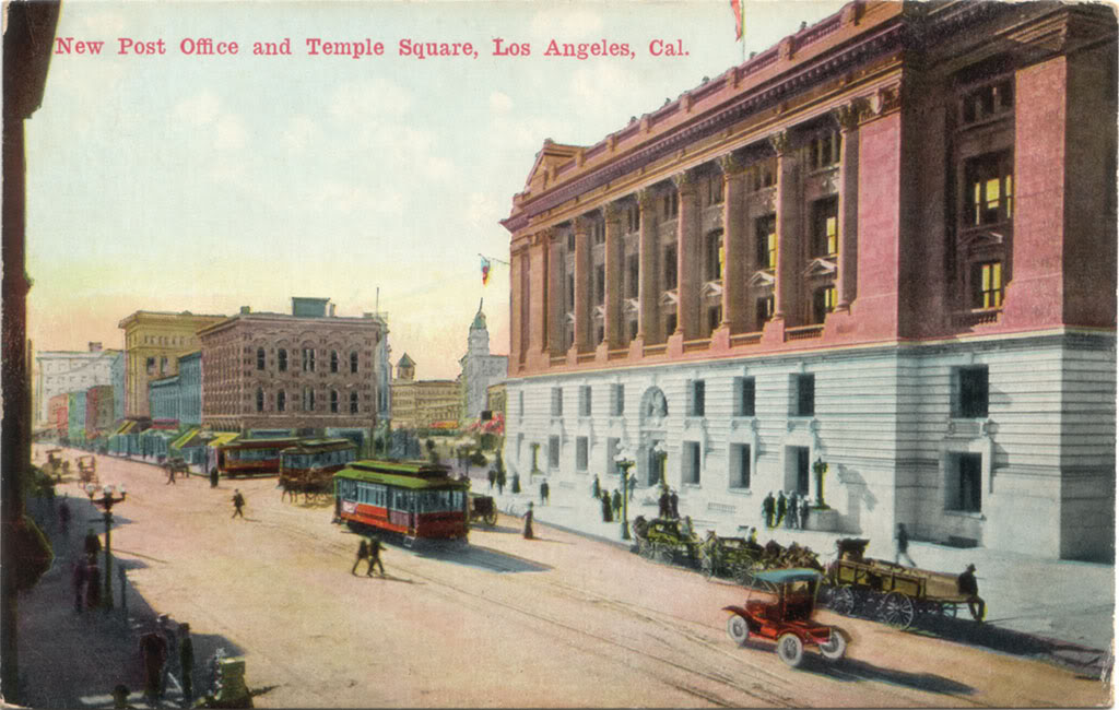
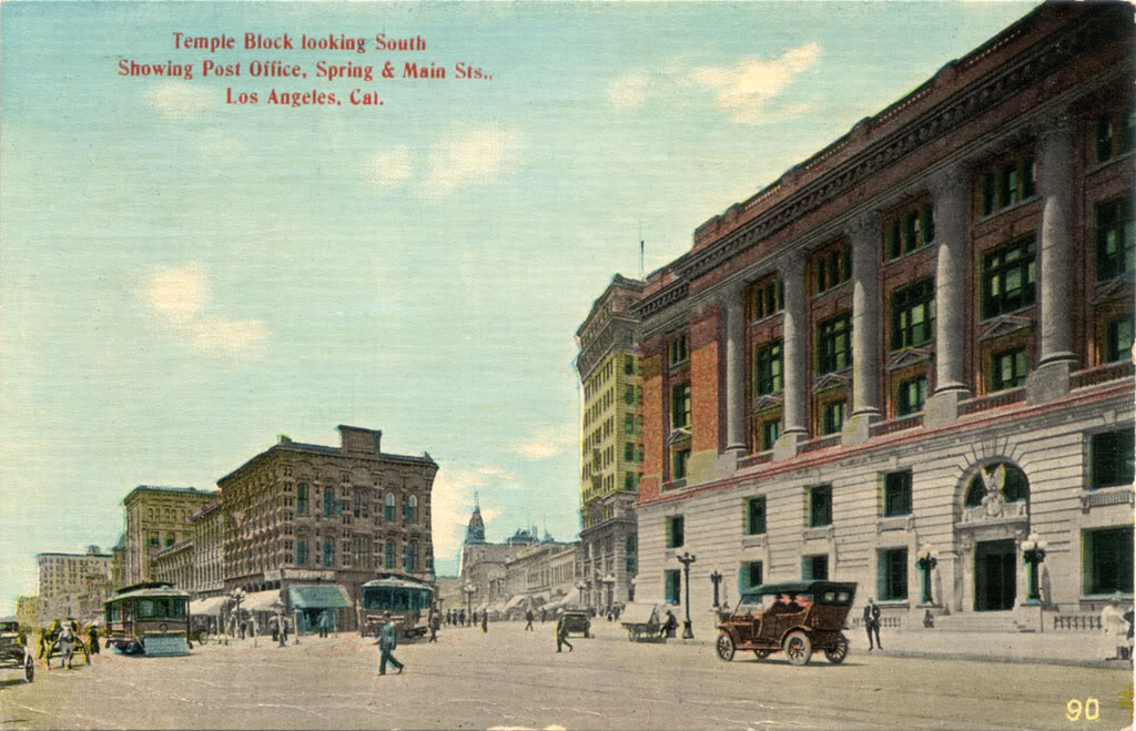
From the 1860s to the 1930s, Temple Square was the original "civic center" of Los Angeles. Formed by the junction of Main, Temple and Spring Streets, it was the nexus of everyday life in the old city. Here are some postcard views of Temple Square from the first and second decades of the 20th century...


Today, no one looking at the intersection of Main and Temple could guess that a grand open public space once existed there. Temple Square has vanished without a trace from the face of the earth...


Wednesday, September 9, 2009

New old Court House view


Another nice postcard view of one of my favorite buildings in the vanished city: the majestic Los Angeles County Court House, circa 1906. The vantage point was the intersection of Temple and New High Streets. No such intersection exists now, but Spring Street today crosses Temple within a few feet of this very spot...


Saturday, May 2, 2009

The Spring Street diagonal

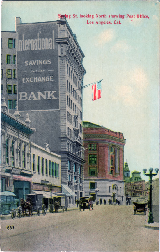
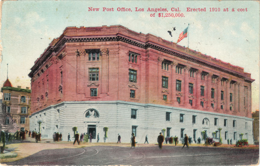
Ever since I started collecting postcards of old Los Angeles, this 90-year-old view of the north end of Spring Street has been one of my "holy grails." One reason for its desirability is that it features the old Post Office that first got me interested in pre-WWII Los Angeles. Mostly, though, this card fascinates me because this particular stretch of Spring Street no longer exists at all.


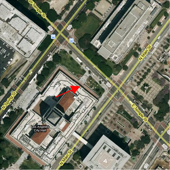
In fact, this portion of Spring's not only completely vanished, this exact vantage point is today located inside L.A.'s City Hall! (See position of red arrow below.)


Google Earth.


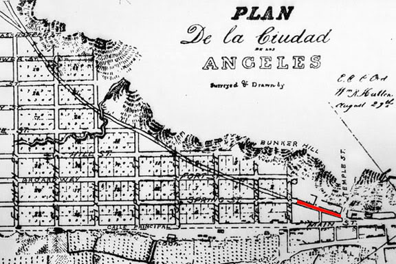
Here's the backstory. Before 1927, when work on the new City Hall began, Spring Street north of First Street did not run parallel to Main Street and Broadway as it does today. Rather, north of First, Spring jogged east-northeasterly, following a diagonal course to the intersection of Main and Temple (the postcard view). This short diagonal portion (also in red, below) was actually the last vestige of an old indian footpath along the base of Bunker Hill which pre-dated the establishment of the Mexican pueblo itself.


Detail from the 1849 Ord survey map.


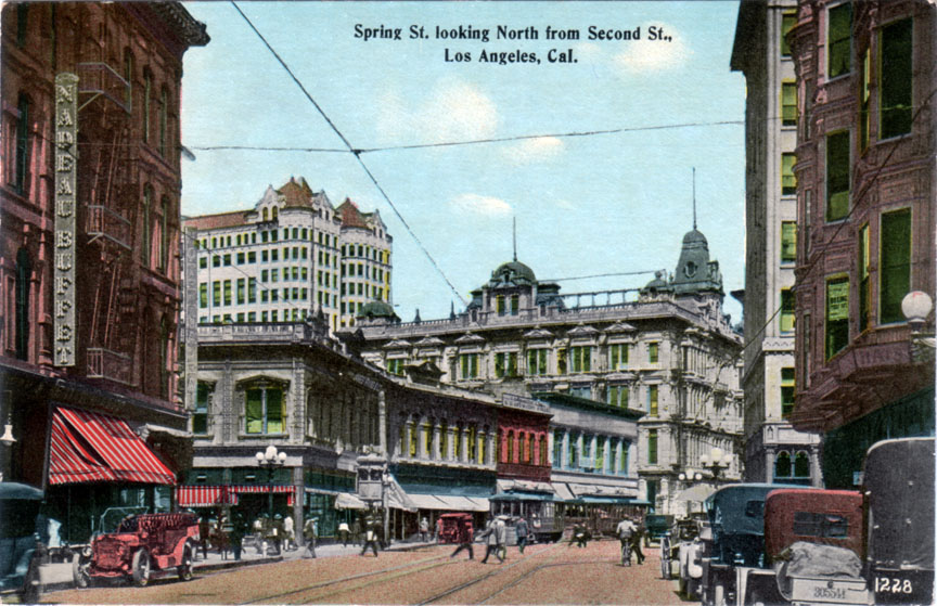
Here are a couple of other postcard views of Spring Street as it was before 1927. This first one shows the intersection of Spring and First Streets, looking north, around 1915. You can see that Spring continues straight through past the intersection for about 30 or 40 feet, then it turns at an angle to the right. That's the beginning of the old diagonal alignment.


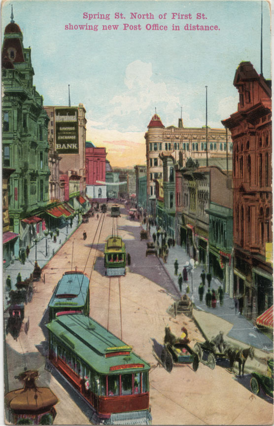
Now, if we were to go up on the roof of the building at the NW corner of Spring and First and look further up the street, this is what we'd see.


And there, near the end of Spring, is that International Savings and Exchange Bank building again, and the 1910 Post Office just beyond that.

A later perspective: here's a photo of the Civic Center in 1938, after Spring Street had been straightened. That structure just to the immediate right of City Hall is the same International Savings and Exchange Bank. Note the angle of the facade. That was the last visible evidence of the old diagonal alignment of Spring Street...


gsjansen on Flickr.


Thursday, January 15, 2009

New treasures!

Last month, I got this neat old postcard of Broadway near its intersection with Temple Street. The photo was taken from the top of the south entrance of the Broadway Tunnel. The design of the reverse side of this Rieder postcard indicates it was printed between 1907-'08. The photo, however, dates to approximately 1903. The Braly Building (1902-'03) can be seen in the distance, just to the right of the Court House. The scene can't be later than 1904, though, otherwise the Hotel Lankershim would be visible at the far end of Broadway.


This is one of my absolute favorite views of the vanished city. I just feel totally at home here, gazing at this simple scene...


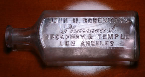
Then, last week, this old medicine bottle showed up on eBay. Broadway & Temple! Holy crap! I just had to have it. And, as of today, I do!


Photo by J Scott Shannon.

I know a little bit about antique bottles, and this one definitely dates to pre-1915. So, it's essentially contemporaneous with the postcard view! I wonder which of the three possible corner buildings housed the Bodenmann pharmacy. I will find out eventually, I'm sure!


Sunday, September 21, 2008

Birthday postcard

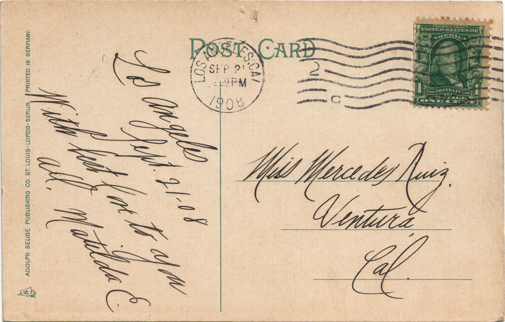
Got an unexpected surprise via eBay the other day: an old postcard mailed exactly 100 years ago today, and 46 years before I would be born.

It features a really nice view of the old L.A. County Court House, too; probably the nicest in my postcard collection.


Lovely penmanship...


Friday, June 13, 2008

Origin of an obsession


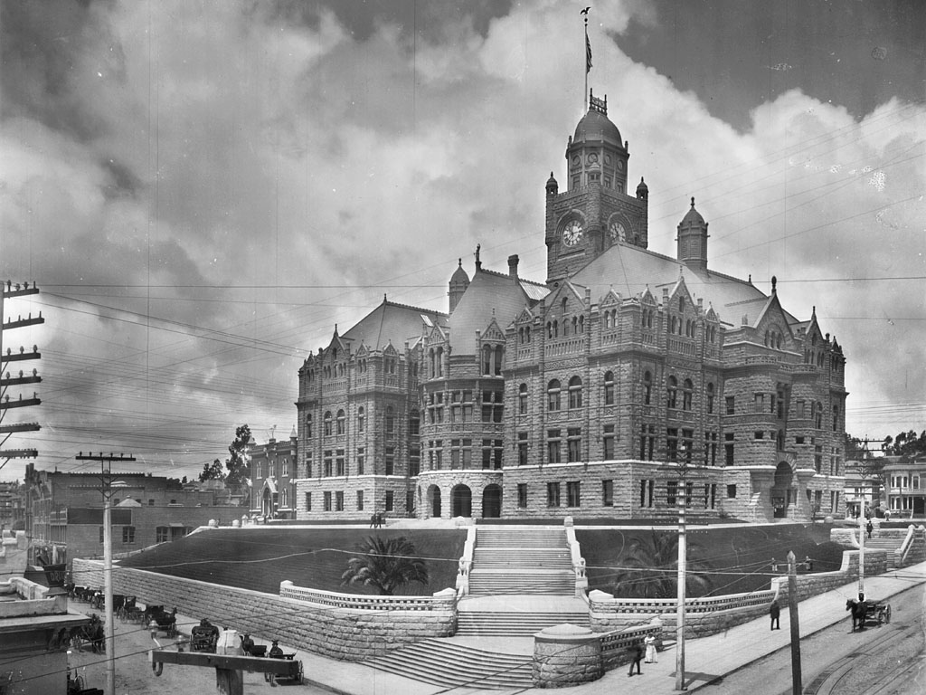
It was this building and this shabby old postcard of it that planted the seeds of my present obsession with pre-WWII Los Angeles.

It's kind of a long story, but I'll try to make short work of it. Back in late 2007, while browsing the Panoramic Maps collection on the Library of Congress website, I found a number of "bird's eye" views of old L.A. I'll never forget my reaction upon seeing them for the first time.

"I don't recognize anything here."

The two maps which most caught my eye were both dated 1909. They were the most detailed, by far. After searching them for a while, I finally found something familiar: the Bradbury Building at Broadway and Third. OK, now that I had my bearings, I kept scanning the maps and found what looked like a civic center: a Hall of Records and a Court House. And, nearby, a large Post Office. Strange thing, though. The two maps had two completely different drawings of that building. Which was the correct one?

A cursory web search proved fruitless, so, just on a whim, I searched eBay for 'los angeles post office', and up came this single postcard. The image was striking and completely unfamiliar. Surely if this building were still standing when I was growing up in the L.A. area, I would have remembered it.

But if such an expensive and ornate edifice – which was clearly meant to endure as a civic monument into the ages – was gone by the time I was born, what happened to it? Well, after studying the more-accurate 1909 map a bit more, I saw why. The old post office was located very close to where the 101 freeway "slot" would be constructed in the 1940s. No wonder everything in that vicinity was gone now...

At that point, I really wanted to find out what that part of town looked like back in the day. Googling again, I queried about the post office's location – Temple and Main Streets – and voilĂ , I found a Blogger entry by a "lastraphanger" entitled "Temple and Main Streets: What Used to be Here." Wow! With both text and photos, this guy answered every question I had about the locale and much much more. I was utterly fascinated by his descriptions of this vanished part of old Los Angeles, and upon searching his blog further, I was delighted to find an absolute wealth of new information there.

So I became an ardent reader of this anonymous person's weblog. Practically every day, I learned more and more about this L.A. I never knew. Unfortunately, less than two months after I found lastraphanger's blog, he moved on in life and deleted it. To this day, I lament the loss of that important historical document...

However, that loss ultimately proved beneficial, because since I no longer had someone else to rely upon to tell me about the history of old L.A., I had to dig up the knowledge I sought by myself. Back when I was a college student, I loved literature searches, and thanks to the various online archives and the wealth of information they contain, I quickly became adept at finding my own answers to practically every aspect of old L.A. that I was curious about. The result is what you see here in my blog today!


*smiles* I still remain rather fixated on that old post office, though. As with everything else about the vanished city, the more I find out about it, the more fascinated I become. Anyway, I will definitely have a lot more to say about this building when its centennial arrives in 2010. Trust me, it will be a tale well worth the telling!


Thursday, May 15, 2008

Temple and Main Streets, Los Angeles: Then and Now

The civic center of Los Angeles in three centuries...

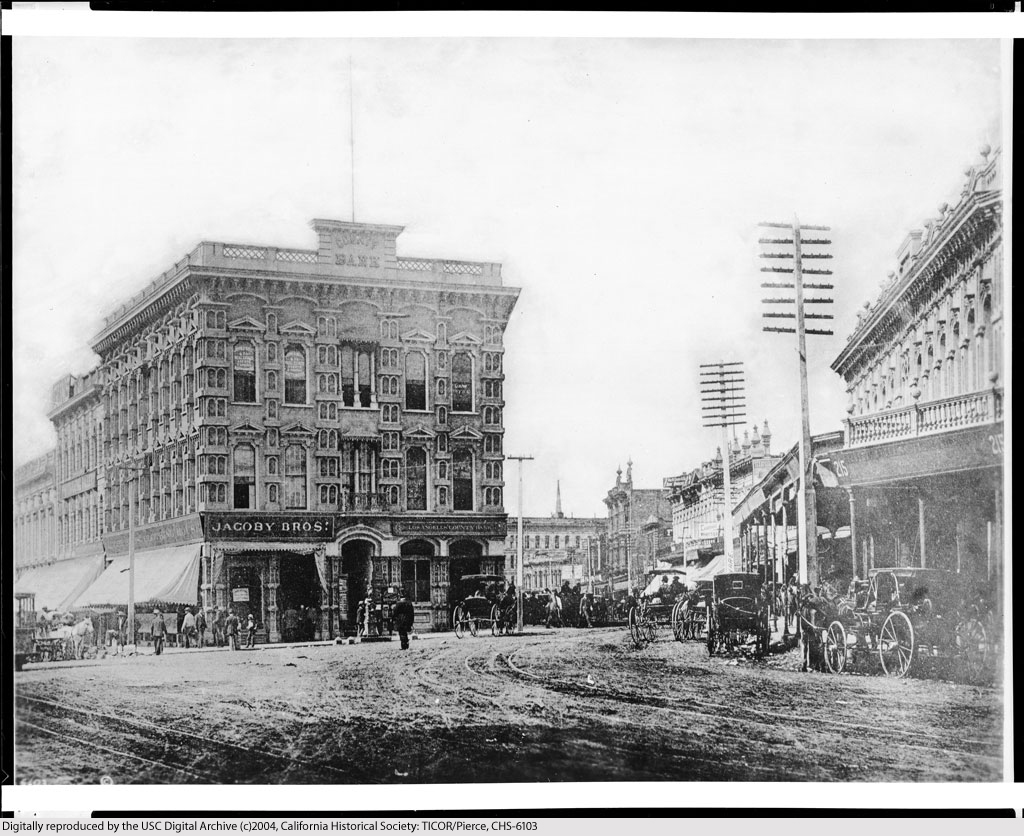
Temple Square – the heart of the city, 1885 – at the intersection of Temple, Main and Spring Streets:


USC Digital Archive.


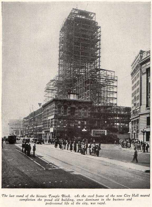
Temple Square, 1927. The new City Hall looms over the doomed Temple Block:


Photo from La Reina - Los Angeles in Three Centuries, Published by Security Trust & Savings Bank, Los Angeles, 1929.


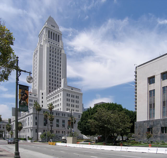
Temple and Main Streets, today:


Photo by J Scott Shannon.


The Temple Block was the ornate 3-storey brick structure in the older photos. It was the hub of civil life in Los Angeles during the 1870s-1880s. As we face the Temple Block, Main Street runs to the left, and Spring Street emerges at a diagonal angle to the right. Temple Street runs from left to right in the upper photo, but it can't be seen because it's obscured by the Downey Block at far right. (Here is Temple Street heading west from Temple Square.)

Spring Street was realigned when construction of the new City Hall began in early 1927. Spring now runs parallel to Main, and intersects with Temple where the large skyscraper at right is now located.

What strikes me the most when I compare these images is how the city center of old Los Angeles was a vibrant place, alive with people and commerce, while today's sterile Civic Center is almost exclusively a home for government, and where the populace is only a transitory visitor.

It's difficult to imagine this extensive a change taking place within a period of only two normal human lifespans, isn't it? Were a citizen of 19th century Los Angeles to suddenly find themself transported to today's Temple and Main, the place would no doubt be completely alien to them. Like another world entirely...