A vanished city lives again...

Showing posts with label old city hall. Show all posts

Thursday, May 23, 2013

Gay Nineties' L.A.

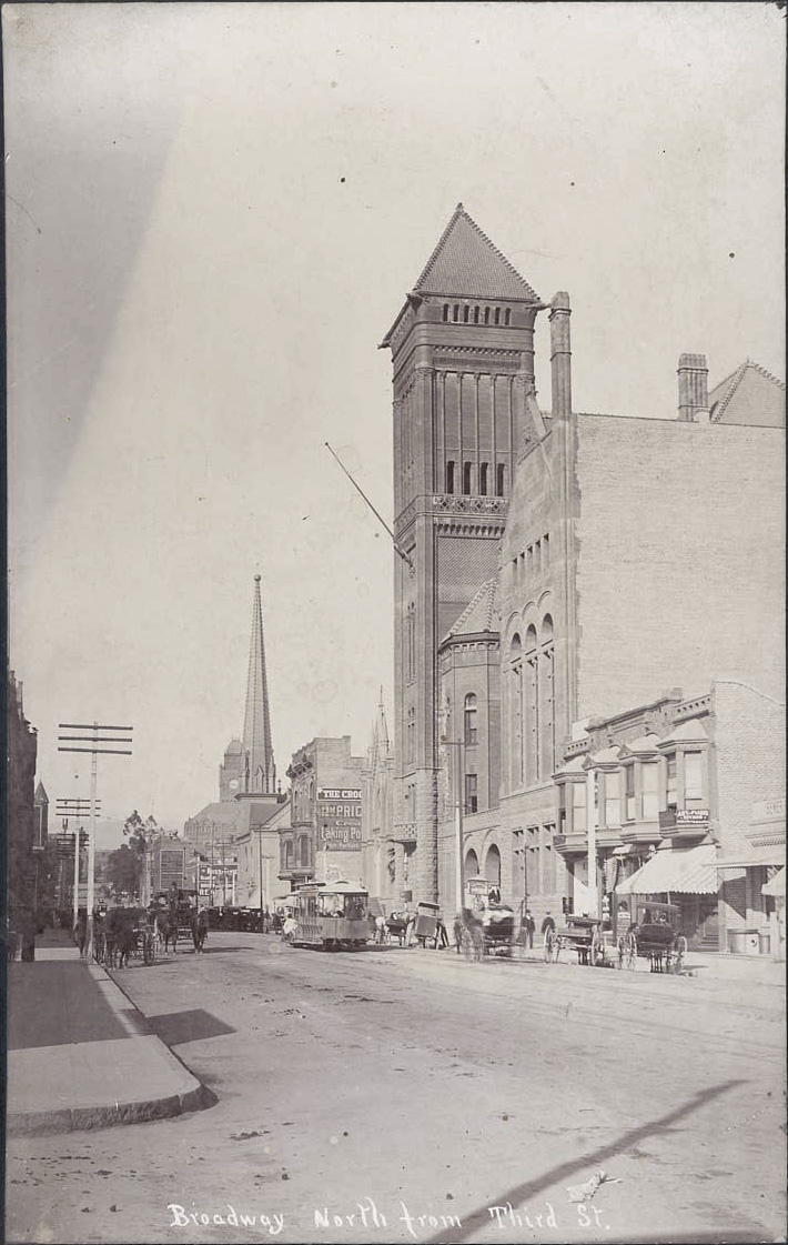
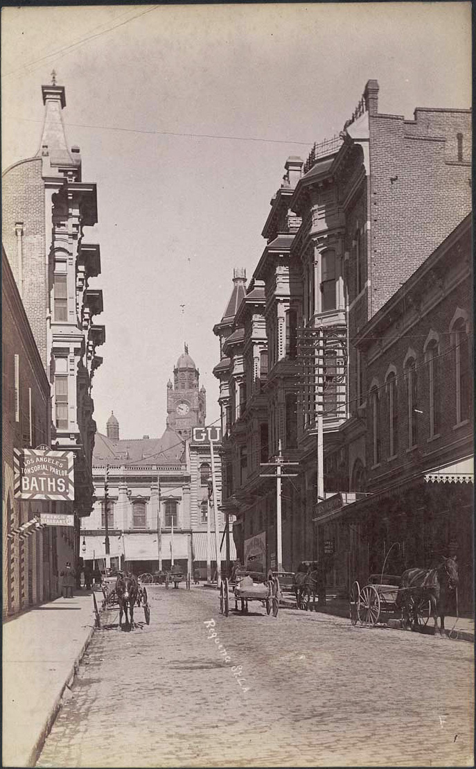
Recently, I happened upon these nice views of Los Angeles from the 1890s.

The 200 block of South Broadway was one of the more active centers of civic life in its time.


Courtesy California State Library.

The almost brand new City Hall (1888-1928) dominates the right of the picture. Several other landmarks of the day can also be seen here. The tower of Los Angeles High School is partially visible to the left of the power poles. The clock tower in the distance is that of the Los Angeles County Court House. The tall spire next to that belongs to the First Presbyterian Church at the SE corner of Broadway and Second Street. And, the gothic structure just barely visible between City Hall and the Crocker Building (with the two bay windows) is Los Angeles's first Jewish synagogue.

Nothing special to see there today, unfortunately.

This quaint brick sideroad – complete with baths and a French restaurant – was Requeña Street (later renamed Market Street). The ornate Victorian on the left is the United States Hotel (1886-1939), and on the opposite corner is the Amestoy Block (1887-1958) – the first brick office building in town (and the first to have an elevator). The clock tower behind, once again, is the Court House.


Courtesy California State Library.

The U.S. Hotel and the Amestoy Block looked much nicer from the front. Click below to view the two from Main Street.

Saturday, November 24, 2012

1891 Landmarks

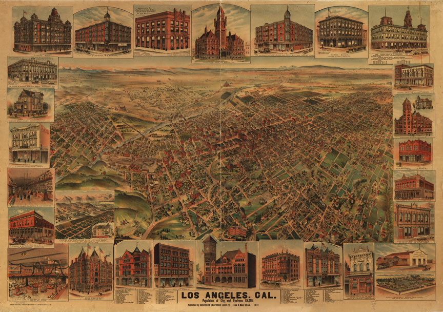
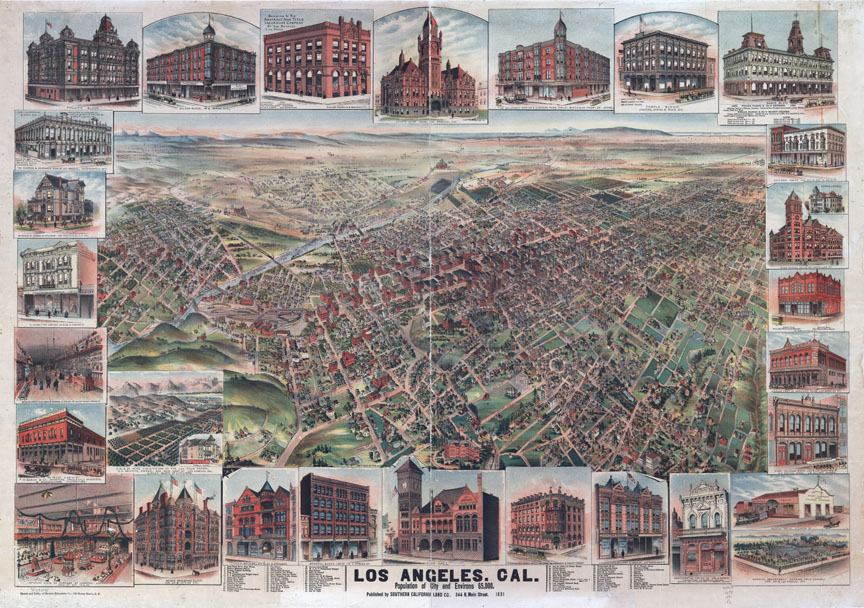
Apologies for the hiatus. Seemingly endless computer snafus and trainwrecks in my personal life have kept me from spending more time indulging in my favorite avocation. Anyway, recently, I used Photoshop to do a little color mod of this panoramic map of Los Angeles from 1891. The highly-foxed original image cleaned up rather well, I think!

Before:

Library of Congress.


After:

Library of Congress.


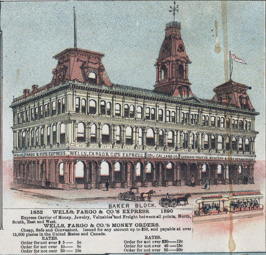
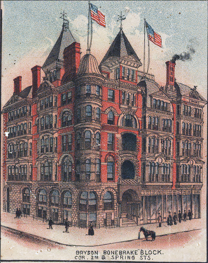
The buildings depicted in the margins are worth a much closer look.


Library of Congress.


Library of Congress.


8 more behind the jump!

Friday, September 14, 2012

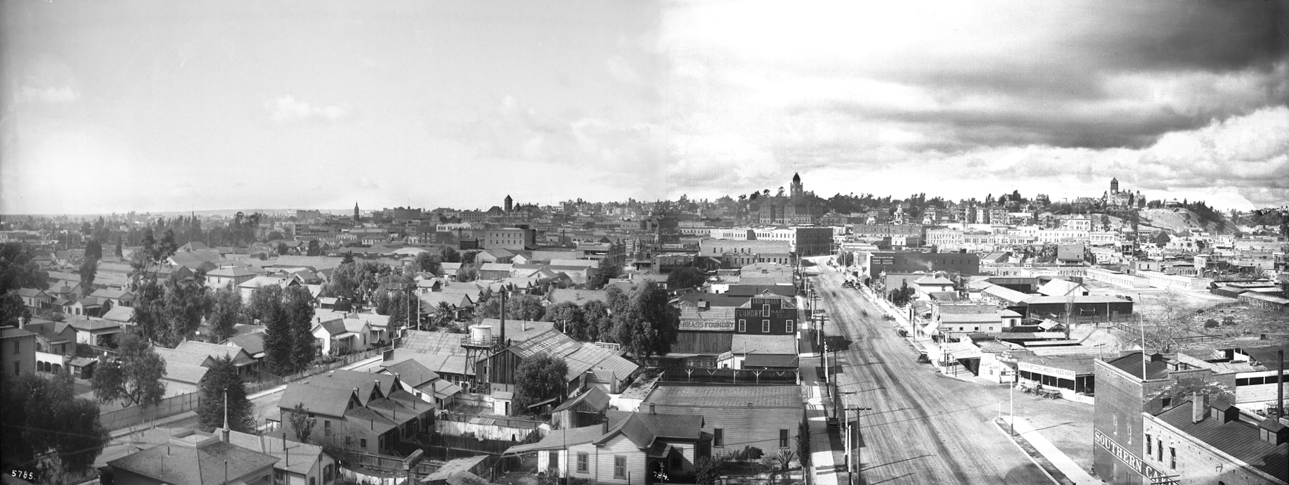
Panorama of Los Angeles, 1899


Click image for full-size enlargement. Images courtesy U.S.C. Digital Library.

A panoramic view of Los Angeles in 1899, looking west from atop the Maier & Zobelein Brewery, known to later generations of Angelenos as the "Brew 102 building." The four tall structures visible here were, from left to right, the Cathedral of St. Vibiana, City Hall, the County Court House, and Los Angeles High School.

In the entire panorama above, I can make out only six buildings that are still standing today.

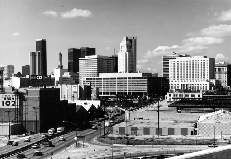
The broad boulevard was Aliso Street. Today, it is U.S. Highway 101. The old Brew 102 building and the modern freeway can be seen in the photo below, circa 1976.


Photo by William Reagh, courtesy Los Angeles Public Library Photo Collection.


Sunday, March 27, 2011

Time-traveling to Old L.A.

Reader and past contributor Nathan Marsak posited a question the other day: what if you had a time machine, and you could pop back to Old L.A. for a weekend. What time in the city's history would you choose?

For me, without a doubt, it would be the weekend of October 14-16, 1910.

Why? Mostly, it would be to attend the Saturday dedication of the brand new 'Million-Dollar' Post Officethe building which first sparked my interest in L.A. history.
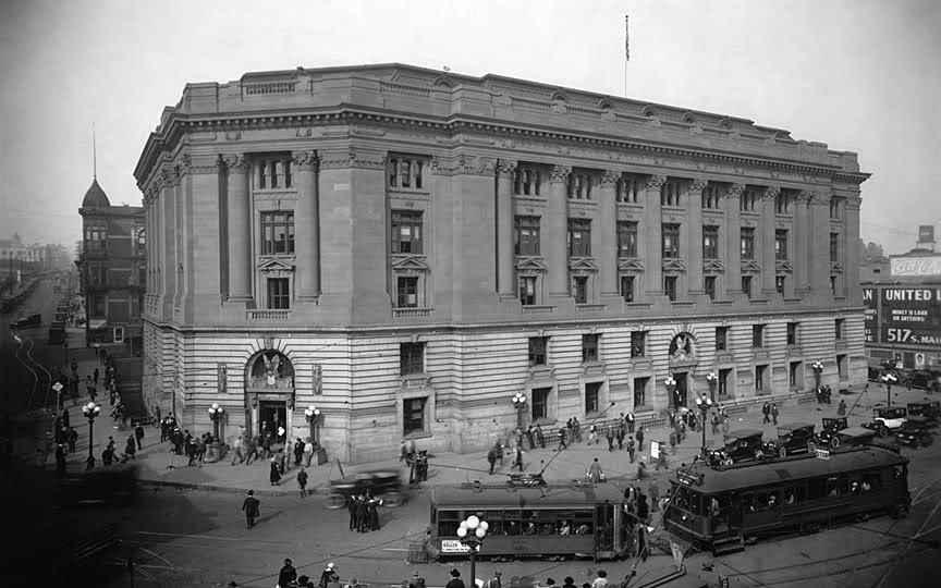

U.S.C. Digital Library.


For my accommodations, I'd book the top-floor corner room at the United States Hotel at Main and Market Sts., which would have an absolutely perfect vantage point for viewing the festivities in Temple Square.
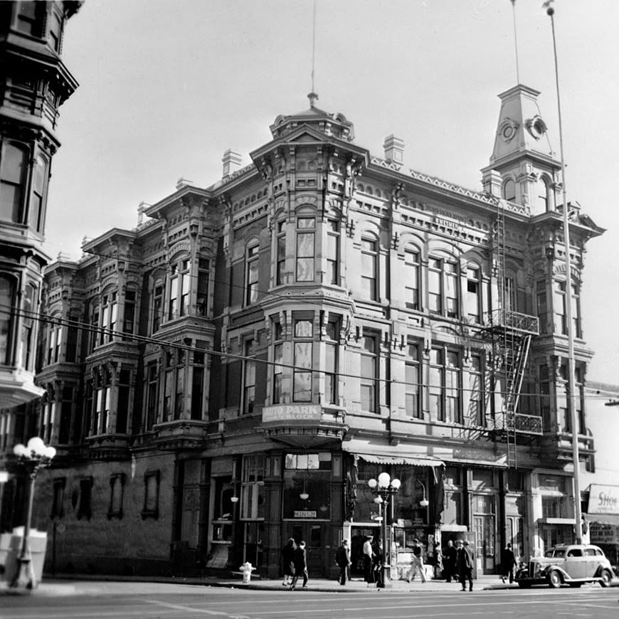

U.S.C. Digital Library.


There'd be plenty of other things to see and do while I was there, of course. Assuming I could get my hands on a period camera, I'd take a ton of good pictures of various buildings for posterity, especially the ruins of the L.A. Times Building, which had been terror-bombed only two Saturdays ago.

I would also love to take a 360-degree panorama from the top of the 1888 Court House. (1910 would be the last year you could do that, with the Hall of Records rising immediately south of the Court House at that time.)

I'd also try to get an Edison cylinder recording of the bell chimes of the old Court House (and the 1888 City Hall's bells, if there actually were bells in that tower – does anyone know for sure?).

And I'd probably walk the old diagonal alignment of Spring Street about a dozen times. I'd ride Court Flight over and over, too, until they kicked me off of it. (Never mind Angels Flight – been there, done that, 50 years later.) ;)
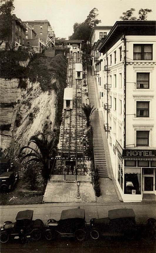

Court Flight.


Re: dining – I'd probably eat breakfasts at the Hollenbeck Hotel and the Hotel Nadeau, and at least one lunch at the little hole-in-the-wall indicated in this old postcard. It had to be good! Someone actually wrote home about it!
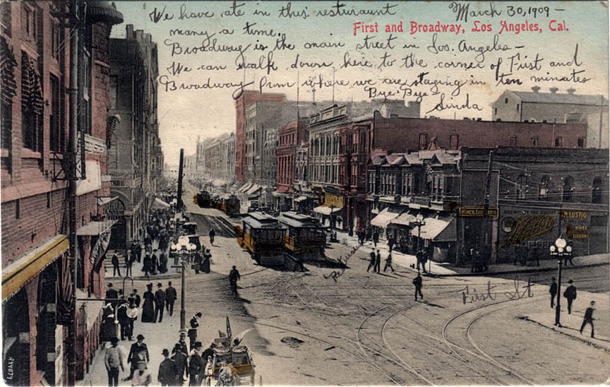


But mostly I'd eat as much "Spanish" food (as Mexican food was called at the time) as I could. I'd be very curious to know what the native cuisine tasted like a hundred years ago!

I'd do a bunch of other things, too, including a mandatory jaunt down to the Longstreet Palms. World-famous at the time, no visit to old L.A. would be complete without seeing them!



Another time I'd like to travel back to would be October of 1936, so I could see the Los Angeles that my mother knew when she first moved there. Of course, Number One on my list of places to visit then would be the incredible Richfield Building. I'd also take my own set of panoramic photos from atop City Hall, and go to the Paris Inn every night for dinner, too. My kind of place, definitely!

But most of all, I'd make sure to be hanging out at the northwest corner of Olympic and Broadway during lunch hour on Tuesday, October 20th, so I could watch a certain snooty young lady get her picture taken by a street photographer. 8)
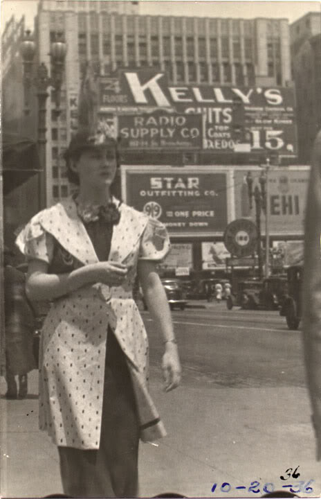


Ooooh, now here's a Twilight Zone thought for you – what if Mom's photographer actually turned out to be time-traveler Me?!  D:


Monday, January 31, 2011

View from atop Angels Flight, 100 years ago

A panoramic postcard view of Downtown Los Angeles from atop the observation deck of Angels Flight, just over 100 years ago.


Click image for a nice 2592x503 enlargement.


I believe this photo can be dated fairly precisely to late summer 1910, as the second Los Angeles Times Building has not yet been bombed, and the Hall Of Records behind it is in the earliest stage of its construction. Quite a remarkable view, in my layman's opinion!


Friday, February 12, 2010

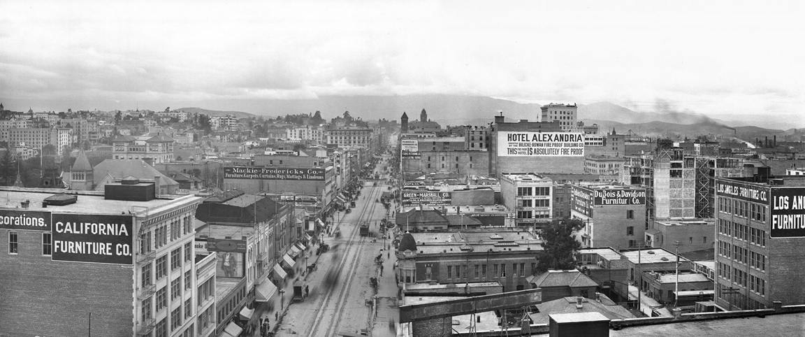
South Broadway, 1905-'06

Recall the image from my last post, which was taken from the roof of the then-new Hotel Lankershim. Now, turn 90 degrees to your right, and this is what you would see. It's South Broadway, looking north from Seventh Street, in winter 1905-'06 :


Source: USC Digital Library.


A pleasing vista of the old city, isn't it? There are familiar landmarks like the pyramid-topped tower of City Hall up the street, with the Los Angeles County Court House on the hill in the background. At right is the tallest structure in town: The Braly Building, or the Union Trust Building as it was called at that particular time.

I have to laugh at the sign on the also-new Hotel Alexandria at center right. "THIS FIRE PROOF HOTEL IS ABSOLUTELY FIRE PROOF." Sounds like a paraphrasing of a familiar internet meme. ;)

Pop quiz! How could I date this photo so precisely to 1906? Hint: it has to do with the conspicuous absence of two formerly-prominent (and pre-eminent) buildings at the left of this picture. If you know which buildings I'm talking about, then you know it's 1906, too! As far as it being winter – that's a very wintry view of the San Gabriel Mountains there. Looks like it does after a cold front's passed through, if my recollection of the area's seasonal weather features is correct.

As nice as this image is, I've saved the best for last. The next view I'll share with you will take your breath away, I guarantee!


Wednesday, January 13, 2010

Views of old Los Angeles

Views of old Los Angeles, compiled by Larry Harnisch...


Pop quiz: Anyone care to guess the exact vantage point for the opening panorama shot?


Sunday, November 22, 2009

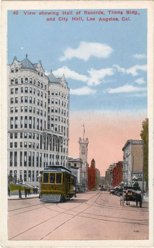
Old Civic Center – south to City Hall

Broadway was the center of civil and commercial life in old Los Angeles. This was the view looking south on Broadway from the Hall Of Records in approximately 1915.


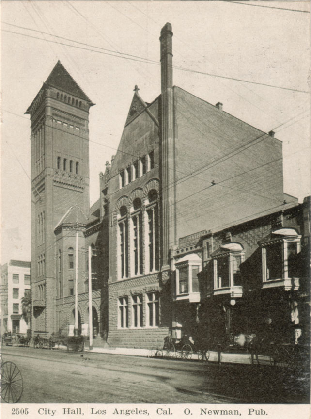
One block down, at the NE corner of Broadway and First, was the L.A. Times building, re-built after the 1910 labor bombing. In the distance, the structure with the pyramid-topped tower was the Los Angeles City Hall, erected in 1888 at 226-238 South Broadway. The postcard view below is from around the turn of the last century.


This grand Romanesque edifice of marble and red sandstone stood for only 40 years, however. It was torn down following the completion of the present City Hall in 1928.

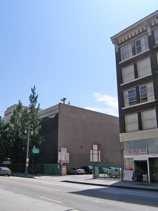
Today, there's nothing to show that this was once an important site in Los Angeles history. It's just for parking now.


Photo by J Scott Shannon.


Actually, the old City Hall isn't completely gone. The Hosfield Building at right was built in 1914 as an annex to house city departments. I'd much rather the Hosfield Building was the one razed for parking, though. It really was a crime to demolish that elegant old civic landmark...


Thursday, September 25, 2008

"Best lighted Street in the World."

While on the subject of street lighting, I'd like to share what is probably my favorite postcard of old Los Angeles: this view of Broadway from First Street. Note the caption. Broadway is said to be the "Best lighted Street in the World." Although the card was mailed in 1907, I believe the image itself may be about a decade older, from around the turn of the last century (due to the conspicuous absence of automobiles).


I love this card mostly because the detail in it is amazing – it really brings the old city alive for me. Broadway was both the commercial center of Los Angeles and the seat of its government. (The tall Romanesque campanile with the pyramidal top is the bell tower of the old City Hall, built in 1888 – at that time, the tallest structure in Los Angeles.) Sadly, as with my even older postcard of Spring Street, not a single structure visible on this Broadway postcard remains standing today.

Here is the same view today. What was once a bustling downtown street filled with people, commerce and civil life is now a home only for sterile monolithic buildings.


View Larger Map


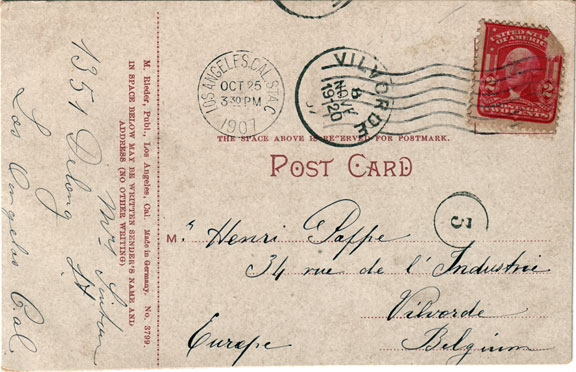
The postcard itself has an interesting story to tell. It was originally mailed to Belgium, and as you can see, it took almost a month to get there; traveling as it must have by sea.


In Europe, the postcard somehow survived two World Wars, made its way to the Netherlands where I bought it from an eBay seller there, and in the 21st century, the postcard is now back in California, with me. ^^

Now, see where the person who sent the card lived, and what's there today...

I can't quite decipher the name of the sender. It looks something like "Mrs. Linton," but her address is clearly "1351 Delong St."; note her 1s written in the European style.

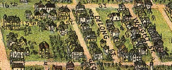
Well, Delong Street is another of those vanished residential L.A. streets, like Palm Drive. And actually, Delong turns out to be walking distance from Palm Drive, in what was generally a very nice old out-of-the-way part of town.


Here's a view of Delong from an 1894 "bird's eye" map of Los Angeles.


We're looking towards the south here. In L.A., odd numbered addresses are on the west sides of streets, so 1351 would probably be the house immediately to the right of the "S" in "ST.", or maybe the small green one up and to the right of the "S."

Anyway, here's an aerial view of the neighborhood today, and a Google Maps Street View image. Delong Street is now occupied by the Los Angeles Convention Center...


Google Earth.


View Larger Map

Where «34 rue de l'industrie» is in Vilvorde, Belgium, though, I wasn't able to determine. Like Delong St. in Los Angeles, it, too, is likely no more...