A vanished city lives again...

Showing posts with label then and now. Show all posts

Thursday, May 15, 2014

Downtown Views, 1880s

Looking north on Main Street from the northwest corner of Fifth Street, circa 1886.
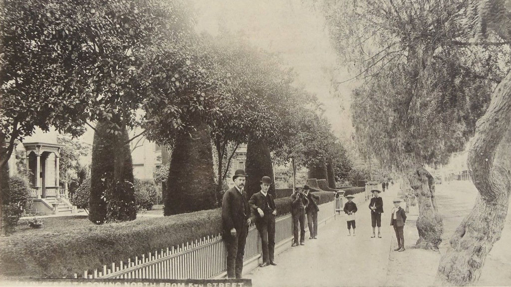
The house whose entrance can be seen at far left was built in 1869 at 343 South Main Street, and was the residence of one John H. Jones until 1900. In 1901, with a new address of 447 South Main, the house became The Belmont, a cafe specializing in oysters and other seafood. By 1907, the restaurant was known as The Beaumont. The Rosslyn Hotel was built on the site in 1911-1912. Today, it is known as Rosslyn Lofts.
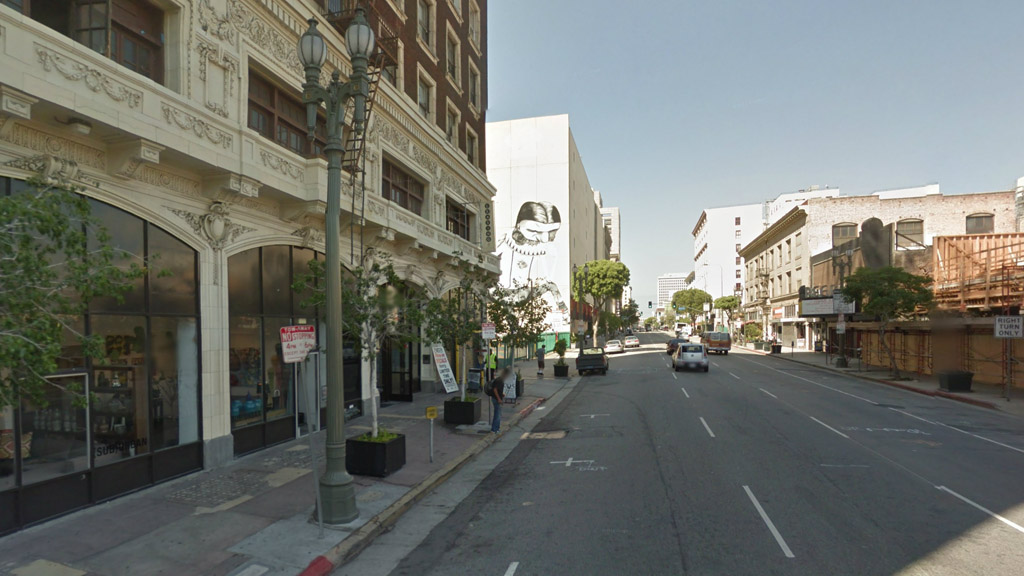

Click image to see Google Maps Street View.

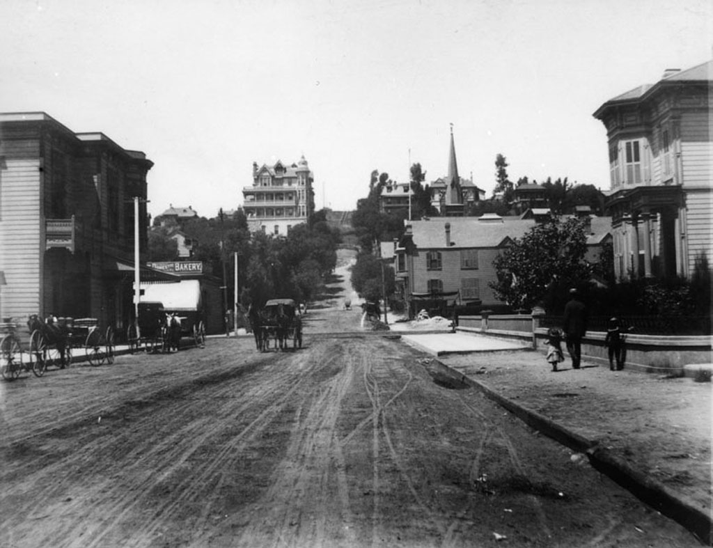
Fort Street (now Broadway) nearing First Street, also circa 1886.
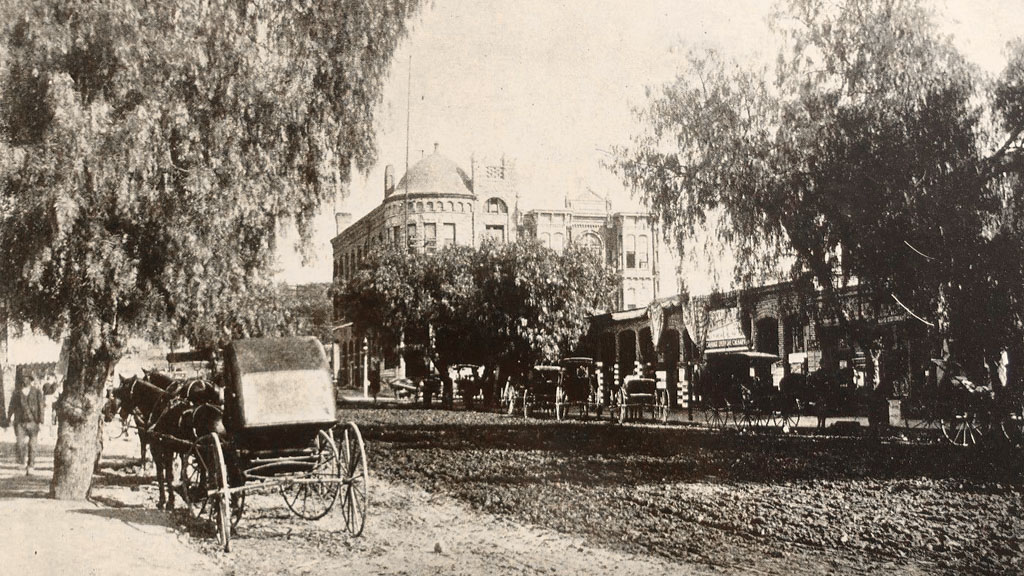
In the background, the brand new home of the Los Angeles Times towers over its pueblo-era neighbors. The first three-storey brick structure built on Fort/Broadway, the Times Building heralded in the era during which the street grew to become the principal commercial district of old Los Angeles. The Times Building was destroyed in a unionist terror bombing in October, 1910.

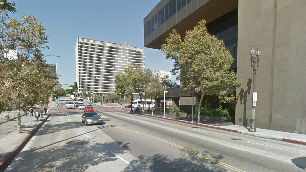
Today, the Los Angeles Times occupies the entire city block bounded by Broadway, Spring, First and Second Streets. The Times' West Building (1972) looms at right.

Click image to see Google Maps Street View.
 

Tuesday, March 19, 2013

Third Street, Then and Now

Third Street looking west from Spring Street, circa 1888:


Courtesy Water and Power Associates.

Up on Bunker Hill stands the ornate victorian Crocker Mansion, built in 1886. Next to it, in 1901, another old L.A. landmark would be constructed: the Angels Flight funicular railway.


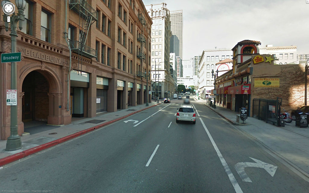
The same view today:


Google Maps Street View.

The famous Bradbury Building, left, was constructed in 1893, and is now the oldest office building in Los Angeles.


Sunday, September 23, 2012

Cahuenga Boulevard, Then & Now

The same spot,
    on the same road,
        in three centuries...

Cahuenga Pass, 1897:


Courtesy U.S.C. Digital Library.

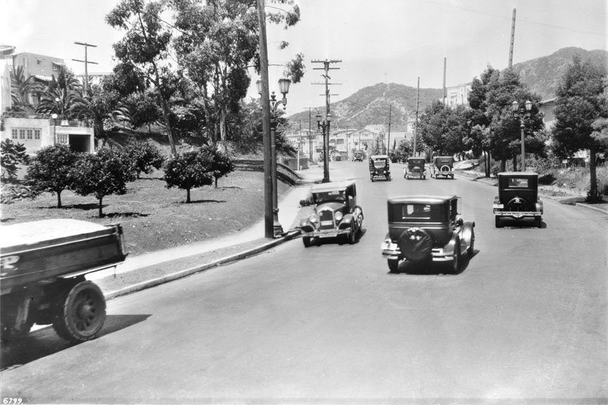
Cahuenga Avenue, 1927:


Courtesy U.S.C. Digital Library.

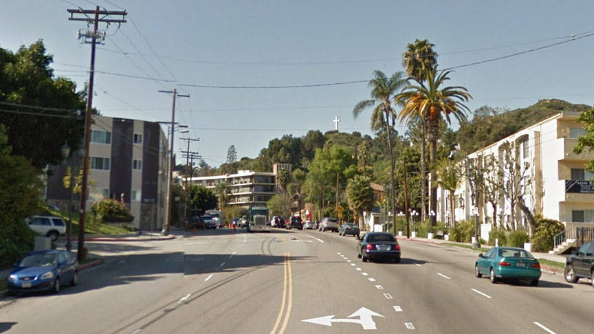
Cahuenga Boulevard, Today:


Click image above to see the Google Maps Street View.


Thursday, August 30, 2012

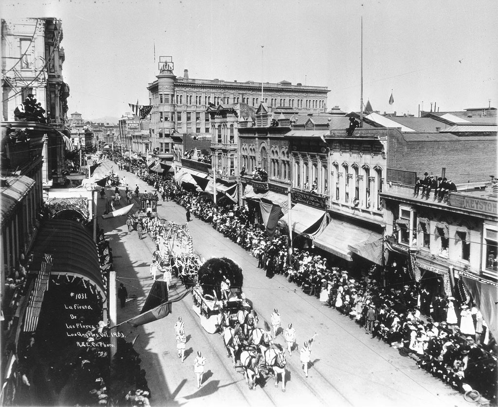
Spring and First Streets, c.1903

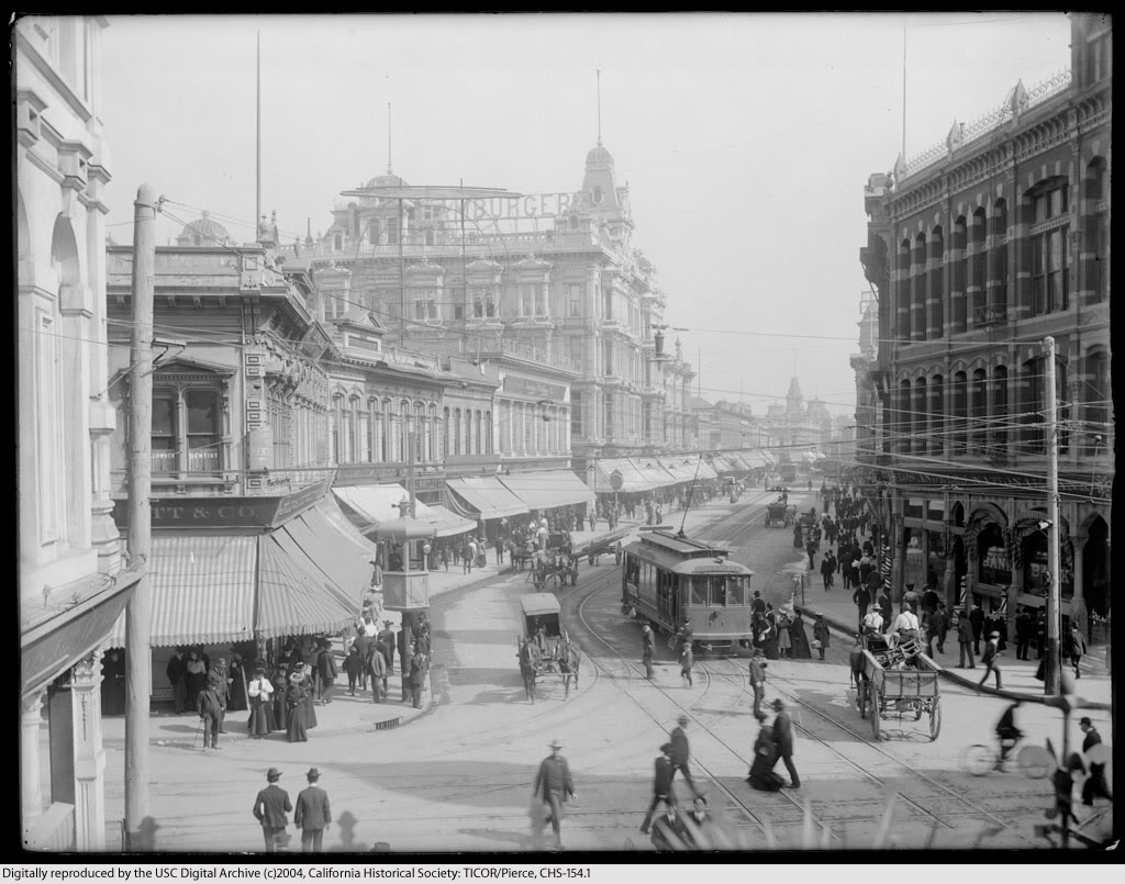
One of my favorite places in vanished Los Angeles was the bustling intersection of Spring and First Streets. Here are three contemporaneous views from just after the turn of the last century.

Looking north on Spring Street from First.


Courtesy U.S.C. Digital Library.


Now, in the photo above, see the man at upper left leaning on the flagpole? He's standing on the roof of the Larronde Block, which is the likely vantage point of this shot dated 1903.


Courtesy U.S.C. Digital Library.


And the view south, probably taken from an upper storey window in the Phillips Block.


Courtesy U.S.C. Digital Library.


South on Spring from First today. Click on the Google Street View image below to have a look around the intersection now. (Peek over your left shoulder to really get your bearings.) ;-)


Google Maps Street View.


Thursday, August 23, 2012

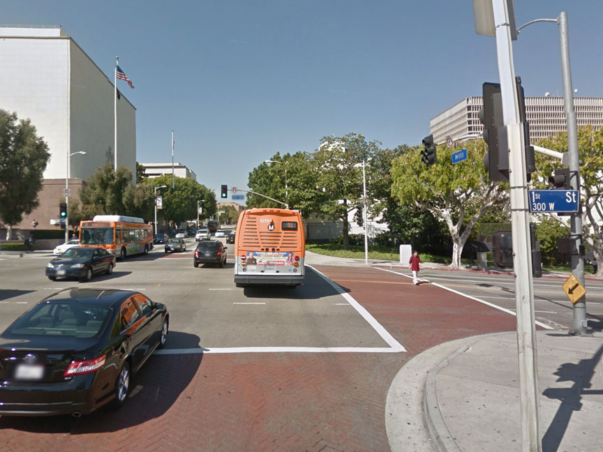
Hill Street at First, Then & Now

1908:


Courtesy U.S.C. Digital Library.


2011:


Google Maps Street View.


Today, clearly, it's "Hill Street" in name only.


Tuesday, September 27, 2011

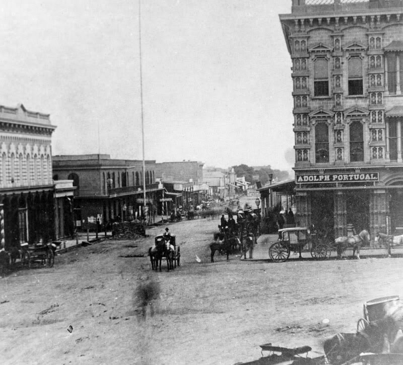
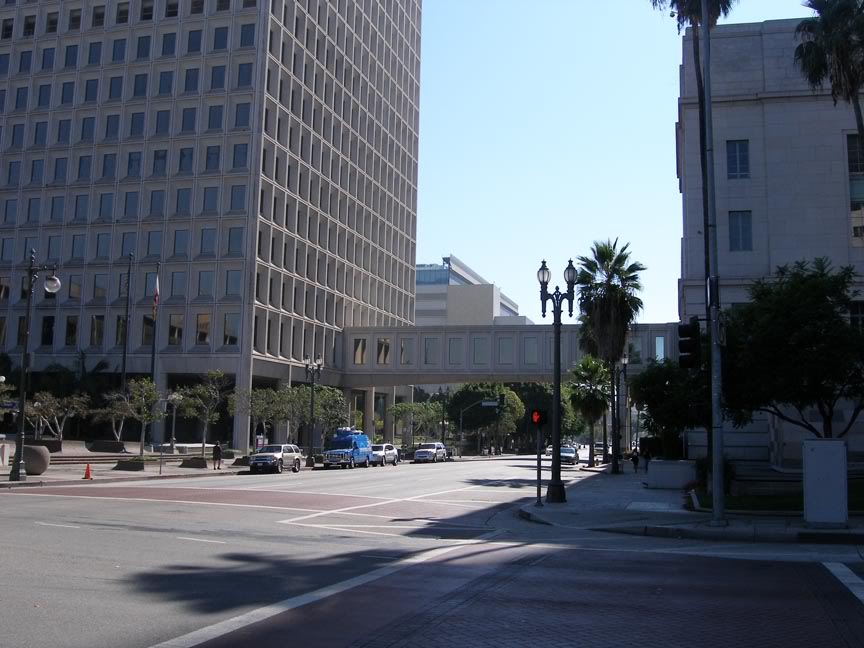
Main Street at Temple, Then & Now

Looking south on Main Street from Temple.

c.1879:  On the corner, the Temple Block.


Los Angeles Public Library Photo Collection.


2011:  Now it's all City Hall.


Photo by J Scott Shannon.


Wednesday, May 4, 2011

Urban Diachrony blog

Just wanted to put in an enthusiastic plug for a relatively new L.A. history blog called Urban Diachrony. Its principal subject matter is "Then & Now" photographs of various locations within the city.

The blogger, Brian Hsu, not only does an excellent job of taking his "Now" photos from the exact same vantage point as "Then," his accompanying descriptions are very detailed and always interesting. I learn something new about L.A. history with every post. Definitely check it out! I guarantee you will find it worthwhile.


I'm going to have cataract surgery on my left eye tomorrow. Hopefully I can start posting to my own blog more often after I get my normal vision back. This bad eye of mine has been a real impediment to me in recent months...


Wednesday, March 16, 2011

Temple Square: Then, Then, Then & Now

Temple Square – the former junction of Main, Temple and Spring Streets – photographed from the roof of the Bella Union Hotel.

c.1870:


Los Angeles Public Library Photo Collection.


1876:


Los Angeles Public Library Photo Collection.


1888:


Link to image on Flickr.


And here is the view from the former site of the Bella Union in the present day...


Photo by J Scott Shannon.


Wednesday, March 2, 2011

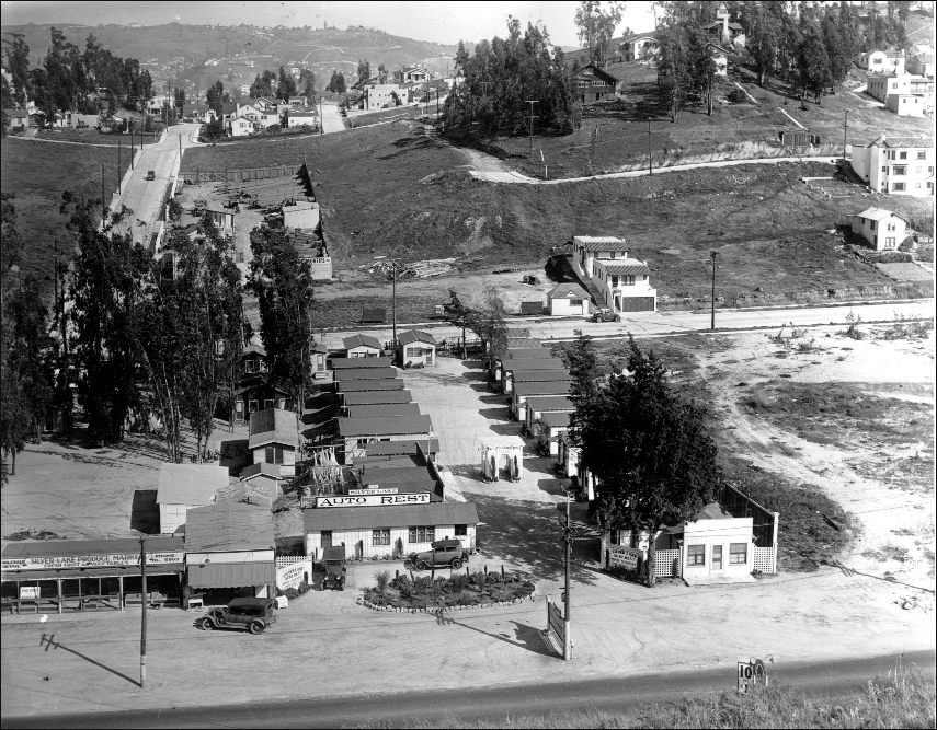
Mom's first car at the Silver Lake Auto Court

Mother's new position as General Secretary of the Los Angeles Civic Light Opera was apparently sufficiently remunerative for her to be able to buy her first car. It was a used 1936 Pontiac Master Six Coupe. Here she is with her new Pride and Joy at the Silver Lake Auto Court at 2500 Glendale Blvd. in July, 1938.


Link to original photo on Flickr.


I know Mom did not live there, though. In 1938, she and her sister were living in their first apartment at the Barker Hotel in Westlake.

Here is a contemporaneous linen postcard of the auto rest.


On the reverse of the card it states: "A 67 unit Auto Court with Trailer Sites. Resort Atmosphere in the heart of the City, well known for its Hospitality and Service. Rates Most Reasonable."

Here is an aerial view. As best as I'm able to determine, Mom was posing with her car near the spot where the red arrow is pointing.


silverlake.org


Remarkably, Michael Smith, a/k/a Kansas Sebastian on flickr, posted this Then & Now composite of the Silver Lake Auto Court in the 1920s with a comparison shot from 2010. His sleuthing revealed that the older aerial view was taken approximately 11 years before Mother was there posing with her Pontiac.


Click image to view the original photo on Flickr.


Amazing the things one can find on the 'net, eh!


Friday, December 31, 2010

Ramona Boulevard – L.A.'s first expressway

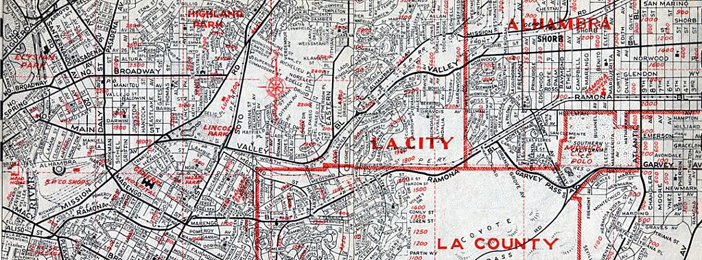
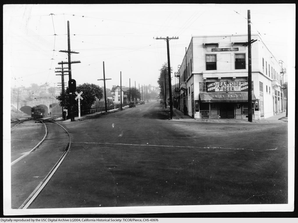
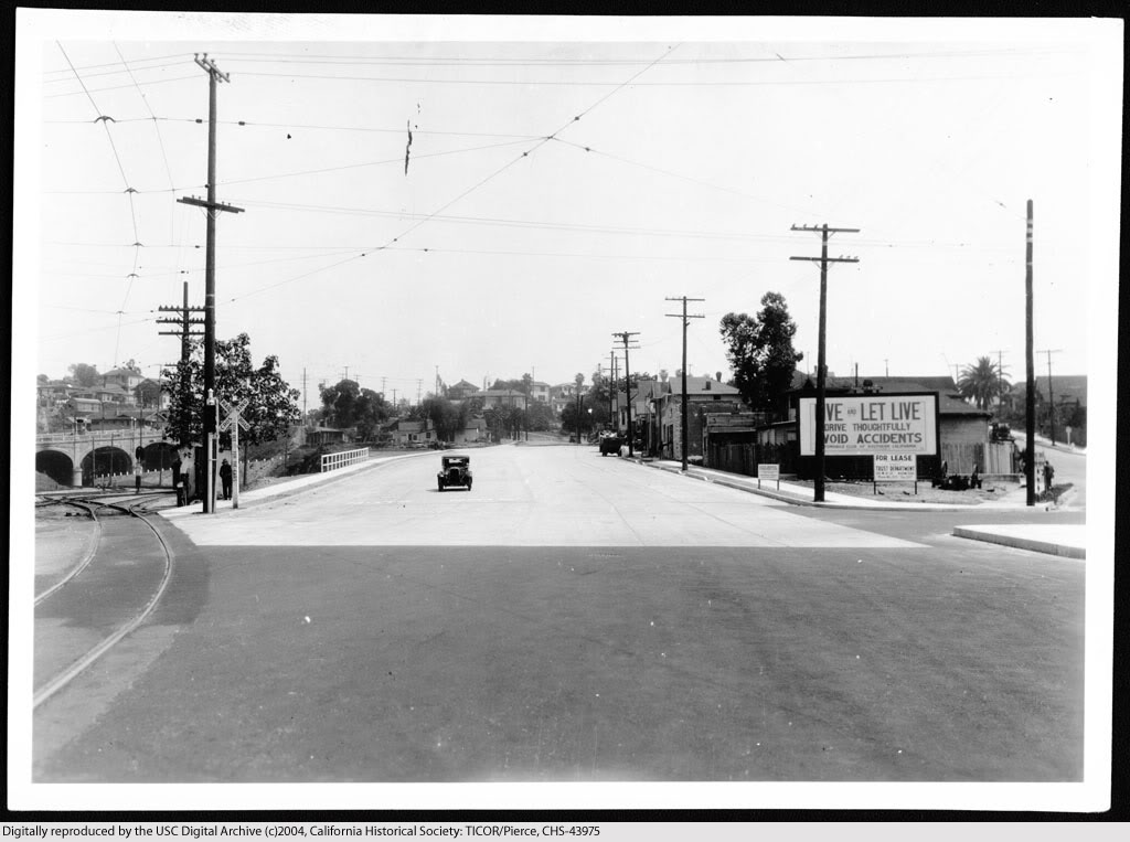
Most people believe that the Arroyo Seco Parkway (1940) was the first express thoroughfare serving the city of Los Angeles. That distinction actually belongs to Ramona Boulevard (at bottom on map below), which was constructed from 1933-1935. It originated at Aliso Street a few hundred feet past Mission Road. The parkway section first passed under the Macy Street viaduct, then continued east approximately 4 miles without any stops until thru traffic turned onto Garvey Pass Avenue.


Renie Atlas, "Victory Edition," May, 1943.


View east on Aliso Street at its intersection with Mission Road (foreground) and Summit Avenue (far right) before its widening for the construction of Ramona Boulevard, November 27, 1933.


USC Digital Library-California Historical Society.


The new east road is open to traffic, April 15, 1935.


USC Digital Library-California Historical Society.


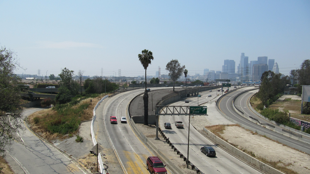
U.S. Highway 101 at Mission Road looking east, 2009.


Link to Google Maps Street View.


Continue reading...

Part 2
Part 3
Part 4


Views southwest from the Macy Street Viaduct, 1933-2010

The proposed route of Ramona Boulevard, November 15, 1933.


USC Digital Library-California Historical Society.


Ramona Boulevard upon completion, April 16, 1935.


USC Digital Library-California Historical Society.


Interchange of the new Ramona Freeway and Santa Ana Freeway, July 12, 1955. Just look at that smog!


USC Digital Library-Los Angeles Examiner.


Interchange of Interstate 10 and U.S. Highway 101, April 18, 2010.


Photo courtesy waltarrrrr on Flickr.


Previous posts about Ramona Boulevard...

Part 1
Part 2
Part 3

Happy New Year, everyone!


Thursday, June 10, 2010

First class People!!

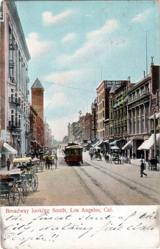
Here's a nice postcard view of old Broadway south from First Street in the mid-aughts. The sender's note is nice, too: "The finest street of the City, walking first class People!!"


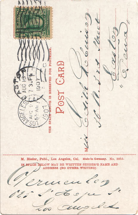
Here is the photograph the postcard was evidently made from.

Note the return address of 625 S. Hope St.


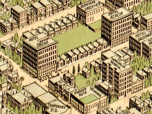
This is what the 600 block of Hope looked like back then. Since odd numbered addresses are on the west sides of streets in L.A., 625 Hope must be one of those little cottages lined up between the Hotel Orena and Hotel Acacia.


Library of Congress.


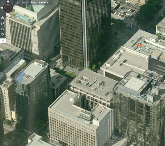
A century later, that stretch of Hope looks just a tad bit different. ;) In fact, Wilshire Boulevard now cuts a wide swath right through where the cottages used to be.


Bing Maps.


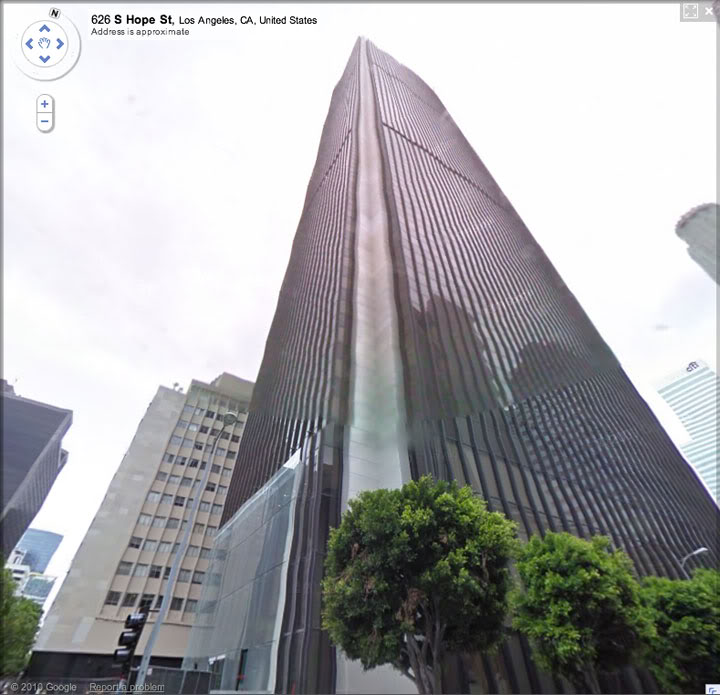
And 625 S. Hope proper? Today, it's the site of one of Los Angeles's most familiar skyscrapers – none other than the United California Bank Tower (1970), which was the tallest building on the West Coast for much of the time I lived in the L.A. area.


Google Maps Street View.


Currently, of course, the UCB/First Interstate building is known as AON Center.


Wednesday, June 2, 2010

New Spring Street treasures

One of the main reasons I haven't been posting here lately is that there's been a long dearth of worthwhile additions to my L.A. history collection, which regular readers have probably noticed is where I get most of my material.

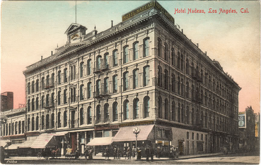
Anyway, my long drought came to an end a couple of weeks ago with the acquisition of this awesome postcard of the Hotel Nadeau from 1908. This was one of the most important structures in early Los Angeles – it being the city's first-ever four-storey building, and incorporating its first passenger elevator, as well.


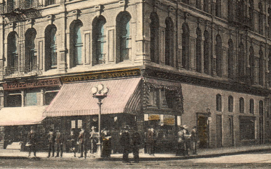
The detail is remarkable, isn't it? I was particularly pleased to finally obtain a clear depiction of the Godfrey & Moore pharmacy in the hotel's corner storefront. And what a corner! First and Spring in 1908 – you could hardly imagine a more ideal location for a retail business back then.


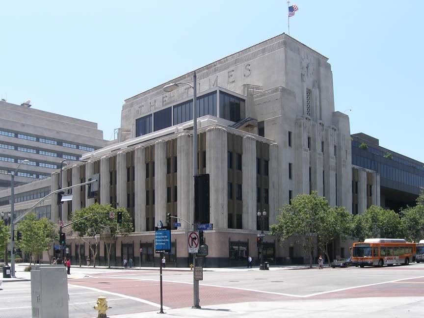
Today, of course, the main L.A. Times building occupies this once-vibrant street corner...


Photo by J Scott Shannon.


And look! I just got this Godfrey & Moore druggist bottle, too. I think this one is older than the Godfrey & Moore bottle I posted about previously. Reason I think that is the presence of a period after "LOS ANGELES." The convention of placing a period at the end of non-sentences ended around 1902, so this bottle probably pre-dates the other (and the postcard) by at least 6 or 7 years.


Photo by J Scott Shannon.

I also like this specimen because it's a "dug" bottle. It was actually unearthed from somewhere under the old city, so it's almost akin to a fossil...


Thursday, March 18, 2010

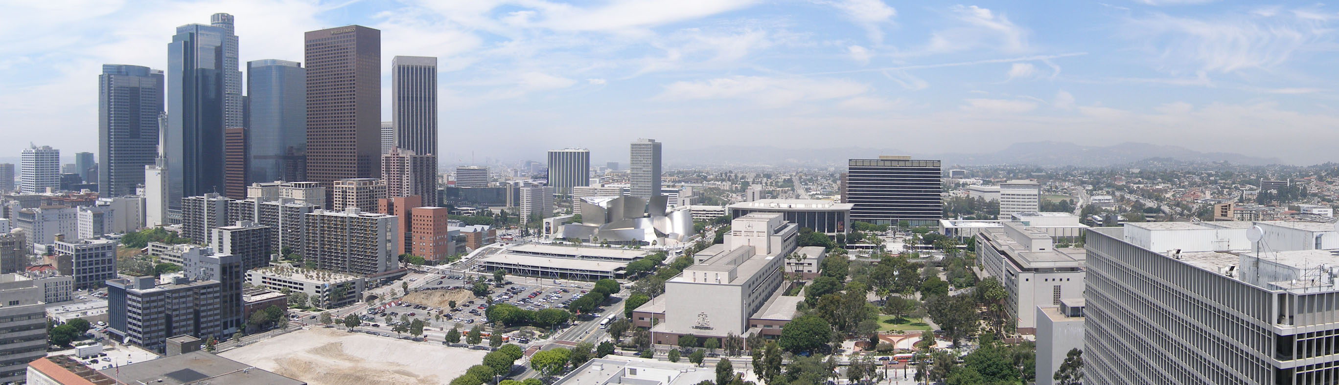
Bunker Hill panorama: Then & Now

Bunker Hill, viewed in its entirety, as few people alive today have ever seen it.

c.1939:


Source: USC Digital Library. (Record IDs: whit-m2777, whit-m2775, whit-m2776 & whit-m2779.)
Click on image above to enlarge.


Only one human lifespan later, the same vista is virtually unrecognizable.

2009:


Photo by J Scott Shannon.
Click on image above to enlarge.


Sunday, November 22, 2009

Old Civic Center – south to City Hall

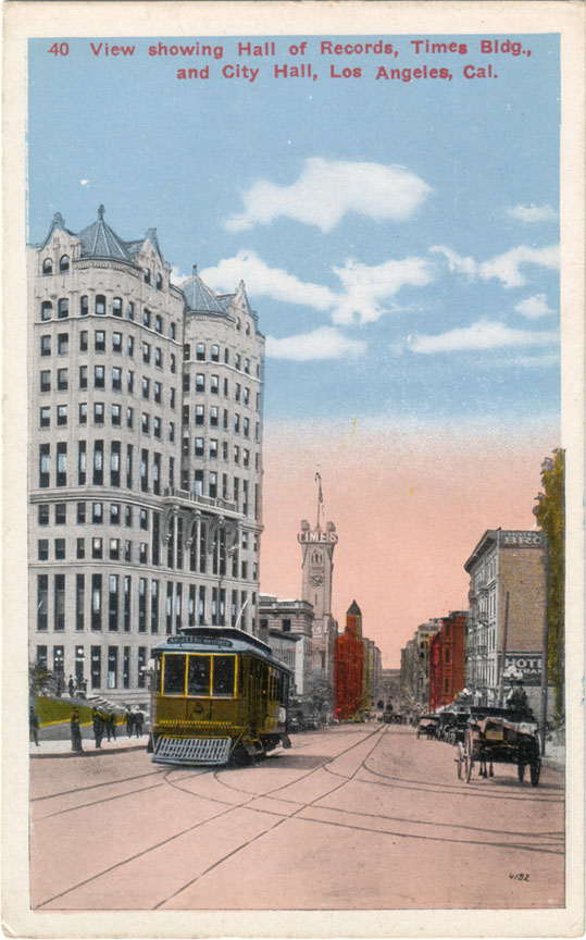
Broadway was the center of civil and commercial life in old Los Angeles. This was the view looking south on Broadway from the Hall Of Records in approximately 1915.


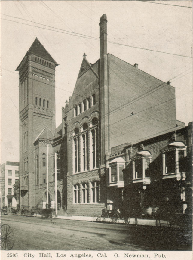
One block down, at the NE corner of Broadway and First, was the L.A. Times building, re-built after the 1910 labor bombing. In the distance, the structure with the pyramid-topped tower was the Los Angeles City Hall, erected in 1888 at 226-238 South Broadway. The postcard view below is from around the turn of the last century.


This grand Romanesque edifice of marble and red sandstone stood for only 40 years, however. It was torn down following the completion of the present City Hall in 1928.

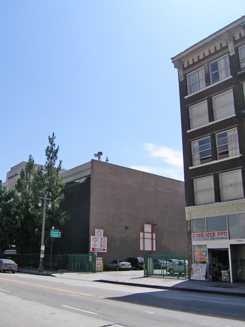
Today, there's nothing to show that this was once an important site in Los Angeles history. It's just for parking now.
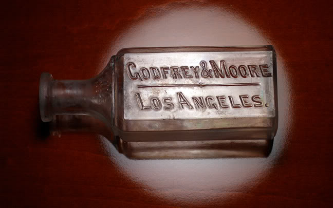

Photo by J Scott Shannon.


Actually, the old City Hall isn't completely gone. The Hosfield Building at right was built in 1914 as an annex to house city departments. I'd much rather the Hosfield Building was the one razed for parking, though. It really was a crime to demolish that elegant old civic landmark...


Monday, November 9, 2009

The old and the new

Main Street south from Republic Street, 1939:

Today: