A vanished city lives again...

Showing posts with label freeways. Show all posts

Monday, February 25, 2013

The 1924 Olmsted "Major Traffic Street Plan"

This recent post by Glen Creason on Los Angeles Magazine's City Think blog introduces readers to Frederick Law Olmsted, Jr. et al.'s grandiose "Major Traffic Street Plan" of 1924.

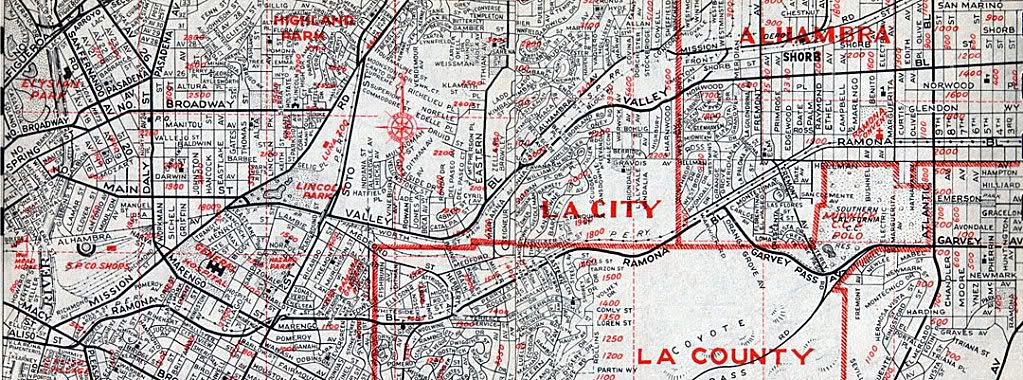
I first acquired this map out of curiosity, mostly because some of the street routes and parkways proposed in it looked significantly different than the ones Los Angeles eventually ended up with.

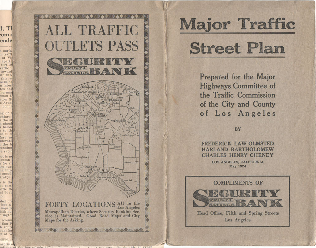
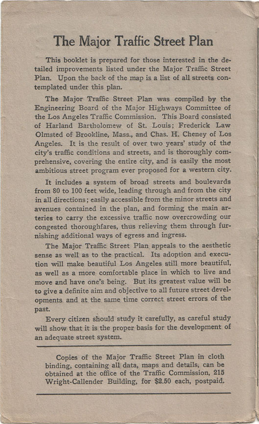
Here's the basic mission statement of the plan.

The legend (the map is far too large for me to scan in its entirety, unfortunately):

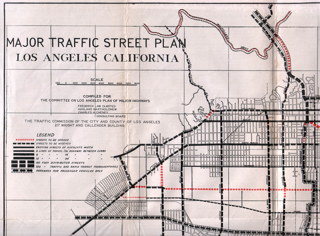
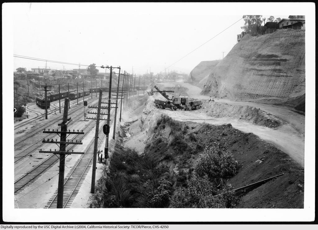
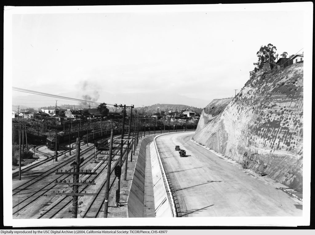
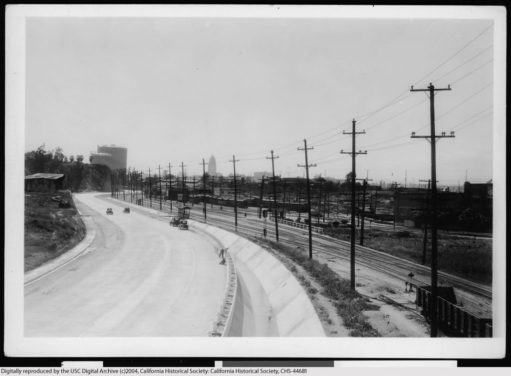
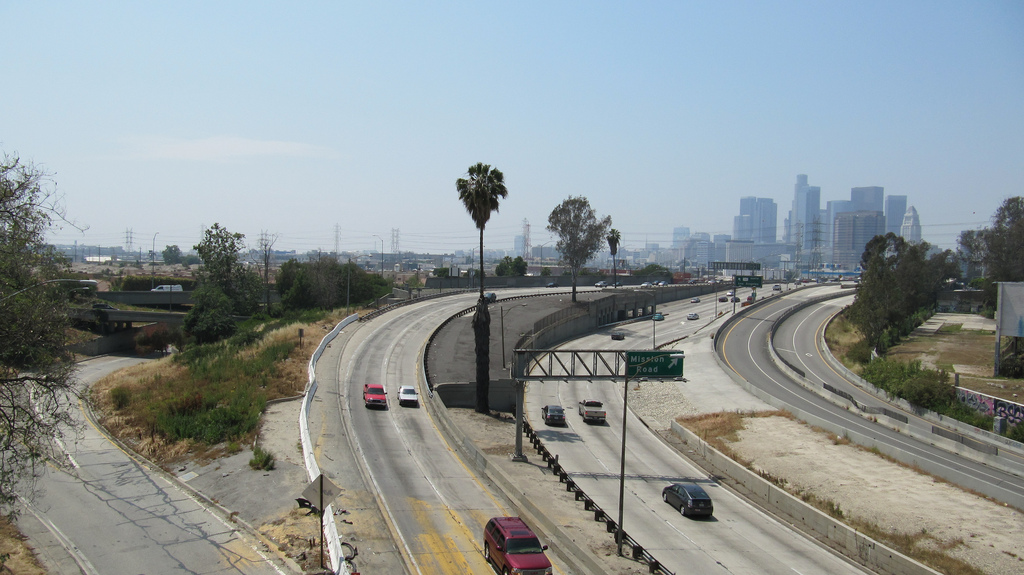
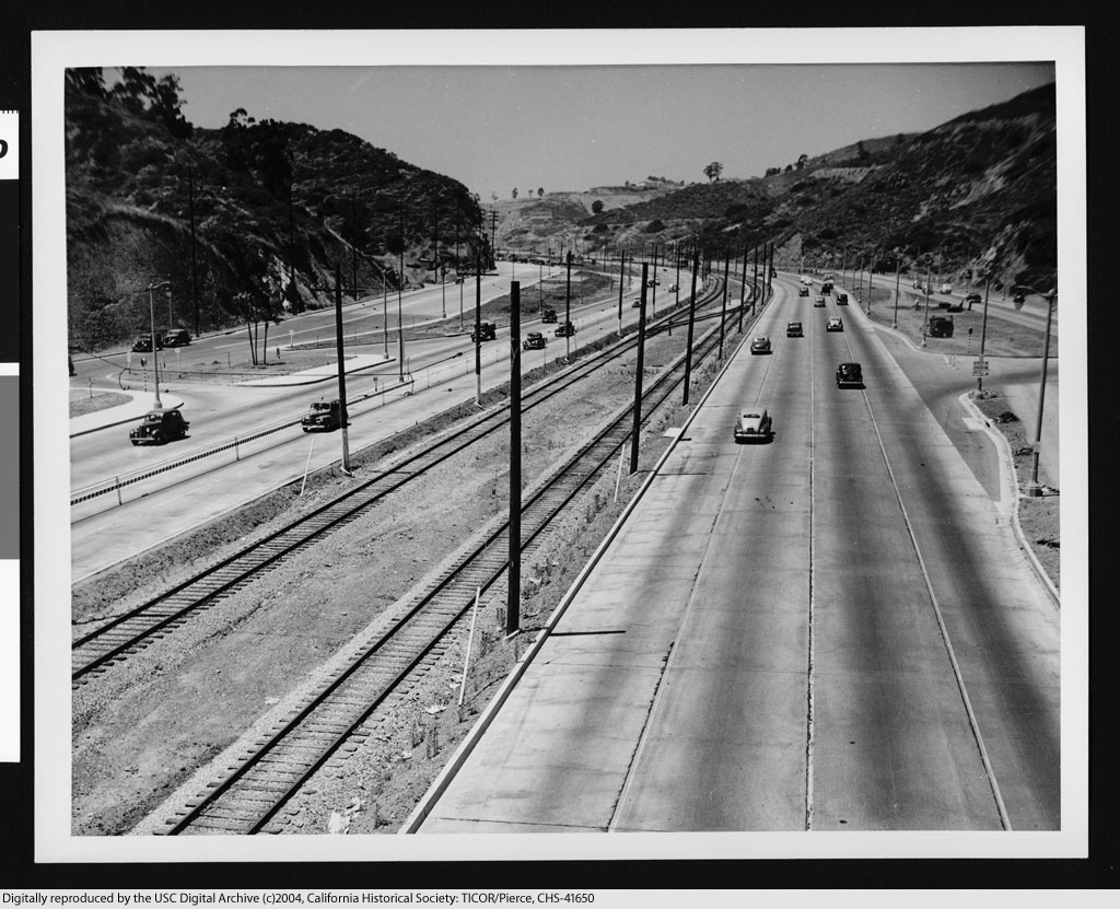
Several new scenic arteries were proposed, one of which was to be called "Arroyo Seco Parkway" (described in the plan as a "radical thoroughfare"). That and "One Hundredth Street" (Century Boulevard) seem to be the only major roads from this plan that ended up being built, though.

One of the rejected proposals was for the Downtown portion of First Street to be widened to 150 feet, and then extended northwest up to Hollywood – clearly a 1924 approximation of what would become the Hollywood Freeway a generation later.

Another interesting proposal was a road called the "River Truck Speedway," which was to run somewhat adjacent to the Los Angeles River and was intended solely for use by commercial vehicles. Obviously this idea didn't get past the drawing board stage, either.

Other proposed roads that were never realized were the "Hollywood-Palos Verdes Parkway," the "Silver Lake Parkway," and parkways for portions of Wilshire Boulevard (west of Crenshaw), Cahuenga Avenue, Riverside Drive, Franklin Avenue/Los Feliz Boulevard, Griffith Park and Mulholland Drive.

The Olmsted plan was admittedly visionary in foreseeing the need for wide urban roads that incorporated a variety of modes of rapid transit, but it was probably for the best that it was not adopted. The present system of freeways, although not without its own inherent problems, turned out to be a much better fit for Los Angeles's ever-evolving traffic challenges.


Friday, December 31, 2010

Ramona Boulevard – L.A.'s first expressway

Most people believe that the Arroyo Seco Parkway (1940) was the first express thoroughfare serving the city of Los Angeles. That distinction actually belongs to Ramona Boulevard (at bottom on map below), which was constructed from 1933-1935. It originated at Aliso Street a few hundred feet past Mission Road. The parkway section first passed under the Macy Street viaduct, then continued east approximately 4 miles without any stops until thru traffic turned onto Garvey Pass Avenue.


Renie Atlas, "Victory Edition," May, 1943.


View east on Aliso Street at its intersection with Mission Road (foreground) and Summit Avenue (far right) before its widening for the construction of Ramona Boulevard, November 27, 1933.


USC Digital Library-California Historical Society.


The new east road is open to traffic, April 15, 1935.


USC Digital Library-California Historical Society.


U.S. Highway 101 at Mission Road looking east, 2009.


Link to Google Maps Street View.


Continue reading...

Part 2
Part 3
Part 4


Ramona Boulevard construction

View northeast along the proposed route of Ramona Boulevard, from the Macy Street viaduct, November 15, 1933.


USC Digital Library-California Historical Society.


Earthmoving for the construction of Ramona Boulevard, June 4, 1934.


USC Digital Library-California Historical Society.


Completed Ramona Boulevard from the Macy Street viaduct, April, 16, 1935.


USC Digital Library-California Historical Society.


View northeast showing the proposed Ramona Boulevard from a point 100 feet north of the intersection of Mitchell and Echandia Streets, November 15, 1933.


USC Digital Library-California Historical Society.


Site cleared for construction, c.1934.


USC Digital Library-California Historical Society.


Ramona Boulevard after completion, April 16, 1935.


USC Digital Library-California Historical Society.

Continue reading...

Part 3
Part 4


Ramona Boulevard extras

The Arroyo de Los Posos, where Ramona Boulevard would soon be built. Looking westward from the vicinity of State Street, November 30, 1933.


USC Digital Library-California Historical Society.


All of the overpasses shown below (except the one at Pomeroy Ave.) were still intact until the very early 1970s, when the three then-existing lanes of the San Bernardino Freeway were widened to more.

Traveling eastbound on Ramona, the first overpass after Macy was the State Street viaduct. April 16, 1935.


USC Digital Library-California Historical Society.


View back towards town from atop the State St. viaduct.


USC Digital Library-California Historical Society.


Next overpass eastbound was the pedestrian bridge at Pomeroy Avenue (c.1934-1939).


USC Digital Library-California Historical Society.


Continuing east on Ramona, the overpasses for Marengo Street (foreground) and Soto (rear).


USC Digital Library-California Historical Society.


Continue reading...

Part 4


Views southwest from the Macy Street Viaduct, 1933-2010

The proposed route of Ramona Boulevard, November 15, 1933.


USC Digital Library-California Historical Society.


Ramona Boulevard upon completion, April 16, 1935.


USC Digital Library-California Historical Society.


Interchange of the new Ramona Freeway and Santa Ana Freeway, July 12, 1955. Just look at that smog!


USC Digital Library-Los Angeles Examiner.


Interchange of Interstate 10 and U.S. Highway 101, April 18, 2010.


Photo courtesy waltarrrrr on Flickr.


Previous posts about Ramona Boulevard...

Part 1
Part 2
Part 3

Happy New Year, everyone!


Saturday, November 7, 2009

In only 30 years...

Cahuenga Pass, 1911:


Courtesy U.S.C. Digital Library.


Cahuenga Boulevard, 1941:


Courtesy U.S.C. Digital Library.


All this change in only 30 years! Not as much change since then, though; the Hollywood Freeway today still follows basically the same path as this old road. It's really something to see Cahuenga Pass when it was only a dirt road traversed by horse teams, though. It's amazing to think that was less than 100 years ago. Only 1-1/2 normal human lifetimes, and Cahuenga Pass is almost unrecognizable from what it originally was...


Monday, June 1, 2009

Downtown Harbor Freeway, 50 years ago


Photo above and others linked to in this post courtesy of the U.S.C. Digital Archive.

Today, this is the downtown section of the Pasadena Freeway (Interstate 110). In 1959, though, when this photo was taken, it was the northernmost section of the Harbor Freeway (California State Highway 11), and this is how I first remember it.

I like this photo primarily for its composition, but also because it gives a great close-up view of what an old L.A. freeway looked like. Mom hated the Harbor Freeway, though, so we rarely took this route, but I still have vivid recollections of the eastern San Bernardino Freeway (U.S. 99 then/I-10 now) in the late '50s, and our hometown stretch looked exactly like this (minus the fancy planters in the center divider).

The freeways were quite different back then. For one thing, all of the exit and informational signs on the original freeways were made of porcelain steel, and had white letters on a black background, like the one here that says "Downtown." The smaller informational signs at the roadside had reflectors in the letters so they could be read at night, but the large signs were illuminated by lights, much like a billboard. (Here's another view of the Downtown Harbor, showing some nice examples of the larger black-and-white signage.) The first time I remember seeing the green freeway signs of today was when the first stretch of the Santa Monica Freeway opened in 1961.

To me, though, the most remarkable feature of the early freeways was the complete absence of any kind of crash barrier in the median strip. This plus the fact that seat belts were still a relatively rare innovation in the 1950s – well, it's no wonder many people back then thought that driving on a freeway was literally taking your life in your hands. Note that the curb isn't even sharply angled to keep a tire from straying into the dividing strip. It's easy to imagine how someone in the fast lane could take their eyes off the road for only a second or two, drift to the left a few inches, then suddenly find themselves facing an imminent, fatal head-on collision. (Here is a photo of the Pasadena Freeway in 1958, showing a similar lack of any effective barrier in the median.)

The first built-in barrier I can recall was again on the new downtown Santa Monica in 1961, which had chain-link fencing in the center divider. (!!!) Oh yeah, I felt A LOT safer then! It was only after they started using chain-link, though, that you could see just how often cars strayed into the median (and how pathetic the chain-link was at preventing cross-overs). Really, that fencing looked like a war zone in places. And it must have been a genuine pain to repair, too, as the metal posts were seated directly into the asphalt of the center divide.

One thing about the freeways that's stayed the same over the last 50 years is the traffic congestion. Everything else in L.A. may change, but traffic jams there really are forever.


Tuesday, May 19, 2009

L.A. Streets: Then and Now

Back when I was first learning about Los Angeles past, I made frequent use of Brent Dickerson's wonderful illustrated historical narrative, A Visit to Old Los Angeles and Environs. (I continue to learn a lot from it to this day, in fact.) Anyway, in his page about New High Street and Broadway, Mr. Dickerson presents a map of the street layout in downtown in the early 20th century. I've found it to be very useful a number of times, especially for finding streets that no longer exist.

A few months ago, though, I got the idea to superimpose a Google map from today over the old map, mostly to see exactly where the freeways were built in relation to the existing streets and neighborhoods of the '40s and '50s. Here was the result:


Unfortunately, I couldn't get the two maps to align precisely, but this was a good enough result for the purpose I intended, and much more. I hope you find the many possible comparisons as interesting as I do!

(Thanks to Mr. Dickerson for permission to post the modification of his original map.)

ADDENDUM: There are two much better overlay maps in this post. Check those out, if you haven't already.


Wednesday, February 27, 2008

Nostalgia for a place I never knew...

I should be taking eBay auction pics right now, but I'm feeling too edgy.

So, I'm relaxing like I have been a lot lately – traveling back in time to 20th century Los Angeles.

It's amazing to me that I feel nostalgic for a place I fled from in terror 25 years ago.

But it's not actually that Los Angeles I journey to in my mind. Mostly it's to a Los Angeles I never knew; before WWII, when it was a real city – a downtown that people actually lived in, as opposed to commuting to.

The freeways changed all that, though. The freeways bled the life out of Los Angeles. By the time I was born in the mid-'50s, most working folks had already left the city for suburbia.

I think this postcard photo was taken around 1950. (That's a '49 Buick in the foreground, and I can't really see any cars on the freeway that look much newer.) It's the Hollywood Freeway westbound just as it's leaving the city center.


It's a pretty view, but from a historical perspective, what's interesting to me is seeing all those houses and trees on Bunker Hill (above the billboard). It was still a largely residential neighborhood in 1950. I don't remember it being like that when I was growing up in the '60s. I do remember when the fate of the last two houses on Bunker Hill became a matter of public debate around 1968, though. That's when I as a young man first really became aware that there ever was a neighborhood there (and a quite wealthy neighborhood it was in its time, too).

*chuckle* I still think it's strange that I think fondly of L.A., though, at any stage of its history. Strange it may be, but that's where my thoughts have been going a lot lately when my mind wanders, which has been fairly often. ;-)