A vanished city lives again...

Friday, December 31, 2010

Ramona Boulevard – L.A.'s first expressway

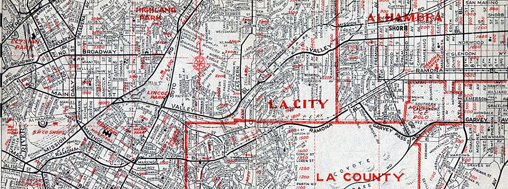
Most people believe that the Arroyo Seco Parkway (1940) was the first express thoroughfare serving the city of Los Angeles. That distinction actually belongs to Ramona Boulevard (at bottom on map below), which was constructed from 1933-1935. It originated at Aliso Street a few hundred feet past Mission Road. The parkway section first passed under the Macy Street viaduct, then continued east approximately 4 miles without any stops until thru traffic turned onto Garvey Pass Avenue.


Renie Atlas, "Victory Edition," May, 1943.


View east on Aliso Street at its intersection with Mission Road (foreground) and Summit Avenue (far right) before its widening for the construction of Ramona Boulevard, November 27, 1933.
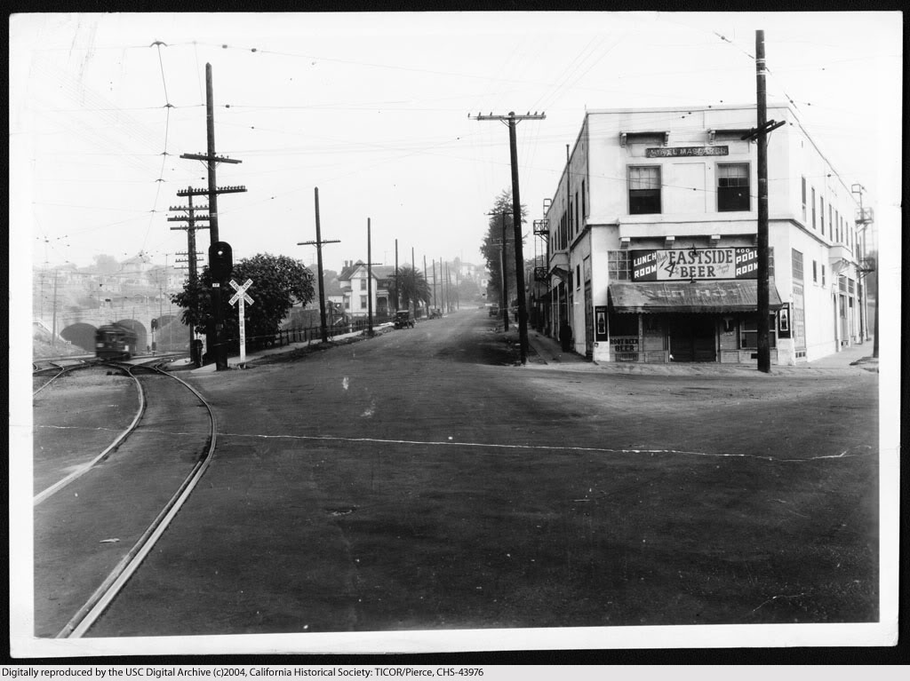

USC Digital Library-California Historical Society.


The new east road is open to traffic, April 15, 1935.
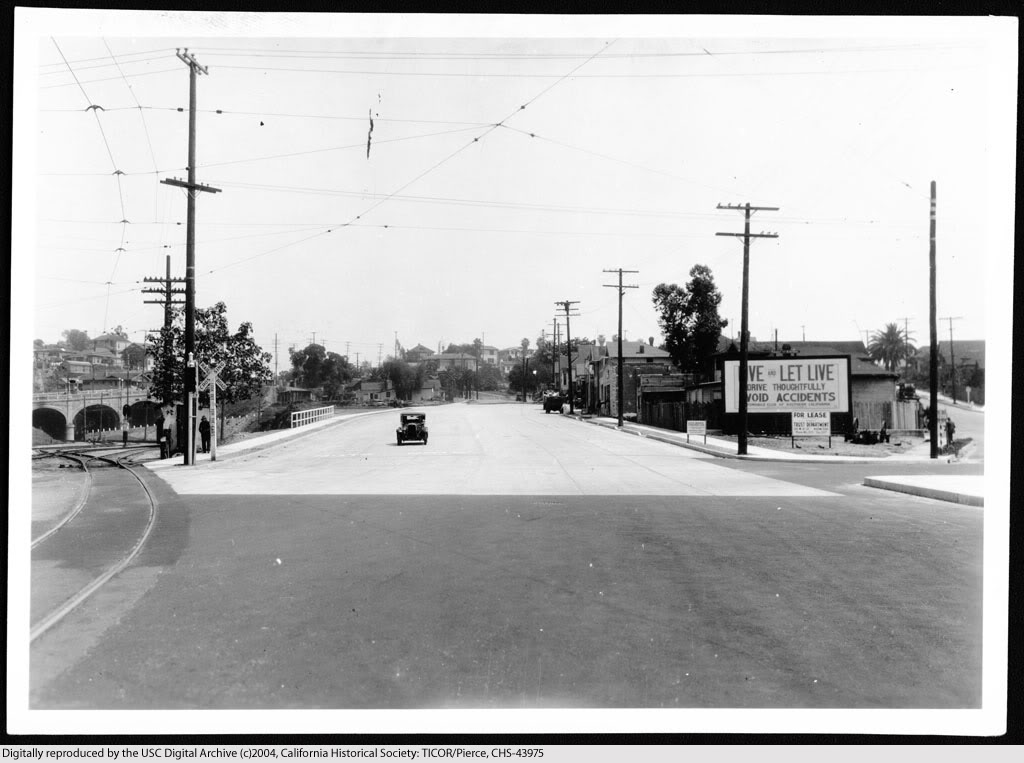

USC Digital Library-California Historical Society.


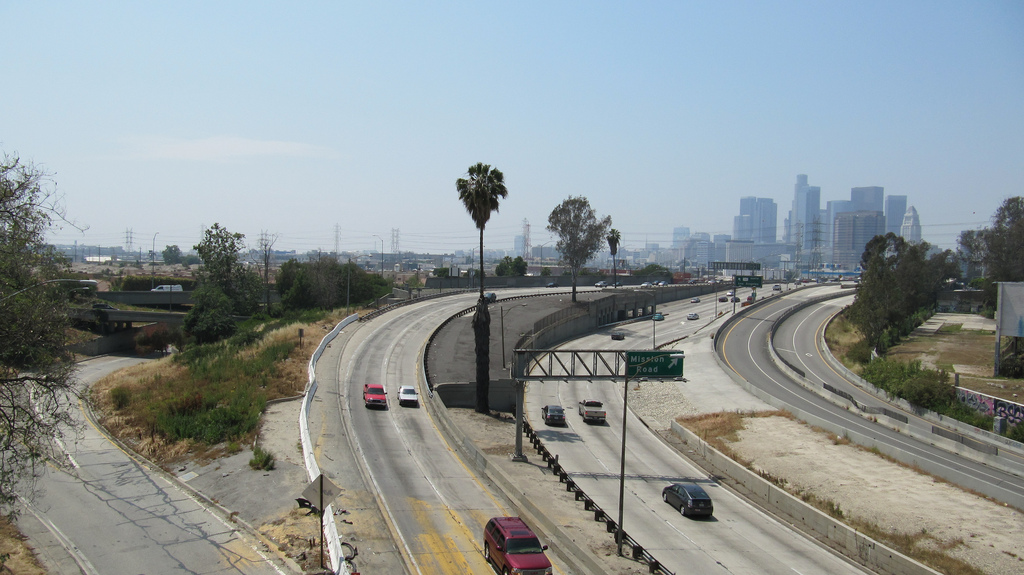
U.S. Highway 101 at Mission Road looking east, 2009.


Link to Google Maps Street View.


Continue reading...

Part 2
Part 3
Part 4


Ramona Boulevard construction

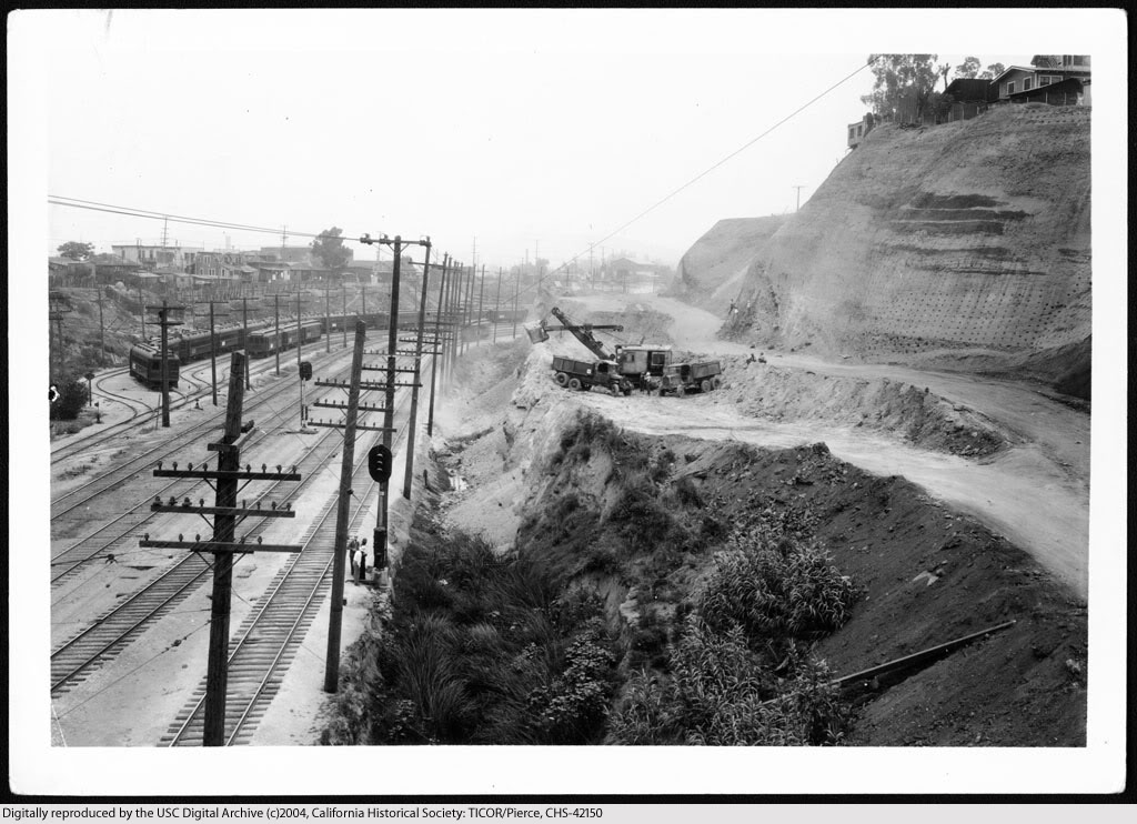
View northeast along the proposed route of Ramona Boulevard, from the Macy Street viaduct, November 15, 1933.


USC Digital Library-California Historical Society.


Earthmoving for the construction of Ramona Boulevard, June 4, 1934.


USC Digital Library-California Historical Society.


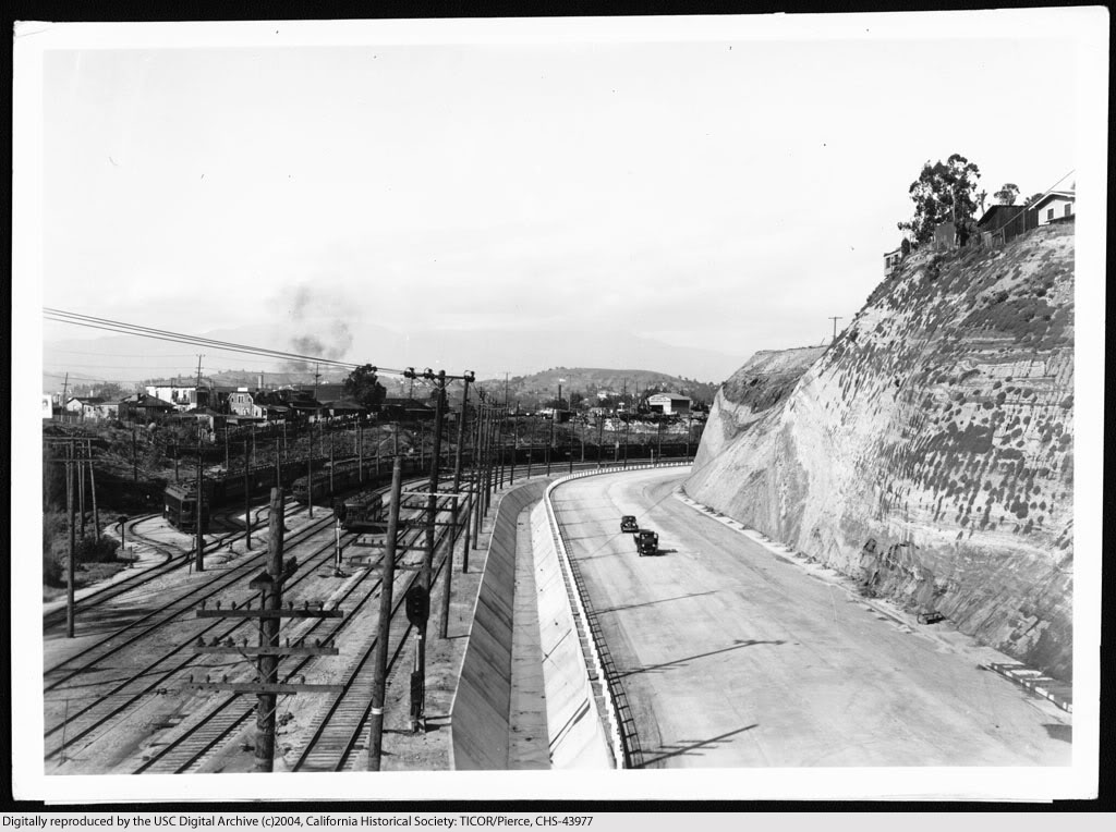
Completed Ramona Boulevard from the Macy Street viaduct, April, 16, 1935.


USC Digital Library-California Historical Society.


View northeast showing the proposed Ramona Boulevard from a point 100 feet north of the intersection of Mitchell and Echandia Streets, November 15, 1933.


USC Digital Library-California Historical Society.


Site cleared for construction, c.1934.


USC Digital Library-California Historical Society.


Ramona Boulevard after completion, April 16, 1935.


USC Digital Library-California Historical Society.

Continue reading...

Part 3
Part 4


Ramona Boulevard extras

The Arroyo de Los Posos, where Ramona Boulevard would soon be built. Looking westward from the vicinity of State Street, November 30, 1933.


USC Digital Library-California Historical Society.


All of the overpasses shown below (except the one at Pomeroy Ave.) were still intact until the very early 1970s, when the three then-existing lanes of the San Bernardino Freeway were widened to more.

Traveling eastbound on Ramona, the first overpass after Macy was the State Street viaduct. April 16, 1935.


USC Digital Library-California Historical Society.


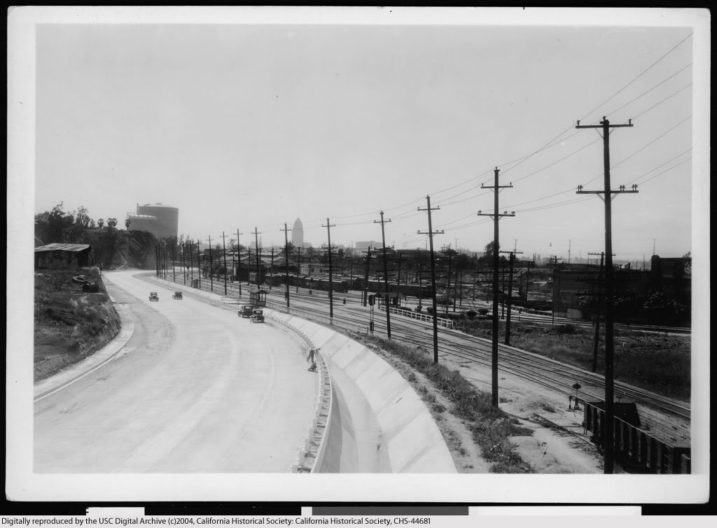
View back towards town from atop the State St. viaduct.


USC Digital Library-California Historical Society.


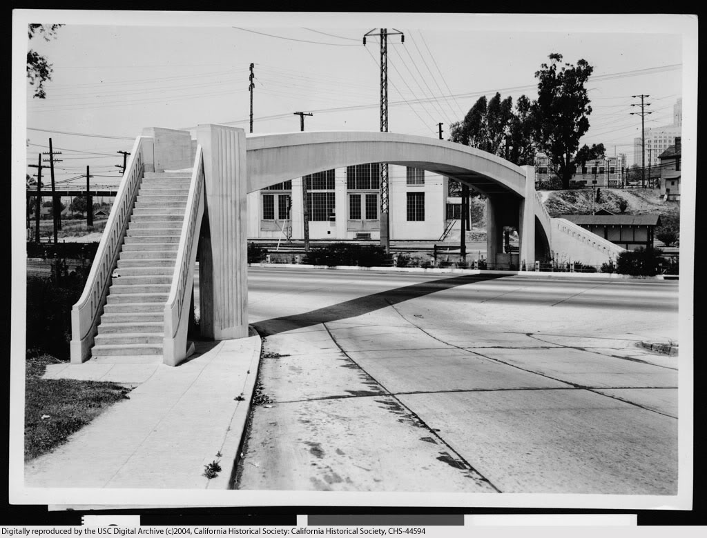
Next overpass eastbound was the pedestrian bridge at Pomeroy Avenue (c.1934-1939).


USC Digital Library-California Historical Society.


Continuing east on Ramona, the overpasses for Marengo Street (foreground) and Soto (rear).


USC Digital Library-California Historical Society.


Continue reading...

Part 4


Views southwest from the Macy Street Viaduct, 1933-2010

The proposed route of Ramona Boulevard, November 15, 1933.


USC Digital Library-California Historical Society.


Ramona Boulevard upon completion, April 16, 1935.


USC Digital Library-California Historical Society.


Interchange of the new Ramona Freeway and Santa Ana Freeway, July 12, 1955. Just look at that smog!


USC Digital Library-Los Angeles Examiner.


Interchange of Interstate 10 and U.S. Highway 101, April 18, 2010.


Photo courtesy waltarrrrr on Flickr.


Previous posts about Ramona Boulevard...

Part 1
Part 2
Part 3

Happy New Year, everyone!


Thursday, December 9, 2010

1904 panorama

Recently obtained: this "double postcard" panoramic view of Downtown, as it appeared near the turn of the last century. The diagonal street at center is Broadway, and we're looking roughly south from atop the clock tower of the old County Court House at Temple Street. To the left is Spring Street with its intersection with First Street, and to the right is the still largely intact residential area of Bunker Hill.

Today, looking to the right, the same view is pretty much solid skyscrapers.


Click image for a nice 1872x582 enlargement.

The postcard is undated, but my best guess is that the photo was taken in 1904. The Hotel Lankershim at the far end of Broadway opened in 1905, but here, the building appears still to be in the later stages of its construction.

Is there any way a normal person living here today would recognize this as Los Angeles? Amazing that a cityscape could change so completely in only one-and-a-half human lifespans, isn't it!