A vanished city lives again...

Sunday, February 17, 2013

La Placita Olvera

More than a little strange to see Olvera Street without any vendor kiosks or restaurants! This photo was taken just prior to the dedication of El Paseo de Los Angeles in 1930. We're looking south here, toward the Plaza.
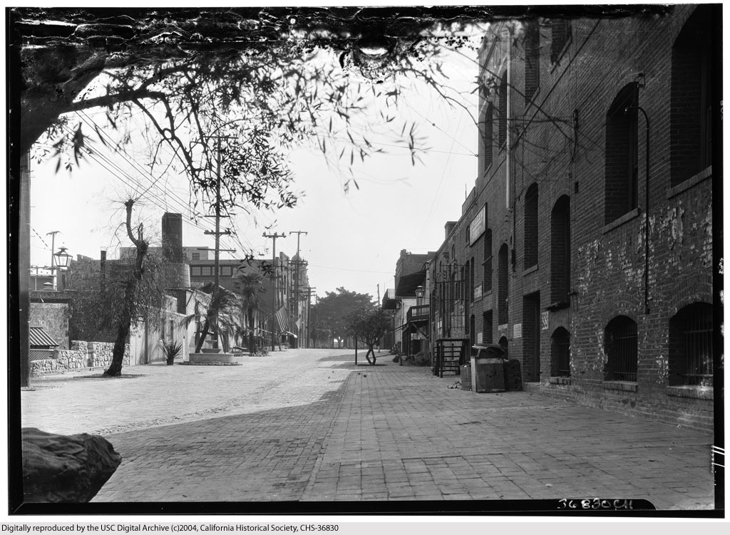

U.S.C. Digital Library
/California Historical Society.


In the distance, two flags can be seen hanging from the front porch of the Avila Adobe: La Bandera de México, and the Stars and Stripes. Zooming in, it can be seen that there are 30 stars in the union. This was the flag of the United States when California became the 31st state in 1850. (The 31-star flag became official on July 4, 1851.)
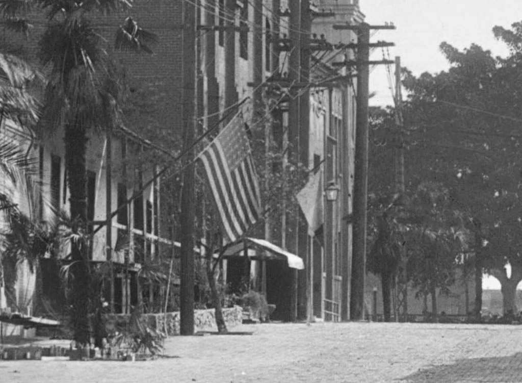

Credit as above.

Thanks to ProphetM from the Skyscraperpage.com 'noirish Los Angeles' thread for identifying this photo as Olvera Street.
 

Saturday, November 24, 2012

1891 Landmarks

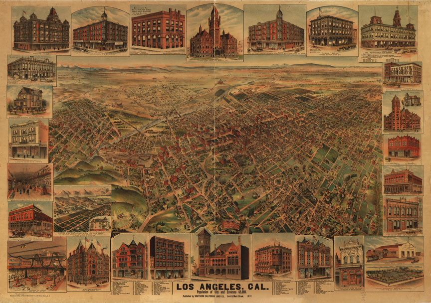
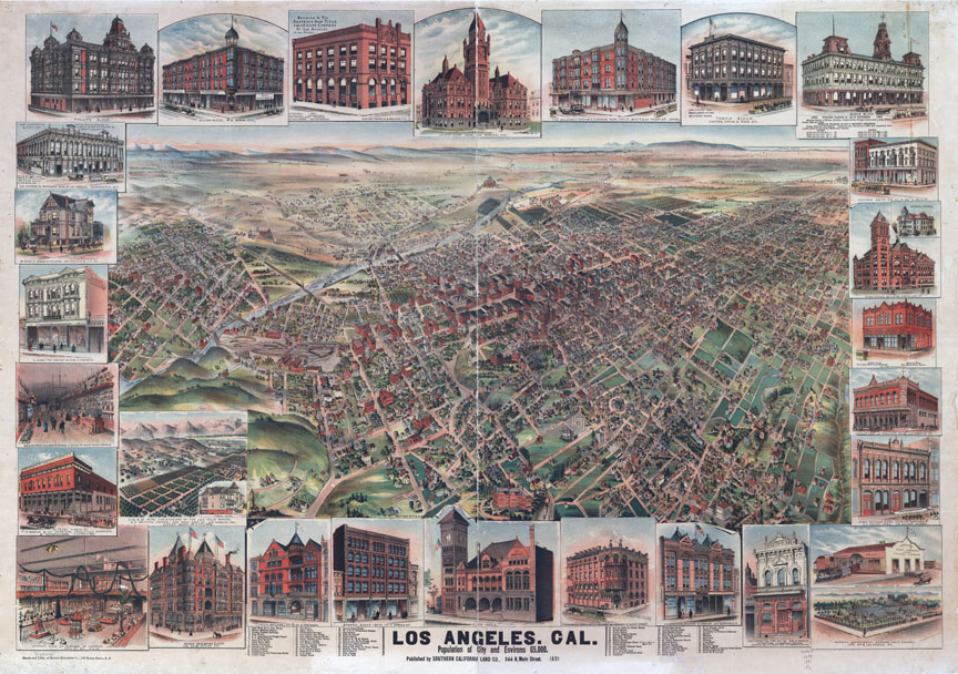
Apologies for the hiatus. Seemingly endless computer snafus and trainwrecks in my personal life have kept me from spending more time indulging in my favorite avocation. Anyway, recently, I used Photoshop to do a little color mod of this panoramic map of Los Angeles from 1891. The highly-foxed original image cleaned up rather well, I think!

Before:

Library of Congress.


After:

Library of Congress.


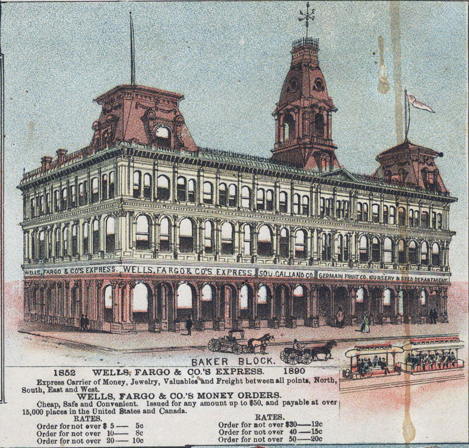
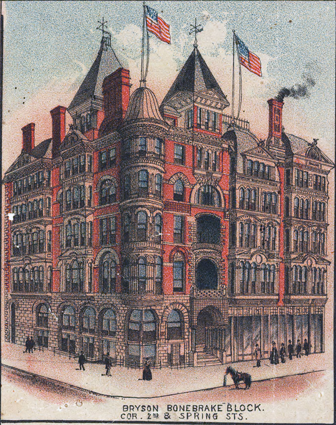
The buildings depicted in the margins are worth a much closer look.


Library of Congress.


Library of Congress.


8 more behind the jump!

Tuesday, October 2, 2012

The oldest building in Los Angeles?

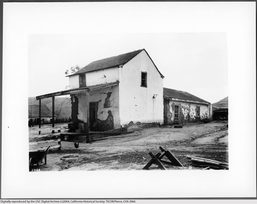
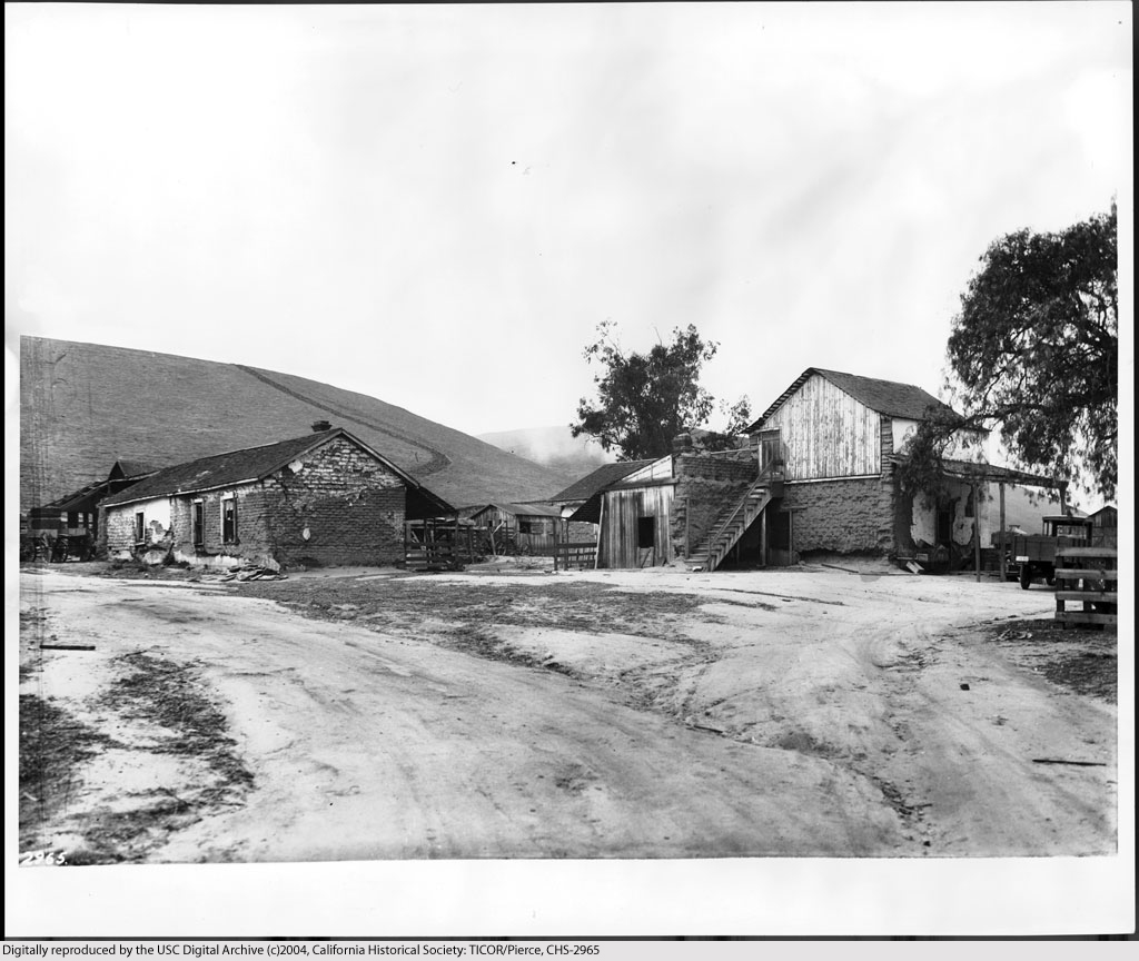
Many have already heard about the emerging realization that the Sanchez Adobe in the Baldwin Hills may be the oldest building in Los Angeles.

Although the structure bears the Sanchez name, it is believed to have actually been built by unknown rancheros fifty years before the land was first deeded to Don Vicente Sanchez in 1843.

This 1840s map depicting the boundaries of "Rancho del Paso de la Tijera" shows the little cottage whose existence has now spanned four centuries.


Hispanic-Heritage Links at the National Archives.


The former Baldwin Ranch, circa 1926. The Sanchez Adobe is the taller white building to the left of center.


Courtesy U.S.C. Digital Library.


Casa de Sanchez, ca. 1924. At this time, the house was already 130 years old.


Courtesy U.S.C. Digital Library.


Another view of the Sanchez house (right) in the 1920s. Does the adobe outbuilding at left still survive? A modern aerial view suggests a possibility that it may.


Courtesy U.S.C. Digital Library.


Only a few years later, the two-storey Sanchez house was incorporated into a much larger modern structure that still stands today at 3725 Don Felipe Drive.


Courtesy U.S.C. Digital Library.


Sunday, September 23, 2012

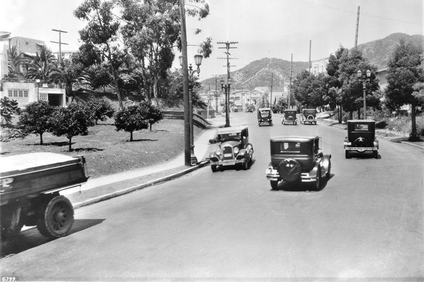
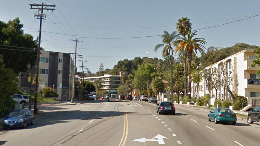
Cahuenga Boulevard, Then & Now

The same spot,
    on the same road,
        in three centuries...

Cahuenga Pass, 1897:


Courtesy U.S.C. Digital Library.

Cahuenga Avenue, 1927:


Courtesy U.S.C. Digital Library.

Cahuenga Boulevard, Today:


Click image above to see the Google Maps Street View.


Tuesday, September 18, 2012

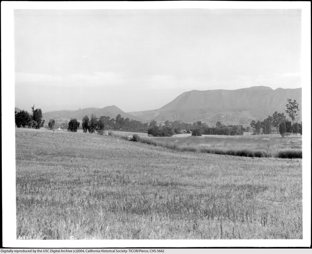
The Cahuenga Valley...

...before it became better known to the world as "Hollywood."

The E.A. Melrose ranch, circa 1915.


Courtesy U.S.C. Digital Library.


Not even yet a century ago. Hard to imagine, isn't it?


Friday, September 14, 2012

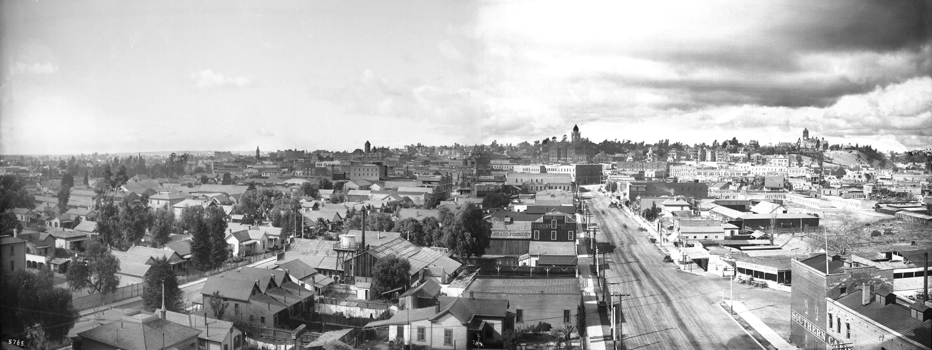
Panorama of Los Angeles, 1899


Click image for full-size enlargement. Images courtesy U.S.C. Digital Library.

A panoramic view of Los Angeles in 1899, looking west from atop the Maier & Zobelein Brewery, known to later generations of Angelenos as the "Brew 102 building." The four tall structures visible here were, from left to right, the Cathedral of St. Vibiana, City Hall, the County Court House, and Los Angeles High School.

In the entire panorama above, I can make out only six buildings that are still standing today.

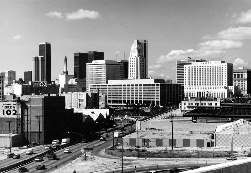
The broad boulevard was Aliso Street. Today, it is U.S. Highway 101. The old Brew 102 building and the modern freeway can be seen in the photo below, circa 1976.


Photo by William Reagh, courtesy Los Angeles Public Library Photo Collection.