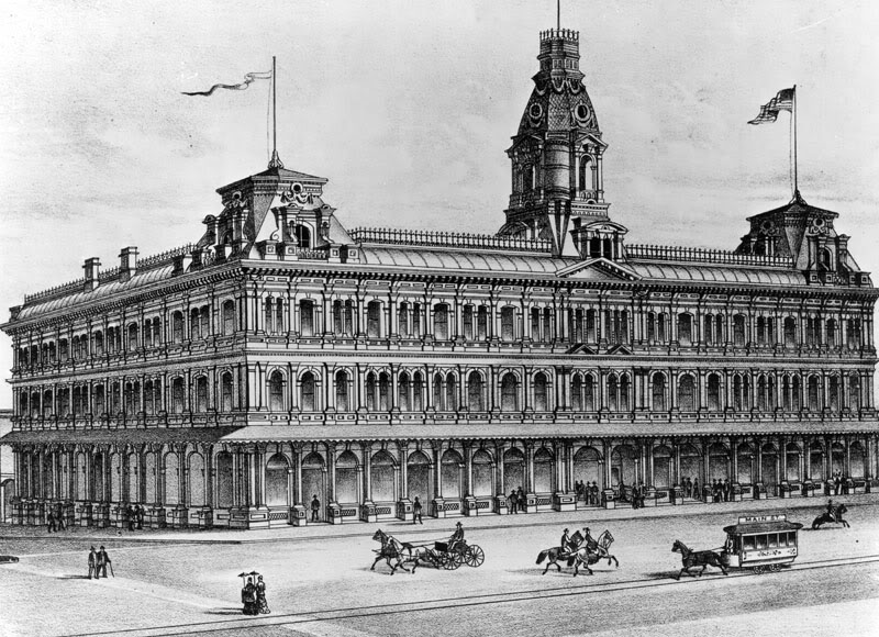
Los Angeles Public Library Photo Collection/Litho. C.L. Smith & Co., Oakland, CA.
The Baker Block was the architectural showpiece of Los Angeles during the city's centennial decade. In a town still consisting mostly of simple frame houses and adobes, this palace of commerce must have been a truly wondrous apparition. Standing for 65 years – from c.1877-1942 – the Baker Block was located at the southeast corner of Main and Arcadia Sts., only a few hundred feet south of the original Pueblo de Los Angeles. An excellent summary of the history of the Baker Block can be found on Brian Hsu's Urban Diachrony weblog. Here are some pictures of this grand old edifice.
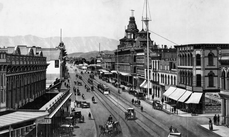
Main Street looking north from atop the Temple Block, c.1880; the Baker Block just right of center. (This vantage point is now occupied by City Hall.)
Los Angeles Public Library Photo Collection.
The uptown commercial heart of the old city, c.1880. The Baker Block at left, and the old Bella Union Hotel building at far right.
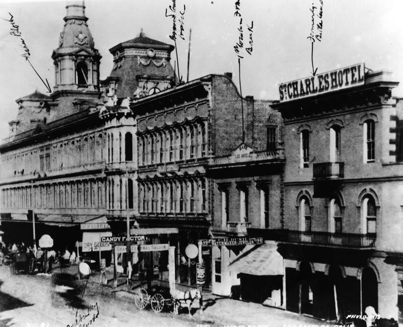
Los Angeles Public Library Photo Collection.
Southeast corner of Arcadia and Main Sts., 1880.
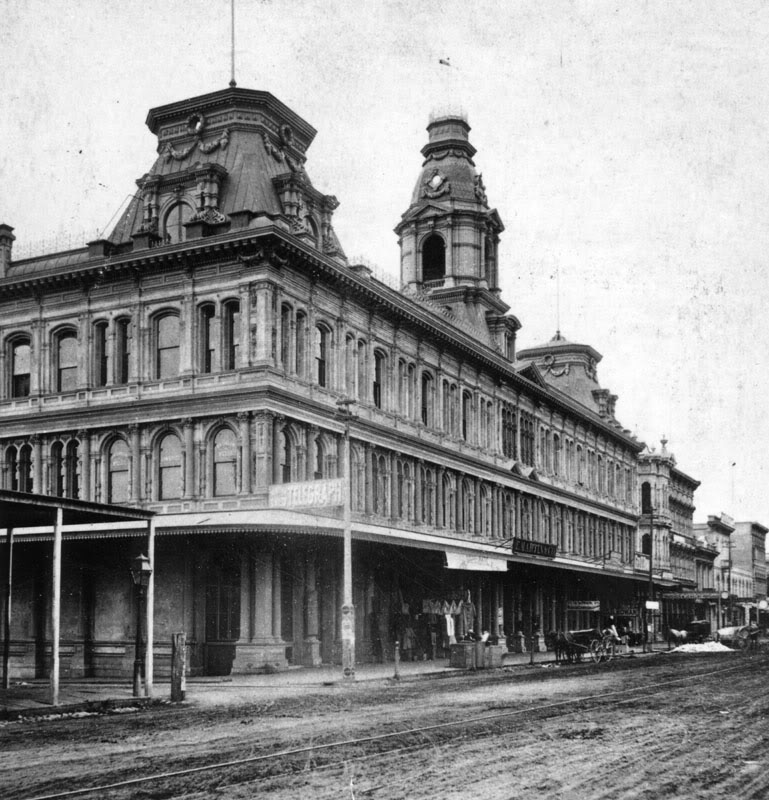
Los Angeles Public Library Photo Collection.
Fifty years later.
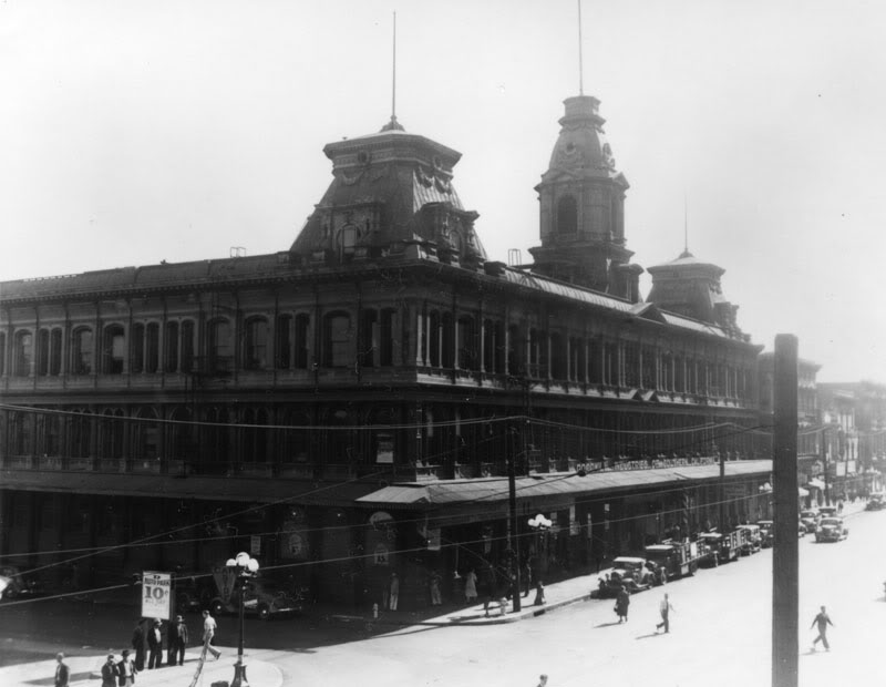
Los Angeles Public Library Photo Collection.
c.1920.

Los Angeles Public Library Photo Collection.
1938. There goes the neighborhood: the new Federal Building begins to rise across Main Street.
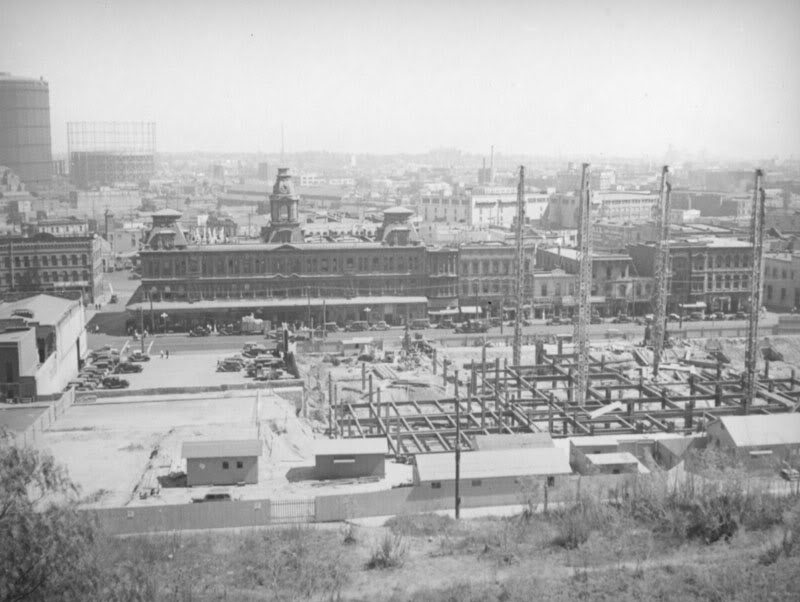
Los Angeles Public Library Photo Collection/Herman Schultheis, Photographer.
Not long for this world, c.1940.
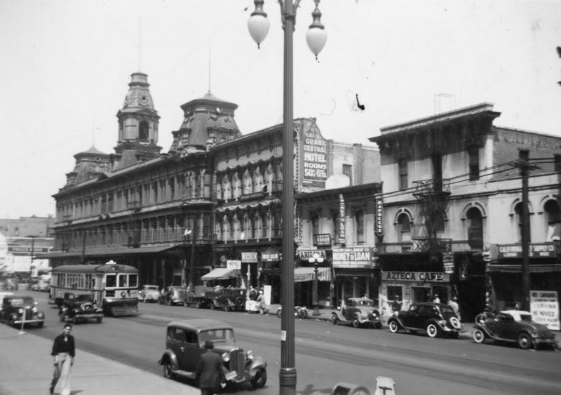
Los Angeles Public Library Photo Collection.
Today, the 101 "Slot" runs right through the site where the Baker Block once stood...

