A vanished city lives again...

Saturday, May 16, 2009

View from the Court House tower, circa 1900

Found a lovely image online yesterday of one of my very favorite views of old Los Angeles. It depicts downtown as seen looking south from the clock tower of the County Court House (1888-1936), formerly located at the corner of Broadway and Temple Street. I have almost a dozen postcards depicting this view, but none are anywhere near as nice as this one.


Wikimedia Commons.


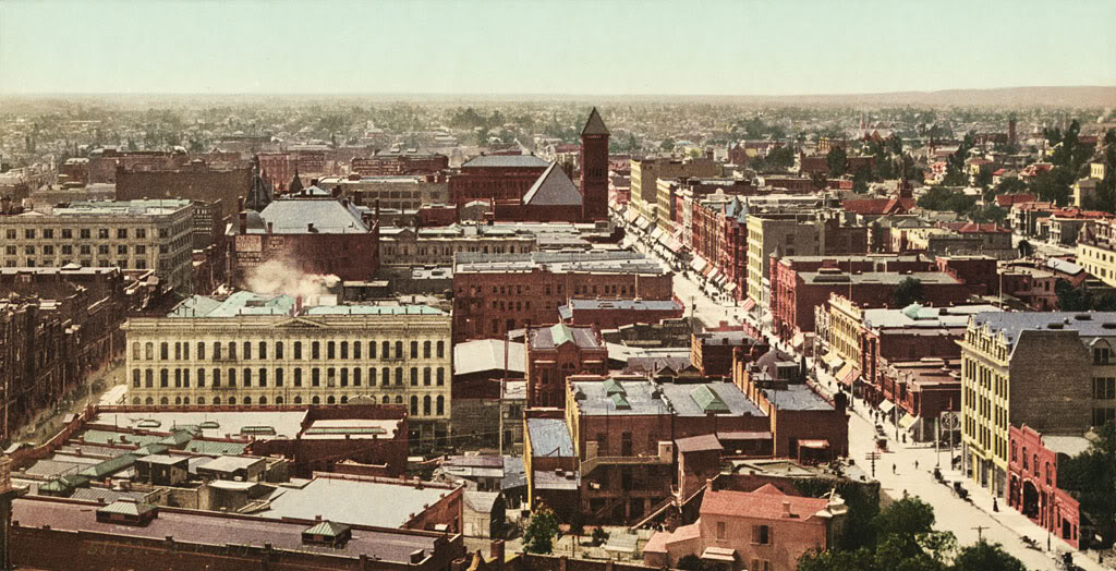
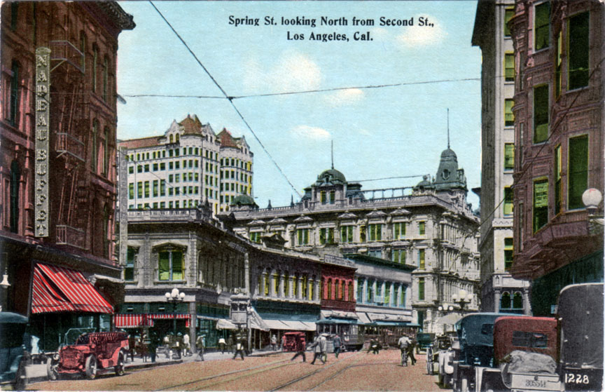
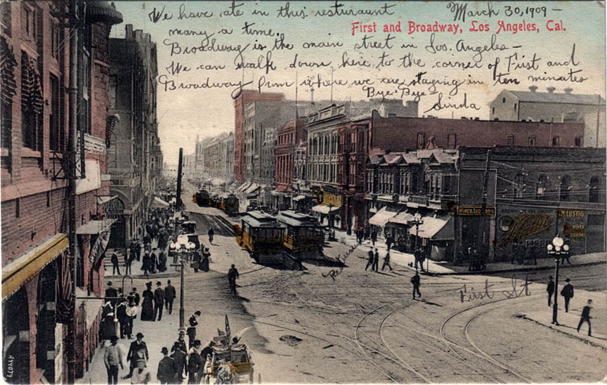
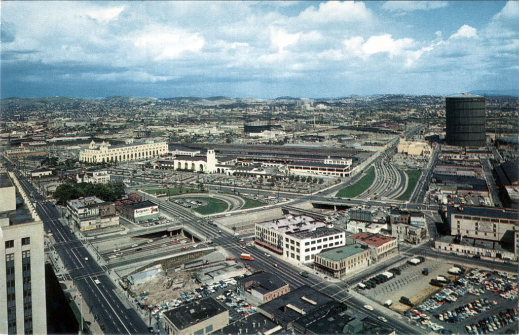
If you live in L.A. today, ask yourself – does anything here look familiar to you? Anything at all? If I told you that's Spring Street at left and Broadway at right, would that help? Probably not, because hardly anything you see in this picture still exists today.

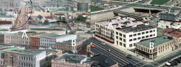
I'm no real expert, myself, but I can identify only four structures in this image that are still standing: the Bradbury (1893), Irvine-Byrne (1895) and Homer Laughlin (1896) buildings around Broadway and Third, and the Douglas Building (1898) at Spring and Third.

Because of the presence of the Douglas Building, this image can't be from earlier than 1898. However, it can't be later than 1903, because the Bryson-Bonebrake Block at the NW corner of Spring and Second still has its ornate Victorian gables, and construction of the Braly Building at the SE corner of Spring and Fourth has not yet begun. And actually, I think I can pin it down to 1900 exactly, because I have a photo of the gabled Bryson-Bonebrake dated 1900 that has at least two of the same three advertisements painted on the north side of the building.

*whew!* History can be really exhausting sometimes! ;)

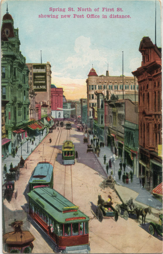
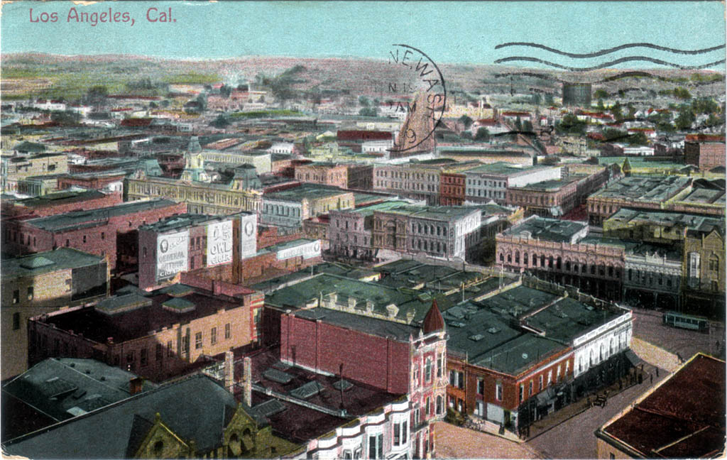
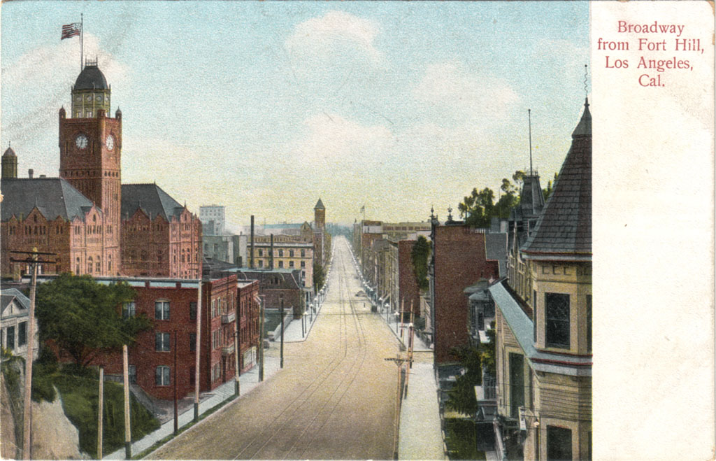
Anyway, here is the old Court House from whose tower that picture was taken.


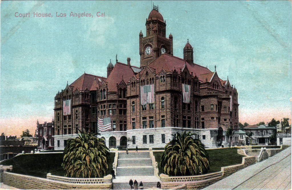
I guesstimate this view dates from roughly the same period as the vista of downtown. It's definitely from 1896-1908, because at least one of the smaller U.S. flags there has 45 stars. The height of the palms, however, makes me suspect that it's more likely closer to 1908 than 1896. That big flag has only 44 stars, though (that was our flag from 1891-1896), so who really knows. I'll still go with circa 1908, I think. It really can't be much later, because construction on the new Hall of Records just south of the Court House began the following year, and there's no evidence of that happening yet.

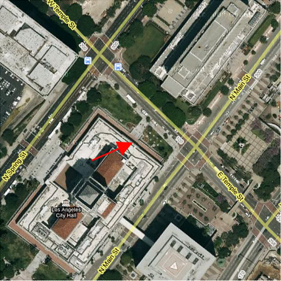
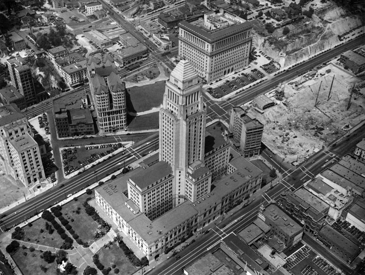
Oh yeah, I almost forgot – to get your bearings, the part of downtown where the majority of the really tall skyscrapers are today would be at the extreme right of the top picture. In fact, only one or two of them would be visible from this frame of reference if it existed now. Not only is this original vantage point gone, though, pretty much everything else someone could see from there is, too. So it goes in ever-changing Los Angeles...


Thursday, May 7, 2009

Western and Wilshire in 1925

Got this old postcard via eBay the other day. It shows Western Avenue from its intersection with "Wiltshire" Boulevard, from around 1925. I bought it almost as an afterthought, but having it in hand and looking closely at it, I've found it to be quite interesting.


First, just to get our bearings, the street corner at lower right by the blue car is where the Wiltern Theatre would be built about half-a-decade later. Today, across Wilshire, where the Standard Public Market is in the postcard, stands the new Solair residential and retail center. The neighborhood's changed quite a bit since 1925, hasn't it!

What really intrigues me in the postcard image is the traffic control device in the center of the intersection. Anyone know what that gizmo's called? It appears to have just a single red light, or maybe it's merely a red reflector, so it's not really a traffic signal as we know them. Also, look how the cars are bunched around it. It's almost like the sign is a marker for a place where autos are supposed to turn; sort of like a modern roundabout. Notice how the driver of that blue car is signaling for a left turn, but he's over near the right side of the road. I don't know – I've never seen this kind of traffic control before. Anyone else got any ideas, or maybe know the actual story behind this device?


Saturday, May 2, 2009

The Spring Street diagonal

Ever since I started collecting postcards of old Los Angeles, this 90-year-old view of the north end of Spring Street has been one of my "holy grails." One reason for its desirability is that it features the old Post Office that first got me interested in pre-WWII Los Angeles. Mostly, though, this card fascinates me because this particular stretch of Spring Street no longer exists at all.


In fact, this portion of Spring's not only completely vanished, this exact vantage point is today located inside L.A.'s City Hall! (See position of red arrow below.)


Google Earth.


Here's the backstory. Before 1927, when work on the new City Hall began, Spring Street north of First Street did not run parallel to Main Street and Broadway as it does today. Rather, north of First, Spring jogged east-northeasterly, following a diagonal course to the intersection of Main and Temple (the postcard view). This short diagonal portion (also in red, below) was actually the last vestige of an old indian footpath along the base of Bunker Hill which pre-dated the establishment of the Mexican pueblo itself.


Detail from the 1849 Ord survey map.


Here are a couple of other postcard views of Spring Street as it was before 1927. This first one shows the intersection of Spring and First Streets, looking north, around 1915. You can see that Spring continues straight through past the intersection for about 30 or 40 feet, then it turns at an angle to the right. That's the beginning of the old diagonal alignment.


Now, if we were to go up on the roof of the building at the NW corner of Spring and First and look further up the street, this is what we'd see.


And there, near the end of Spring, is that International Savings and Exchange Bank building again, and the 1910 Post Office just beyond that.

A later perspective: here's a photo of the Civic Center in 1938, after Spring Street had been straightened. That structure just to the immediate right of City Hall is the same International Savings and Exchange Bank. Note the angle of the facade. That was the last visible evidence of the old diagonal alignment of Spring Street...


gsjansen on Flickr.


Monday, March 30, 2009

A prelude to terror


One century ago today – indeed, 100 years to this very hour – this postcard was penned in a long-vanished boarding house at Temple and Figueroa Streets in Los Angeles, and addressed to a now also non-existent residence in Cleveland, Ohio...


In 1909, the intersection of Broadway and First Street was the center of civic life in old Los Angeles. Today, however, absolutely nothing you see in this postcard still exists. Old San Francisco was destroyed by its famous earthquake and fire of 1906, most of Chicago was wiped out by its own Great Fire of 1871, but old Los Angeles was even more thoroughly destroyed by the hand of man himself.


In 1910, however, another kind of destruction would visit Broadway and First, when the building to your immediate left (you could almost reach out and touch it from this vantage point) would be dynamited into fiery rubble in the third most murderous act of domestic terrorism in the first half of the 20th century. Only the Wall Street bombing of 1920 and the Bath School bombings of 1927 produced higher death tolls than this anarchist attack in Los Angeles in 1910.

And yet, I doubt that even 1 out of 10,000 of the present-day residents of L.A. know about the horrific bombing that took place in their own city less than a century ago. I didn't, myself, before the history of pre-WWII Los Angeles became an avocation of mine a few years back.

I'll have more to say about the bombing at its centennial in October of next year...


Thursday, March 26, 2009

Old city center: Then and Now

Two superb postcard scores within a week! The top one is a rare view of Los Angeles taken around the turn of the last century from the top of the old County Court House, looking east-northeast.


At far right is Temple Square: the heart of the city at the turn of the last century. The street car is running on Main Street. The wide dirt road by the semi-circular postmark is Aliso Street, and the narrower road running parallel to it at right is Commercial Street.

Now, here's roughly the same east-northeast view a half-century later.


This photo was taken from the top of the present City Hall at the SW corner of Temple and Main (out of the picture to the right of where the street car is in the earlier view). Aliso Street has been replaced by the 101 freeway; Commercial Street runs just to the left of the large natural gas storage tower and to the right of the yellow Brew 102 brewery.

In the 1950s view, the street running from side to side in the lower center of the picture is Los Angeles Street. Two buildings on the east side of Los Angeles Street appear in both postcards. Can you spot which ones?

Here they are...

Buildings "A" and "B" on Los Angeles Street survived at least into the 1950s.


Neither structure still stands today, however.


Thursday, January 15, 2009

New treasures!

Last month, I got this neat old postcard of Broadway near its intersection with Temple Street. The photo was taken from the top of the south entrance of the Broadway Tunnel. The design of the reverse side of this Rieder postcard indicates it was printed between 1907-'08. The photo, however, dates to approximately 1903. The Braly Building (1902-'03) can be seen in the distance, just to the right of the Court House. The scene can't be later than 1904, though, otherwise the Hotel Lankershim would be visible at the far end of Broadway.


This is one of my absolute favorite views of the vanished city. I just feel totally at home here, gazing at this simple scene...


Then, last week, this old medicine bottle showed up on eBay. Broadway & Temple! Holy crap! I just had to have it. And, as of today, I do!


Photo by J Scott Shannon.

I know a little bit about antique bottles, and this one definitely dates to pre-1915. So, it's essentially contemporaneous with the postcard view! I wonder which of the three possible corner buildings housed the Bodenmann pharmacy. I will find out eventually, I'm sure!