A vanished city lives again...

Thursday, February 10, 2011

Los Angeles's THREE historical Plazas

Fellow Los Angeles history buff "Richard R." recently found a very interesting webpage which details and summarizes various pieces of historical evidence pertaining to the location of the original pueblo and its plazas. Yes, that's "plazas," plural.

Article from the website La Nopalera.

tl;dr version – It turns out there have actually been three different locations for La Plaza de Los Angeles:

• The first plaza dates to the founding of the pueblo in the 1770s. It is believed to have been located to the south and east of the present Plaza. Constructed on low ground adjacent to the Los Angeles River, the first plaza was obliterated by the Flood of 1815.

• The second plaza and the re-built pueblo were re-located to higher ground a few dozen meters to the north and west of the present Plaza Church, on the west side of Main Street. The approximate location of the second plaza is shown on the map below:
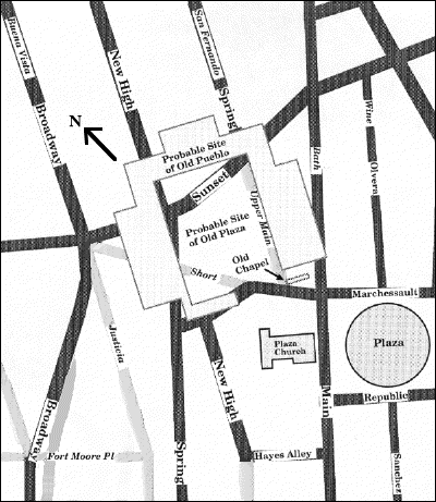


Map by Howard Hurtig Metcalfe from his webpage La Nopalera.


The second plaza was in existence for only a decade or two, though, from the post-Flood of 1815 period to c.1830, when it was moved to its present location east of Main Street and south of the southern terminus of Wine (Olvera) Street. This is "La Plaza" that all latter-day Angelenos are familiar with. The general assumption that La Plaza has always been located where it is today, however, is now known to be demonstrably incorrect. Somewhere along the line, the knowledge that there had been two historical locations which pre-date the present Plaza was mostly forgotten.

Some general awareness of the location of the second plaza lingered on into the mid-20th century, however. In 1950, the "Plaza de Los Angeles, Inc." submitted this re-development plan to the State Park Commission. N.b. the yellowed label pointing to the "Original Plaza" at what would then have been the northwest corner of Main and Marchessault Sts.
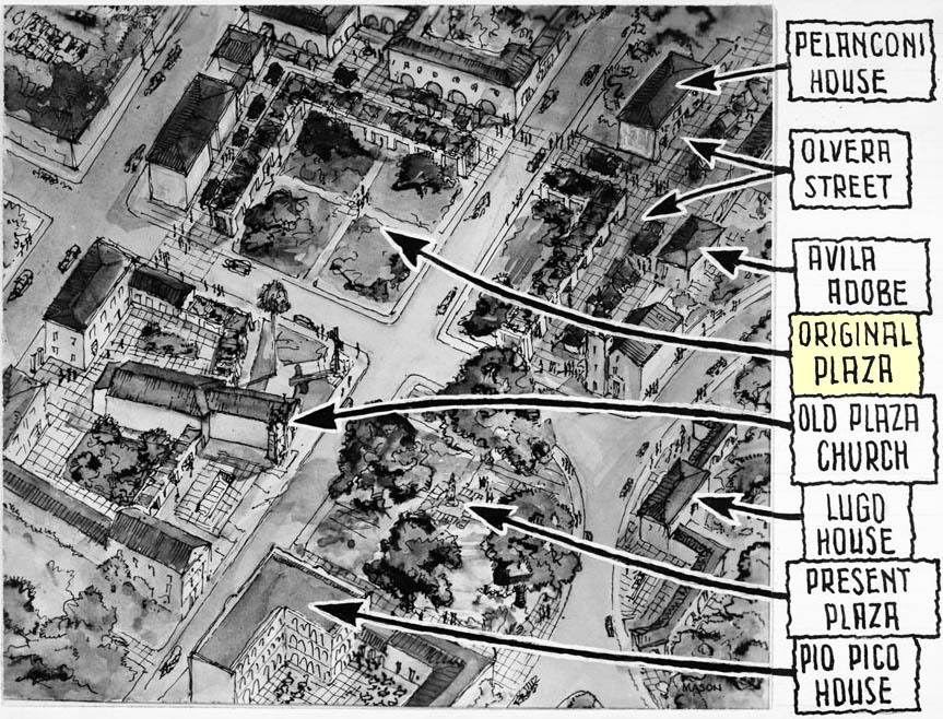


Courtesy USC Digital Library-Los Angeles Examiner.


"Richard R." also found this interesting account in the Department of Water and Power database hosted by the Los Angeles Public Library:
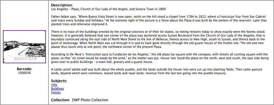

Historical Photo Collection of the Department of Water and Power, City of Los Angeles.


It should be noted that the docent website of El Pueblo de Los Angeles does, in fact, acknowledge that the present Plaza is actually Los Angeles's third such town square. It was certainly surprising news to me, though, and I'm sure it remains an unknown fact to all but a handful of knowledgeable L.A. historians.

And what now occupies the former site of the second plaza? What else but a parking lot!


View Larger Map

A big thank you to "Richard R." for his excellent historical sleuthing!


Monday, January 31, 2011

View from atop Angels Flight, 100 years ago

A panoramic postcard view of Downtown Los Angeles from atop the observation deck of Angels Flight, just over 100 years ago.


Click image for a nice 2592x503 enlargement.


I believe this photo can be dated fairly precisely to late summer 1910, as the second Los Angeles Times Building has not yet been bombed, and the Hall Of Records behind it is in the earliest stage of its construction. Quite a remarkable view, in my layman's opinion!


Wednesday, January 12, 2011

Los Angeles past

An historical chronology from the 1943 Renie Road atlas of L.A. City and County. It's interesting to me to note what events/dates were thought to be significant at the time...


Friday, December 31, 2010

Ramona Boulevard – L.A.'s first expressway

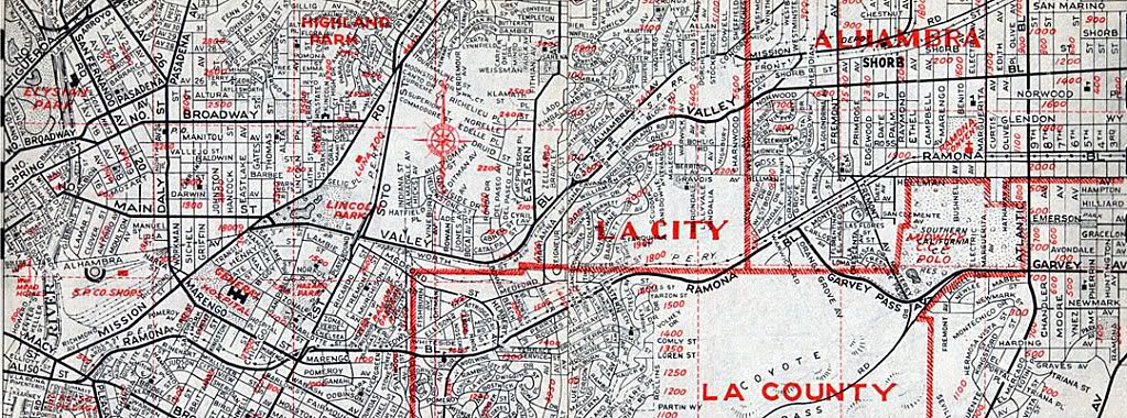
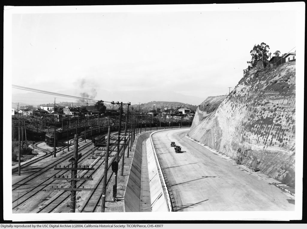
Most people believe that the Arroyo Seco Parkway (1940) was the first express thoroughfare serving the city of Los Angeles. That distinction actually belongs to Ramona Boulevard (at bottom on map below), which was constructed from 1933-1935. It originated at Aliso Street a few hundred feet past Mission Road. The parkway section first passed under the Macy Street viaduct, then continued east approximately 4 miles without any stops until thru traffic turned onto Garvey Pass Avenue.


Renie Atlas, "Victory Edition," May, 1943.


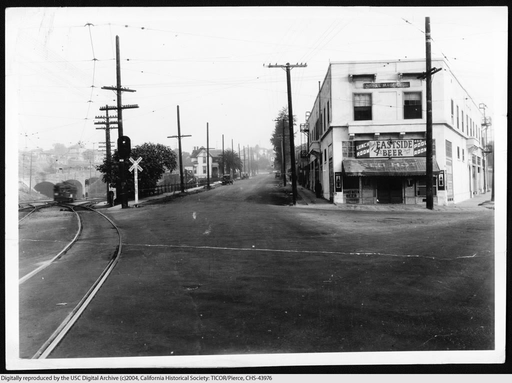
View east on Aliso Street at its intersection with Mission Road (foreground) and Summit Avenue (far right) before its widening for the construction of Ramona Boulevard, November 27, 1933.


USC Digital Library-California Historical Society.


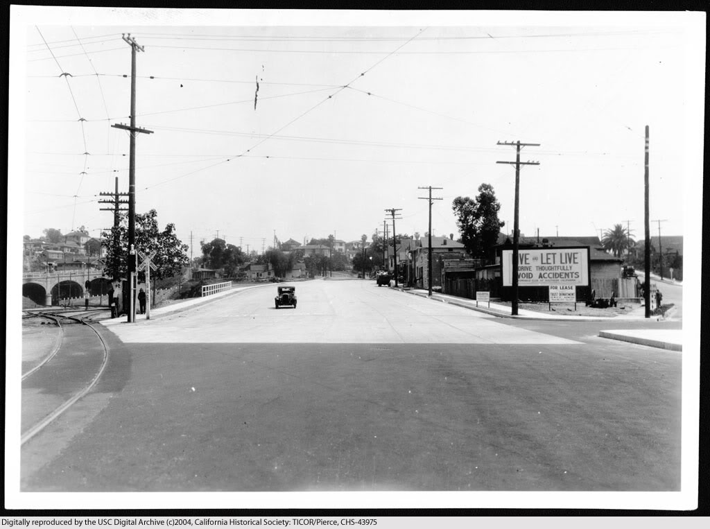
The new east road is open to traffic, April 15, 1935.


USC Digital Library-California Historical Society.


U.S. Highway 101 at Mission Road looking east, 2009.


Link to Google Maps Street View.


Continue reading...

Part 2
Part 3
Part 4


Ramona Boulevard construction

View northeast along the proposed route of Ramona Boulevard, from the Macy Street viaduct, November 15, 1933.


USC Digital Library-California Historical Society.


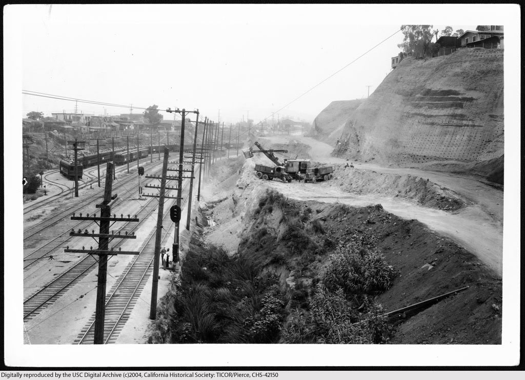
Earthmoving for the construction of Ramona Boulevard, June 4, 1934.


USC Digital Library-California Historical Society.


Completed Ramona Boulevard from the Macy Street viaduct, April, 16, 1935.


USC Digital Library-California Historical Society.


View northeast showing the proposed Ramona Boulevard from a point 100 feet north of the intersection of Mitchell and Echandia Streets, November 15, 1933.


USC Digital Library-California Historical Society.


Site cleared for construction, c.1934.


USC Digital Library-California Historical Society.


Ramona Boulevard after completion, April 16, 1935.


USC Digital Library-California Historical Society.

Continue reading...

Part 3
Part 4


Ramona Boulevard extras

The Arroyo de Los Posos, where Ramona Boulevard would soon be built. Looking westward from the vicinity of State Street, November 30, 1933.


USC Digital Library-California Historical Society.


All of the overpasses shown below (except the one at Pomeroy Ave.) were still intact until the very early 1970s, when the three then-existing lanes of the San Bernardino Freeway were widened to more.

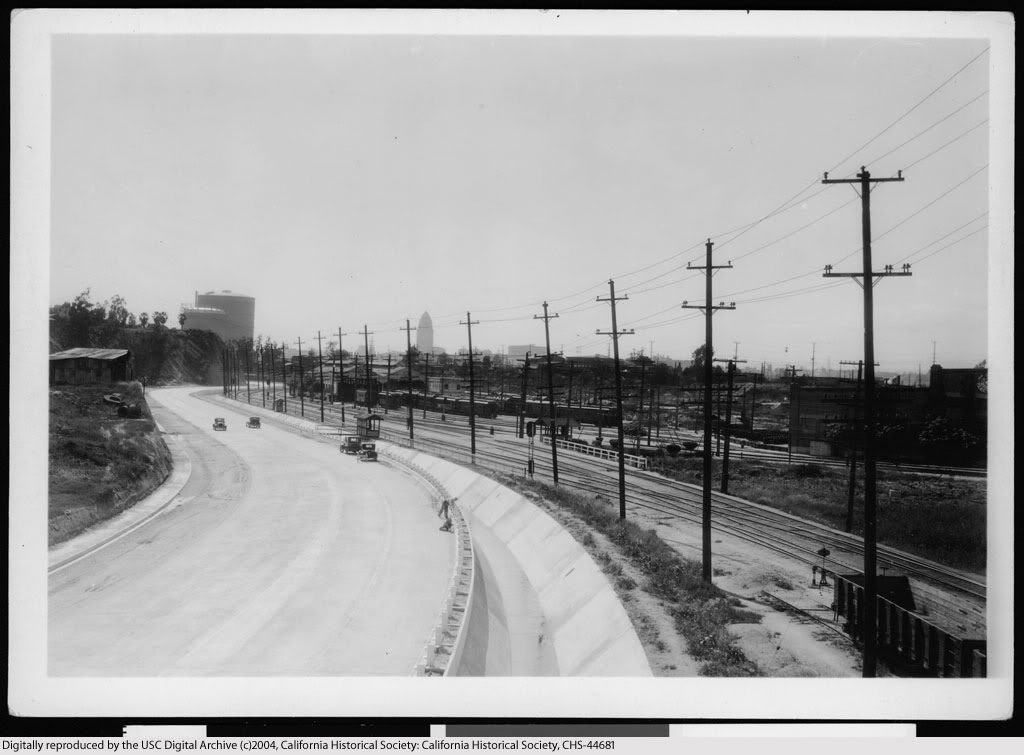
Traveling eastbound on Ramona, the first overpass after Macy was the State Street viaduct. April 16, 1935.


USC Digital Library-California Historical Society.


View back towards town from atop the State St. viaduct.


USC Digital Library-California Historical Society.


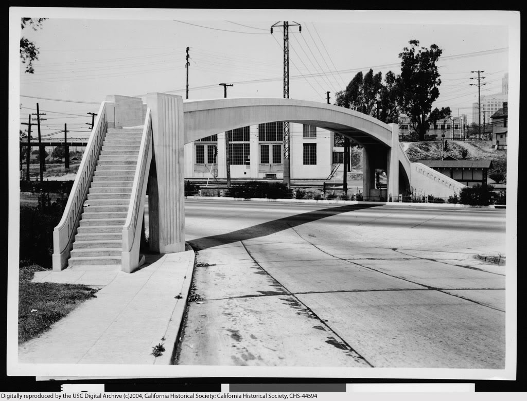
Next overpass eastbound was the pedestrian bridge at Pomeroy Avenue (c.1934-1939).


USC Digital Library-California Historical Society.


Continuing east on Ramona, the overpasses for Marengo Street (foreground) and Soto (rear).


USC Digital Library-California Historical Society.


Continue reading...

Part 4