A vanished city lives again...

Friday, May 2, 2014

Little House on Pearl Street

This is Los Angeles, almost exactly a century ago. Doesn't look very familiar, does it? That's because, with the exception of a few homes in the hills in the far distance, every single structure you see in this photo is now vanished off the face of the earth.
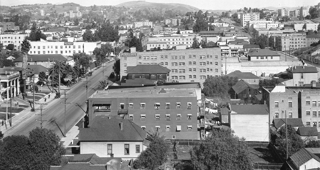

"Panoramic view of Los Angeles, showing Sixth Street, Figueroa Street, Flower Street, east side of Sixth Street, ca.1916" (detail), C.C. Pierce, photographer. Courtesy USC Digital Library/California Historical Society. Link to full-res image.

When the picture was taken in 1916, this area was called the Apartment District. Today, it's the heart of the Financial District. The street to the left is Figueroa (formerly Pearl), and that's its intersection with Fifth Street at left. From 1928-1968, to our immediate right and just in back of us here, the late, lamented Richfield Building once stood. Now, the twin towers of City National Plaza would be directly in front of us, and past the Streicher Apartments, that entire city block is now occupied by the Westin Bonaventure Hotel. From the left edge of this picture into the hills to the north, the Harbor Freeway (I-110) now cuts a wide swath through this old residential neighborhood, and atop the hill at far upper right (if we could see through the buildings in front of us, that is), we would be able to catch a glimpse of the top of the Walt Disney Concert Hall, and the Dorothy Chandler Pavilion just beyond.


But this post isn't about any of these grand modern buildings. It's about the oldest structure you see in the photo above that was still standing in 1957 when the photo below was taken. See that rather forlorn-looking little wooden house in the rear of the parking lot?
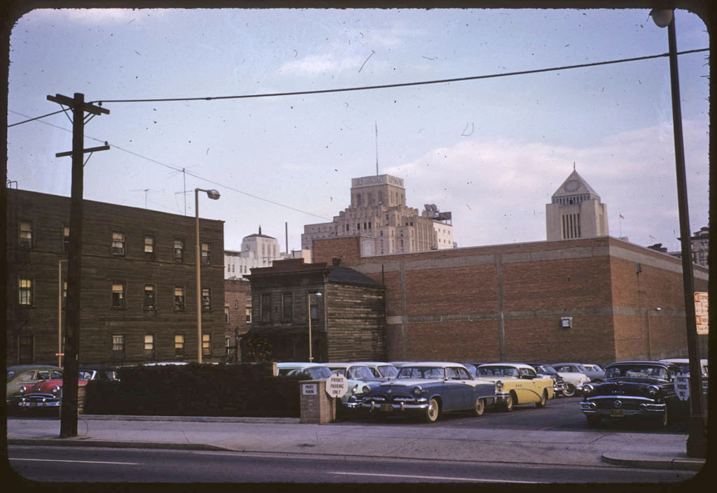
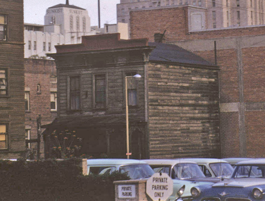

"Oldest building in downtown Los Angeles," Palmer Connor, photographer. From the Palmer Connor Collection of Color Slides of Los Angeles. Courtesy of The Huntington Library, San Marino, CA. Link to full-res image.

That's the exact same building with the square white side that's in the right foreground of the picture at top. Although some architectural elements of the house suggest it might be from the 1870s, the structure actually makes its first appearance on a Sanborn fire insurance map in Volume 3 of the 1894 edition (it was not present in the 1888 edition). Its original address was 516 Pearl Street. When the St. Dunston Hotel was built on that property not long after the turn of the last century, though, the little house was moved to the rear of the lot and became 516-1/2 Figueroa. It was this move back from the street frontage that probably saved it from the wreckers for as long as it was.

Quite amazing to think that, in 1957, the "oldest building in downtown Los Angeles" had only been standing for about 65 years. And yet, 60-70 years was pretty much the maximum life span of any 19th century building in the old city. Los Angeles, impermanence is thy name...

(For more on this story, click here.)


Friday, February 14, 2014

View from atop Crown Hill, c.1886

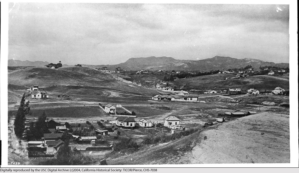
This has to be one of the more remarkable images of historical Los Angeles that I have ever seen. The year is around 1886, and we're looking south toward what would become Long Beach from the present site of Belmont High School, near the intersection of Beverly Blvd. and Glendale Blvd. In the far distance at right is the still-recognizable profile of the Palos Verdes peninsula, at left, the Santa Margarita Mountains by San Clemente, and in between, what today is solid cityscape was then nothing but sparsely-settled open rangeland as far as the eye could see.


Click image to enlarge.


The photo was taken from the roof of the Belmont Hotel, which was located atop Crown Hill at the end of the old Second Street Cable Car line.


Courtesy U.S.C. Digital Library, California Historical Society.


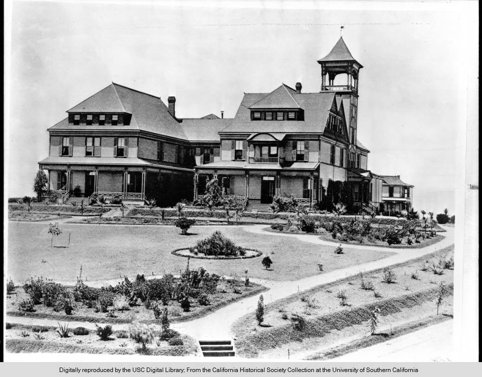
The contemporaneous photo below shows the Belmont Hotel (upper left) as seen from Bunker Hill. The vantage point is near what would later become Hope Street overlooking Third Street (the road at the extreme left edge of the photo is Third). Today, the Harbor Freeway (I-110) runs left/right directly through this little valley. The familiar hills overlooking Hollywood can be seen in the distance.


Courtesy U.S.C. Digital Library, California Historical Society.


To learn more about the historic Belmont Hotel, click here.


Thursday, May 23, 2013

Gay Nineties' L.A.

Recently, I happened upon these nice views of Los Angeles from the 1890s.

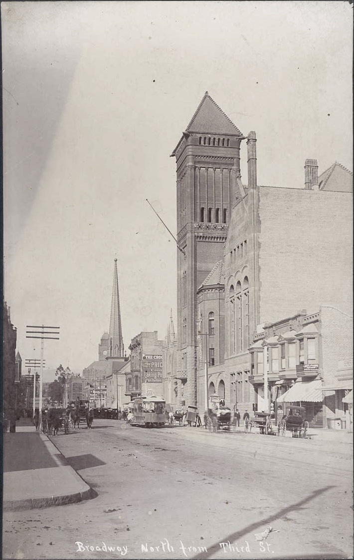
The 200 block of South Broadway was one of the more active centers of civic life in its time.


Courtesy California State Library.

The almost brand new City Hall (1888-1928) dominates the right of the picture. Several other landmarks of the day can also be seen here. The tower of Los Angeles High School is partially visible to the left of the power poles. The clock tower in the distance is that of the Los Angeles County Court House. The tall spire next to that belongs to the First Presbyterian Church at the SE corner of Broadway and Second Street. And, the gothic structure just barely visible between City Hall and the Crocker Building (with the two bay windows) is Los Angeles's first Jewish synagogue.

Nothing special to see there today, unfortunately.

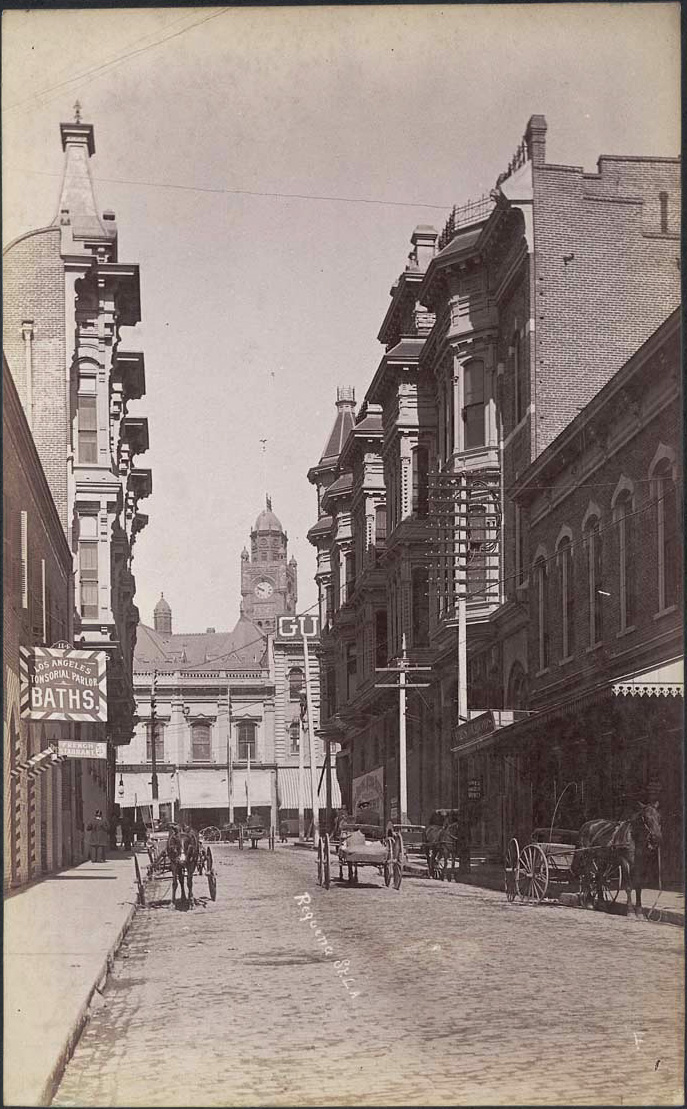
This quaint brick sideroad – complete with baths and a French restaurant – was Requeña Street (later renamed Market Street). The ornate Victorian on the left is the United States Hotel (1886-1939), and on the opposite corner is the Amestoy Block (1887-1958) – the first brick office building in town (and the first to have an elevator). The clock tower behind, once again, is the Court House.


Courtesy California State Library.

The U.S. Hotel and the Amestoy Block looked much nicer from the front. Click below to view the two from Main Street.

Thursday, May 16, 2013

The oldest palm tree in Los Angeles

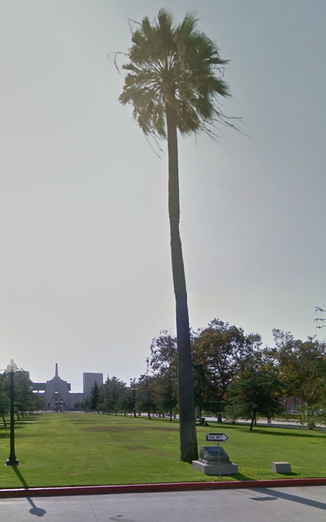
Many by now have probably seen Nathan Masters's recent blog post or read elsewhere about this lone palm tree standing today in front of the Memorial Coliseum in Exposition Park.


Google Maps Street View.


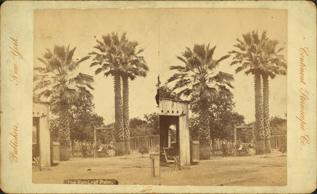
At approximately 180 years of age, it is almost certainly the oldest-known palm in Los Angeles, and the stereoscopic photograph below from circa 1873* may just be the oldest-known image of said tree (the smaller palm on the left).

My attempt to reproduce the original camera image.
Wikimedia Commons, public domain.


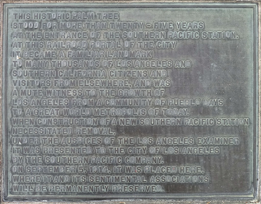
The basic story of how the palm ended up in Exhibition Park is told on its commemorative plaque.


Photo by J Scott Shannon.


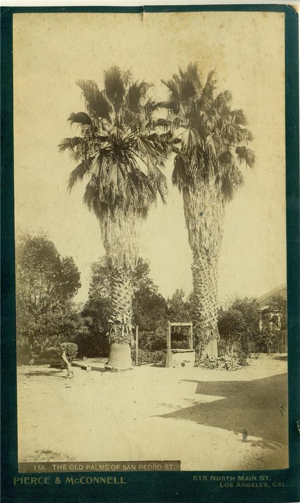
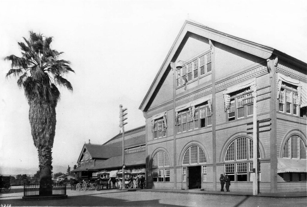
The fascinating details of the palm's earlier journey from a back yard on San Pedro Street to the Southern Pacific Arcade Depot in 1888 have been meticulously detailed here.


Taken c.1888, just prior to the move to the Arcade Depot...

...where it stood greeting travelers for the next quarter of a century.
Courtesy U.S.C. Digital Library/California Historical Society.


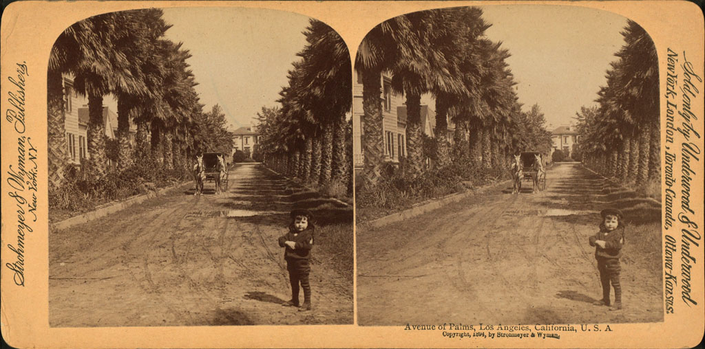
While the palm at Exposition Park may be the oldest documented Washingtonia filifera in Los Angeles, we shouldn't forget the oldest-known examples of W. robusta: the Longstreet Palms (below), the story of which I've told here many times. These Civil War-era veterans are at least 150 years old, and are therefore no less worthy of monument status than their cousin in Exposition Park.


Wikimedia Commons, original photo by waltarrrrr on Flickr.


Wikimedia Commons, public domain.


The Hammel Palm and the Longstreet Palms were each world famous in their day. Now that they have all arisen out of obscurity, I think it's wonderful that their historical importance is once again being acknowledged, and celebrated.


Tuesday, March 19, 2013

Third Street, Then and Now

Third Street looking west from Spring Street, circa 1888:


Courtesy Water and Power Associates.

Up on Bunker Hill stands the ornate victorian Crocker Mansion, built in 1886. Next to it, in 1901, another old L.A. landmark would be constructed: the Angels Flight funicular railway.


The same view today:


Google Maps Street View.

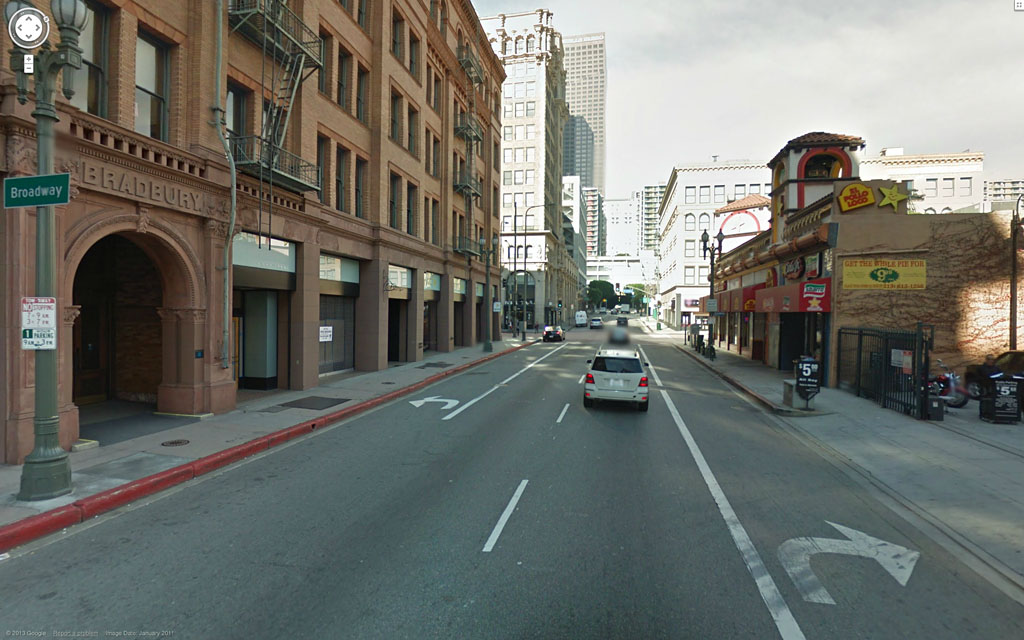
The famous Bradbury Building, left, was constructed in 1893, and is now the oldest office building in Los Angeles.


Tuesday, March 5, 2013

Courthouse Time Capsules

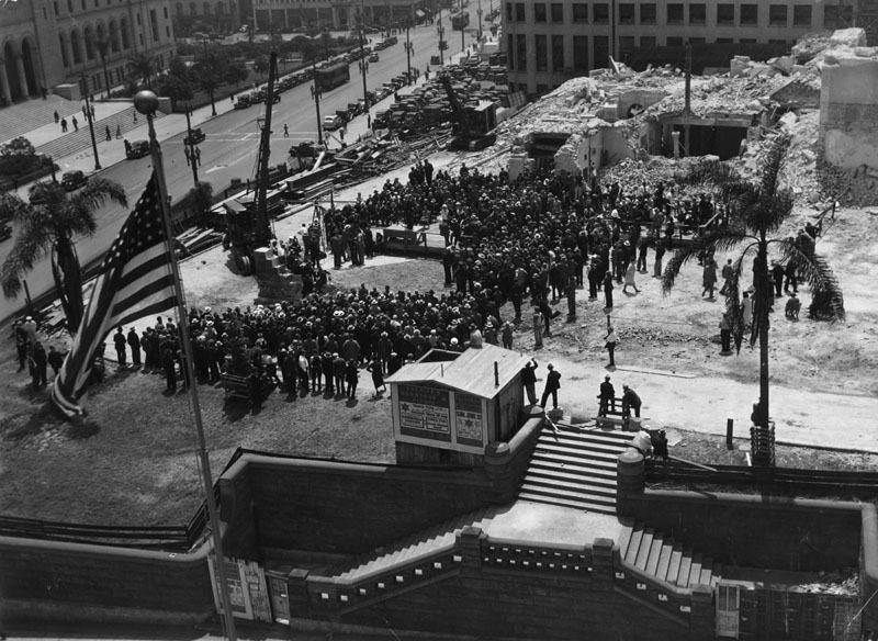
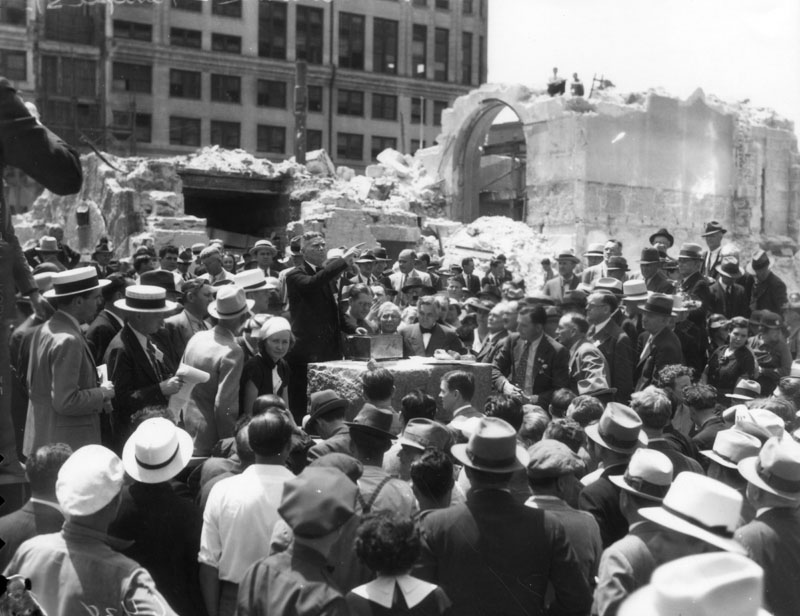
A set of photos of the removal of the cornerstone of the old Los Angeles County Court House, May 12, 1936.

The cornerstone ceremony as viewed from atop the Hall of Justice, across Temple Street. At this point, the cornerstone is still in situ in the small remaining section of wall standing by the crane at left of center.


Courtesy Los Angeles Public Library.

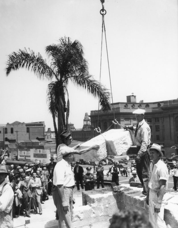
The cornerstone is hoisted free. In the background, at right, across Spring Street, can be seen the rear of the 1909 Federal Building, and to its immediate left, up Main Street, the Baker Block.


Courtesy Los Angeles Public Library.

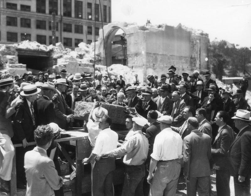
Here, the granite block is being lowered onto a makeshift platform as the assembled crowd looks on.


Courtesy Los Angeles Public Library.

The time capsule – a small box which appears to be made from tin – is about to be opened by Marshall Stimson, president of the Historical Society of Southern California. Inside were various mementos, newspapers, cards and event programs from the Los Angeles of 1888. (Ref: Courthouses of California: an illustrated history, by Ray McDevitt, California Historical Society.)


Courtesy Los Angeles Public Library.

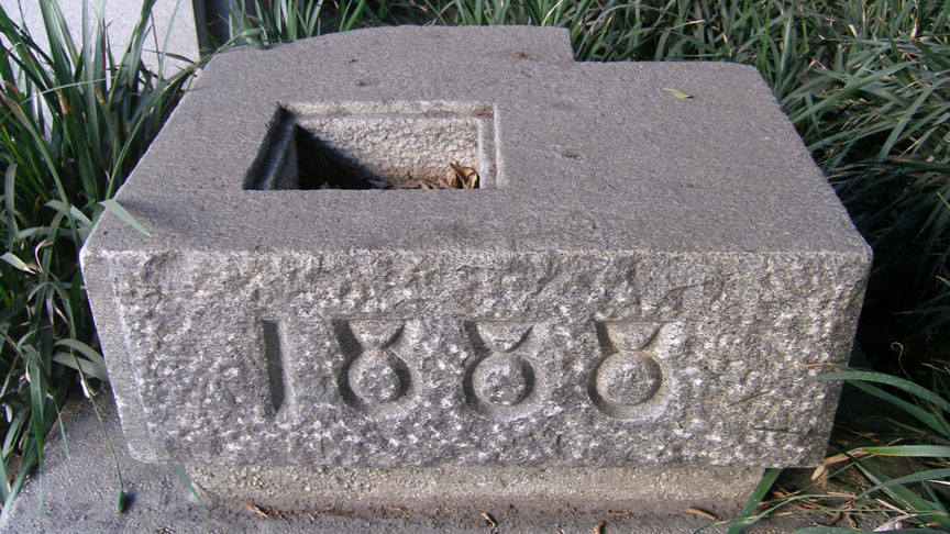
The cornerstone today, on display at the southwest corner of Spring and Temple Streets. It sits in the shadow of the Clara Shortridge Foltz Criminal Justice Center, which has occupied the site of the old Court House since 1972.


Photo by J Scott Shannon.

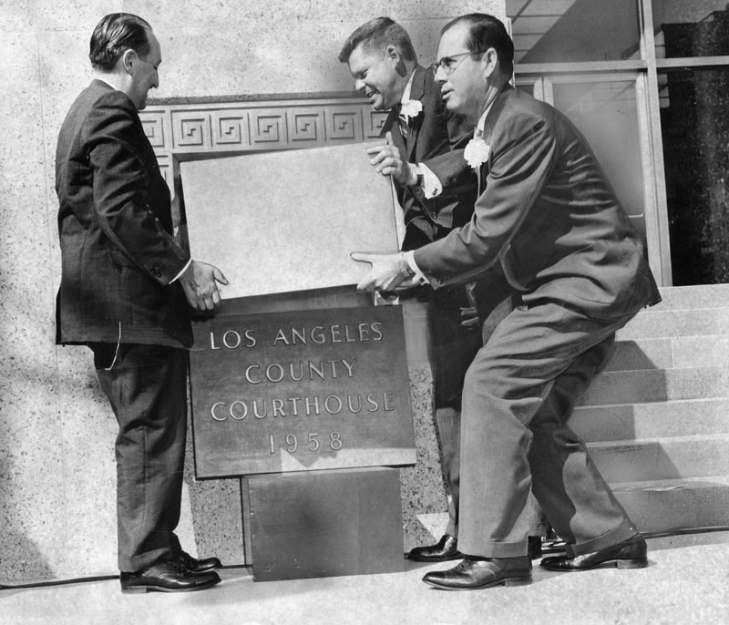
Here, Supervisors Frank Bonelli, Warren Dorn and Kenneth Hahn prepare to place a new time capsule into the cornerstone of the 1958 Los Angeles County Courthouse on October 31, 1958. Now to find out what is in this time capsule!


Courtesy Los Angeles Public Library.