A vanished city lives again...

Tuesday, March 19, 2013

Third Street, Then and Now

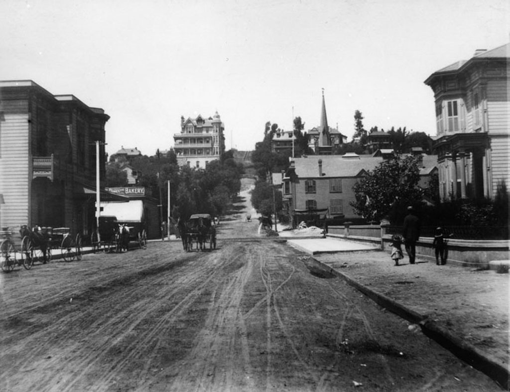
Third Street looking west from Spring Street, circa 1888:


Courtesy Water and Power Associates.

Up on Bunker Hill stands the ornate victorian Crocker Mansion, built in 1886. Next to it, in 1901, another old L.A. landmark would be constructed: the Angels Flight funicular railway.


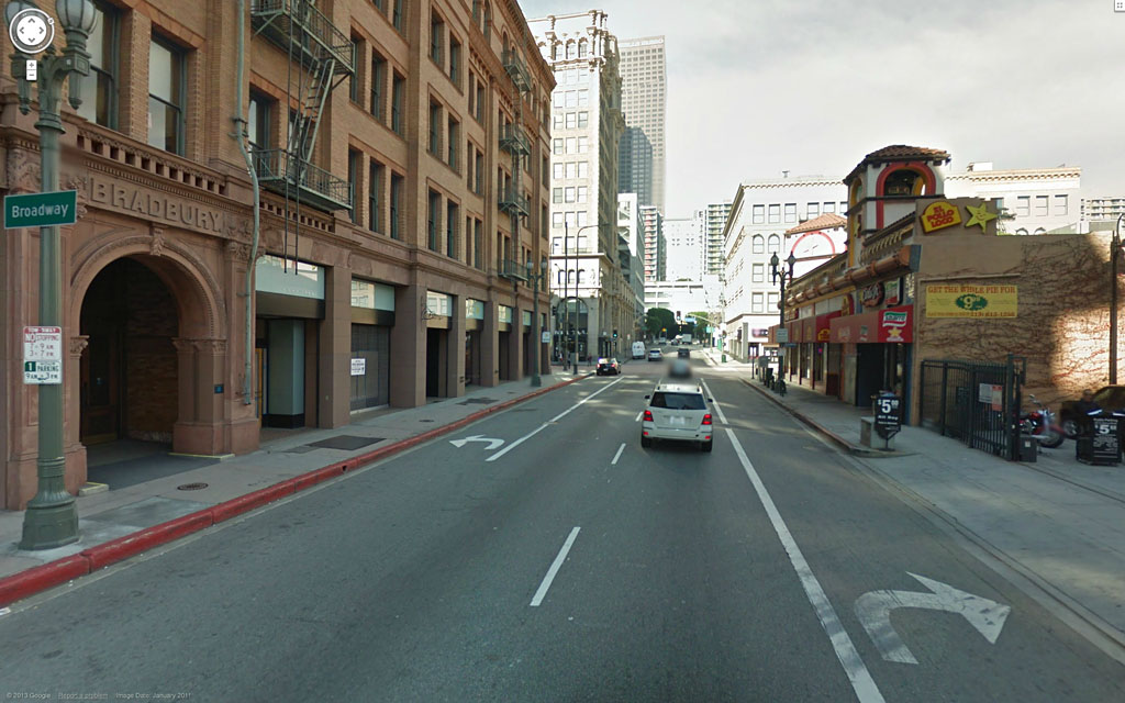
The same view today:


Google Maps Street View.

The famous Bradbury Building, left, was constructed in 1893, and is now the oldest office building in Los Angeles.


Tuesday, March 5, 2013

Courthouse Time Capsules

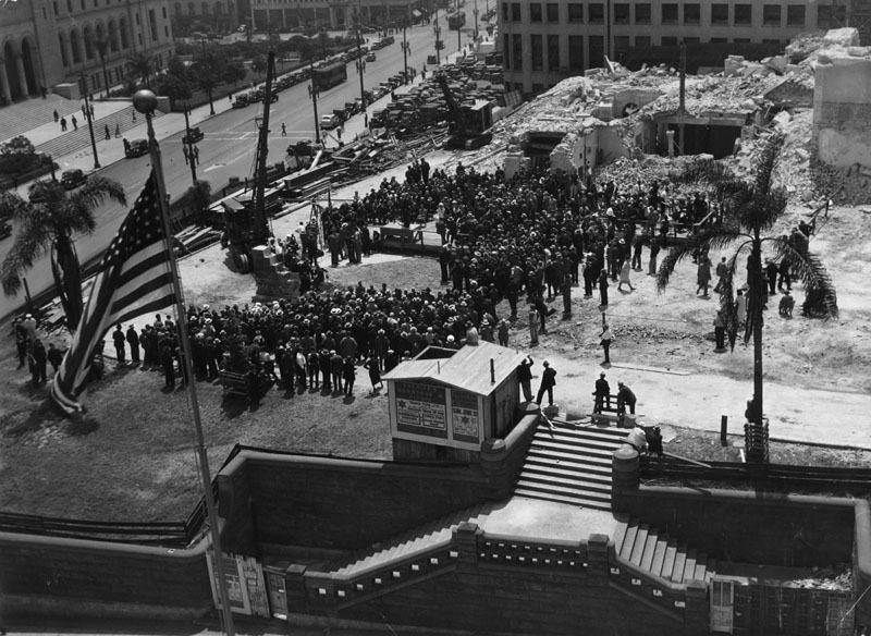
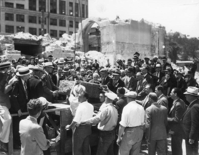
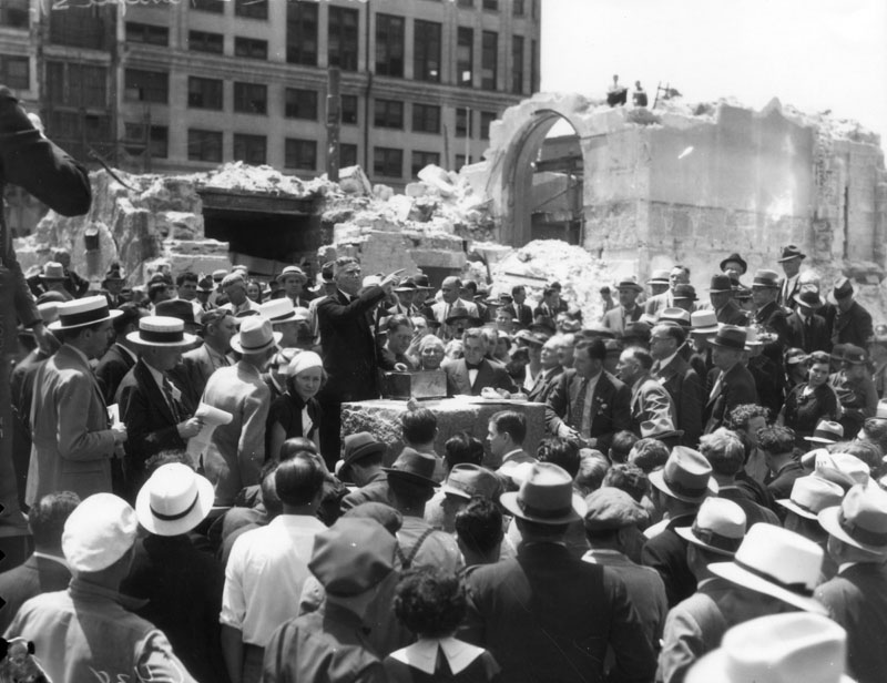
A set of photos of the removal of the cornerstone of the old Los Angeles County Court House, May 12, 1936.

The cornerstone ceremony as viewed from atop the Hall of Justice, across Temple Street. At this point, the cornerstone is still in situ in the small remaining section of wall standing by the crane at left of center.


Courtesy Los Angeles Public Library.

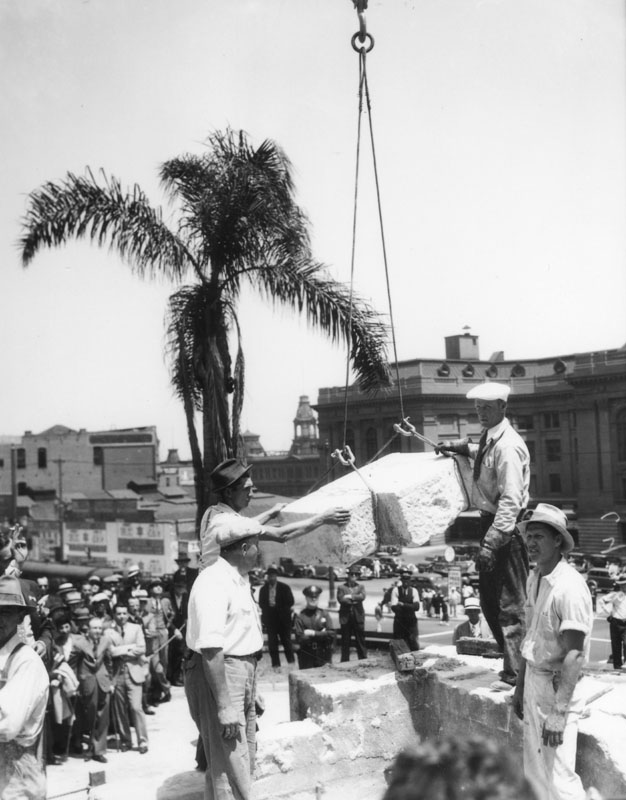
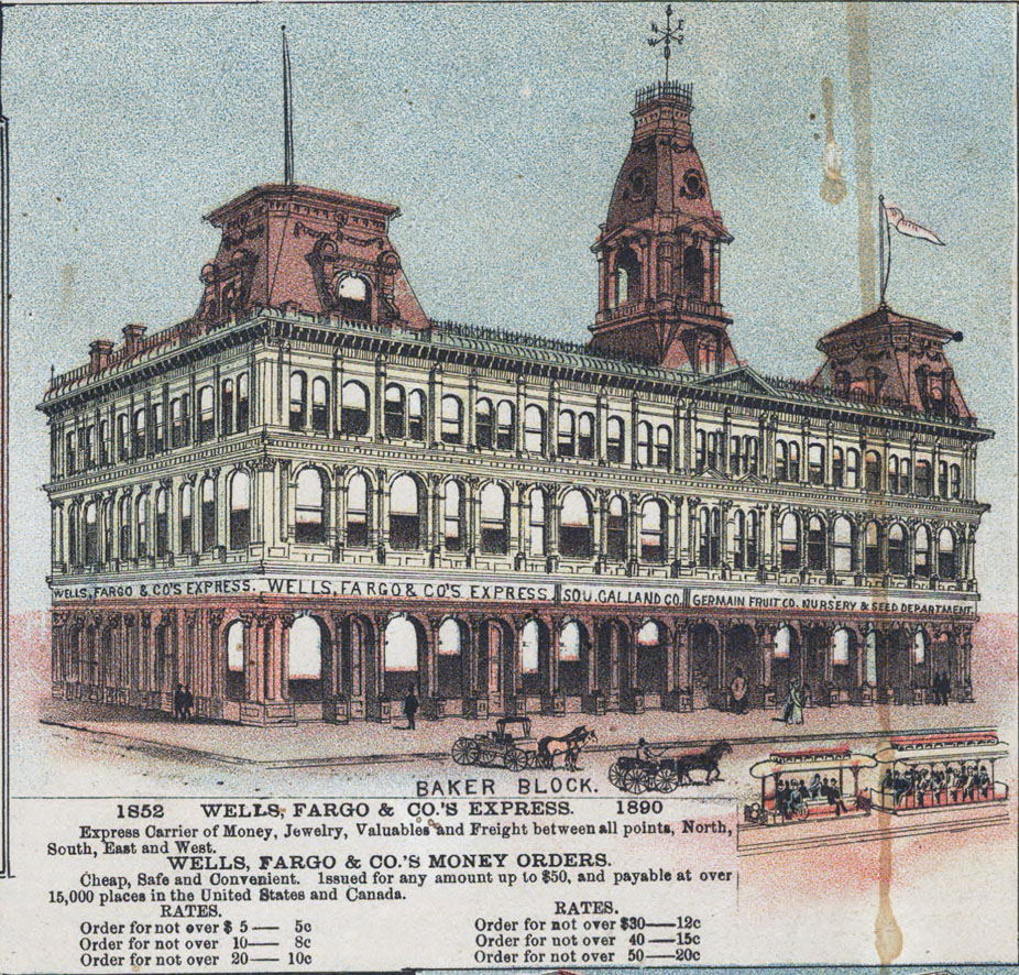
The cornerstone is hoisted free. In the background, at right, across Spring Street, can be seen the rear of the 1909 Federal Building, and to its immediate left, up Main Street, the Baker Block.


Courtesy Los Angeles Public Library.

Here, the granite block is being lowered onto a makeshift platform as the assembled crowd looks on.


Courtesy Los Angeles Public Library.

The time capsule – a small box which appears to be made from tin – is about to be opened by Marshall Stimson, president of the Historical Society of Southern California. Inside were various mementos, newspapers, cards and event programs from the Los Angeles of 1888. (Ref: Courthouses of California: an illustrated history, by Ray McDevitt, California Historical Society.)


Courtesy Los Angeles Public Library.

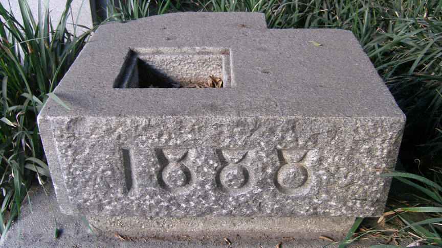
The cornerstone today, on display at the southwest corner of Spring and Temple Streets. It sits in the shadow of the Clara Shortridge Foltz Criminal Justice Center, which has occupied the site of the old Court House since 1972.


Photo by J Scott Shannon.

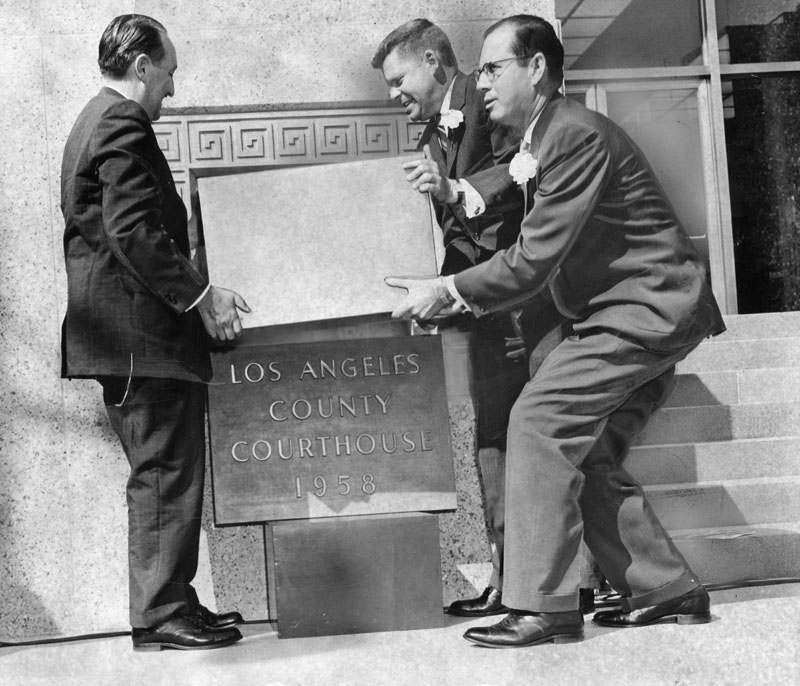
Here, Supervisors Frank Bonelli, Warren Dorn and Kenneth Hahn prepare to place a new time capsule into the cornerstone of the 1958 Los Angeles County Courthouse on October 31, 1958. Now to find out what is in this time capsule!


Courtesy Los Angeles Public Library.


Monday, February 25, 2013

The 1924 Olmsted "Major Traffic Street Plan"

This recent post by Glen Creason on Los Angeles Magazine's City Think blog introduces readers to Frederick Law Olmsted, Jr. et al.'s grandiose "Major Traffic Street Plan" of 1924.

I first acquired this map out of curiosity, mostly because some of the street routes and parkways proposed in it looked significantly different than the ones Los Angeles eventually ended up with.
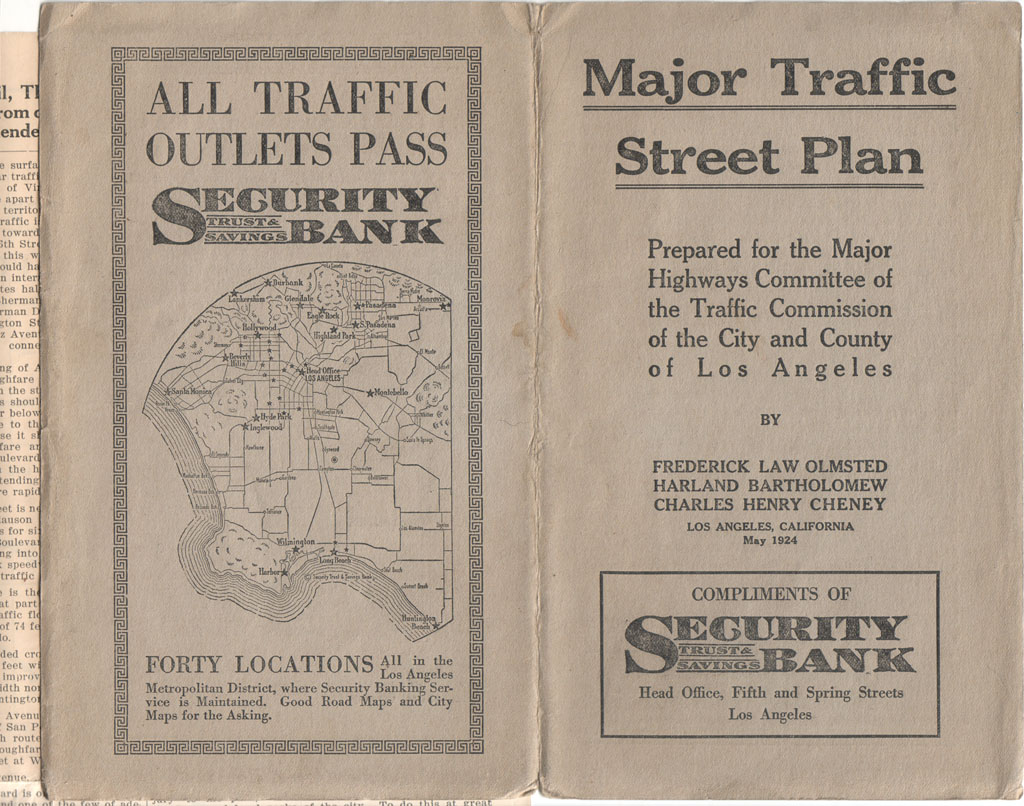
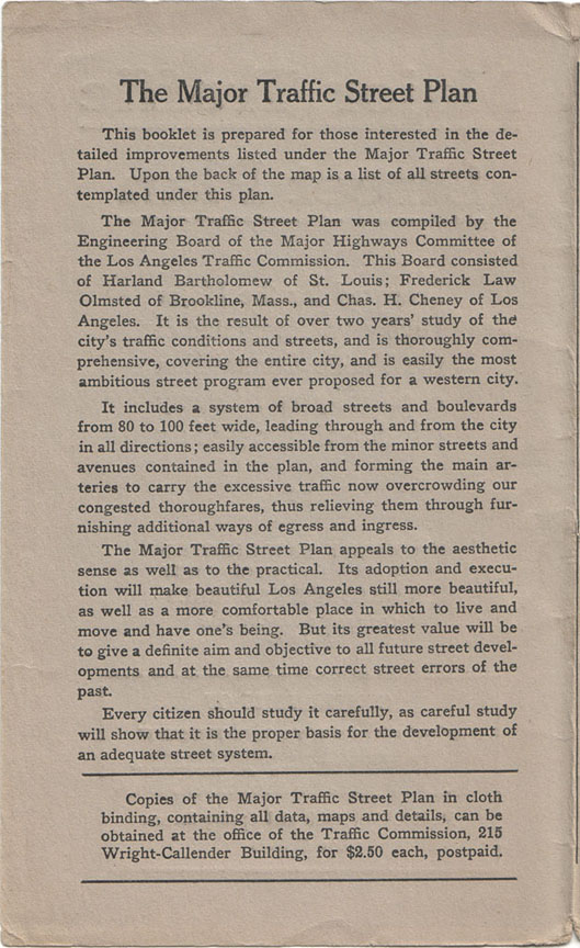
Here's the basic mission statement of the plan.
The legend (the map is far too large for me to scan in its entirety, unfortunately):
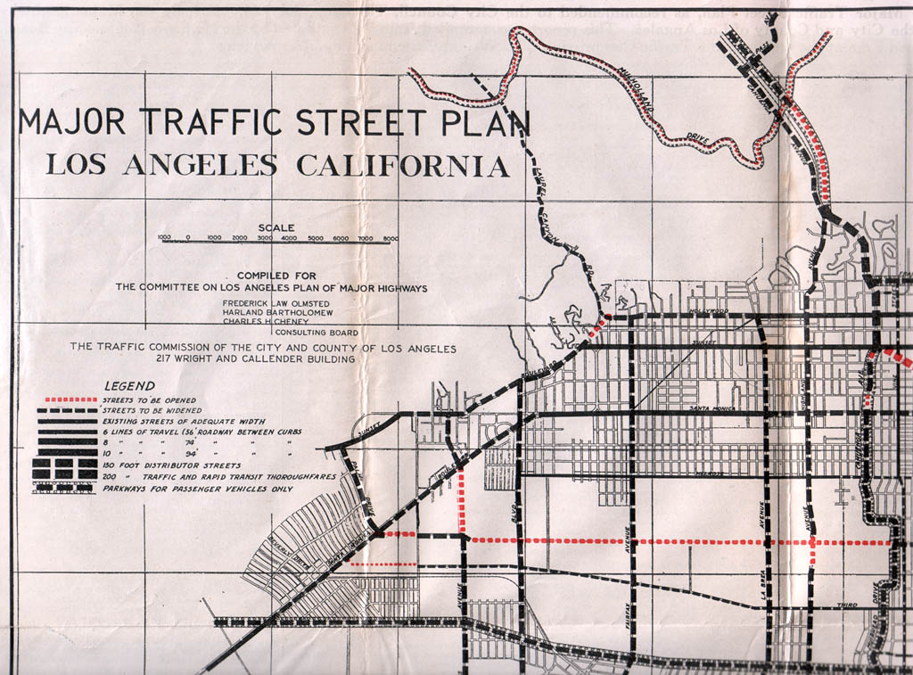
Several new scenic arteries were proposed, one of which was to be called "Arroyo Seco Parkway" (described in the plan as a "radical thoroughfare"). That and "One Hundredth Street" (Century Boulevard) seem to be the only major roads from this plan that ended up being built, though.

One of the rejected proposals was for the Downtown portion of First Street to be widened to 150 feet, and then extended northwest up to Hollywood – clearly a 1924 approximation of what would become the Hollywood Freeway a generation later.

Another interesting proposal was a road called the "River Truck Speedway," which was to run somewhat adjacent to the Los Angeles River and was intended solely for use by commercial vehicles. Obviously this idea didn't get past the drawing board stage, either.

Other proposed roads that were never realized were the "Hollywood-Palos Verdes Parkway," the "Silver Lake Parkway," and parkways for portions of Wilshire Boulevard (west of Crenshaw), Cahuenga Avenue, Riverside Drive, Franklin Avenue/Los Feliz Boulevard, Griffith Park and Mulholland Drive.

The Olmsted plan was admittedly visionary in foreseeing the need for wide urban roads that incorporated a variety of modes of rapid transit, but it was probably for the best that it was not adopted. The present system of freeways, although not without its own inherent problems, turned out to be a much better fit for Los Angeles's ever-evolving traffic challenges.


Sunday, February 17, 2013

La Placita Olvera

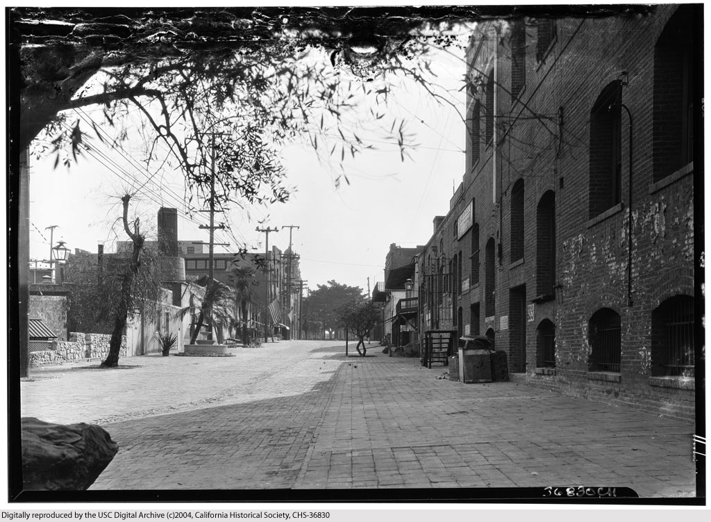
More than a little strange to see Olvera Street without any vendor kiosks or restaurants! This photo was taken just prior to the dedication of El Paseo de Los Angeles in 1930. We're looking south here, toward the Plaza.


U.S.C. Digital Library
/California Historical Society.


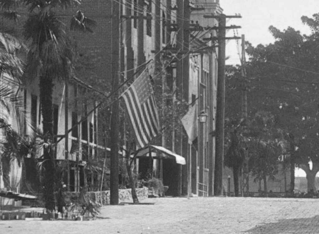
In the distance, two flags can be seen hanging from the front porch of the Avila Adobe: La Bandera de México, and the Stars and Stripes. Zooming in, it can be seen that there are 30 stars in the union. This was the flag of the United States when California became the 31st state in 1850. (The 31-star flag became official on July 4, 1851.)


Credit as above.

Thanks to ProphetM from the Skyscraperpage.com 'noirish Los Angeles' thread for identifying this photo as Olvera Street.


Saturday, November 24, 2012

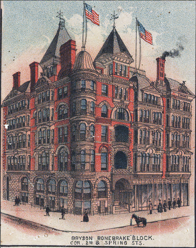
1891 Landmarks

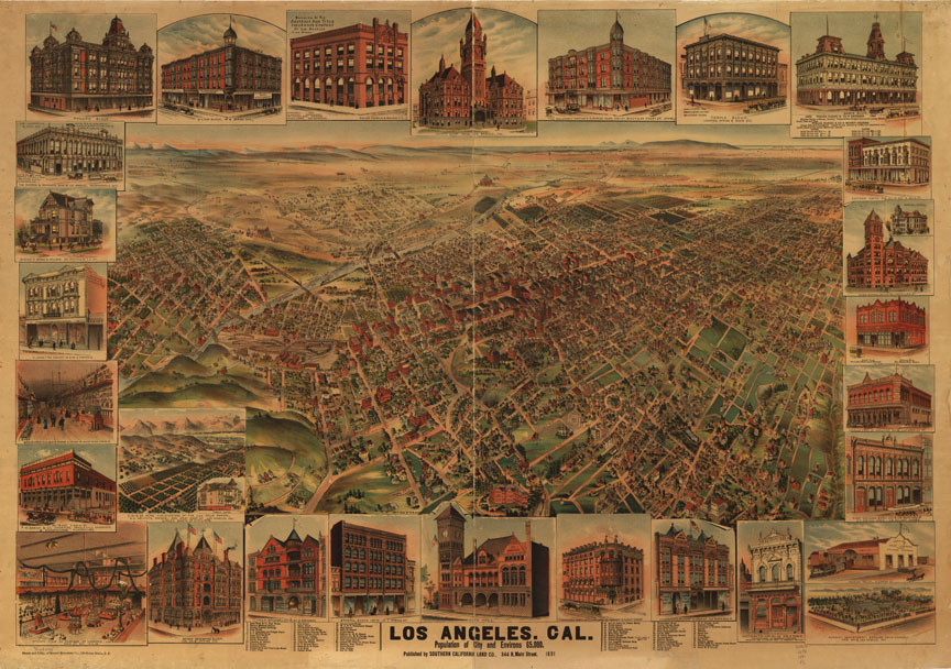
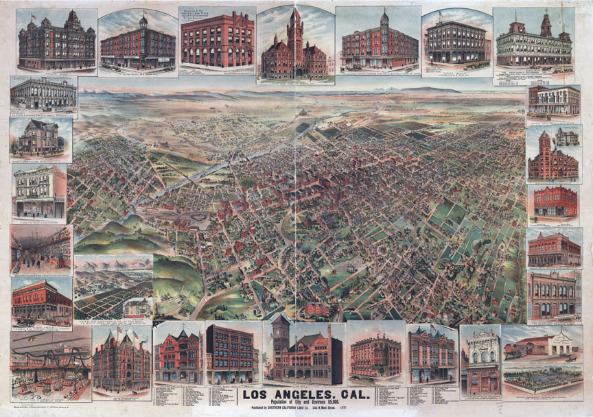
Apologies for the hiatus. Seemingly endless computer snafus and trainwrecks in my personal life have kept me from spending more time indulging in my favorite avocation. Anyway, recently, I used Photoshop to do a little color mod of this panoramic map of Los Angeles from 1891. The highly-foxed original image cleaned up rather well, I think!

Before:

Library of Congress.


After:

Library of Congress.


The buildings depicted in the margins are worth a much closer look.


Library of Congress.


Library of Congress.


8 more behind the jump!

Tuesday, October 2, 2012

The oldest building in Los Angeles?

Many have already heard about the emerging realization that the Sanchez Adobe in the Baldwin Hills may be the oldest building in Los Angeles.

Although the structure bears the Sanchez name, it is believed to have actually been built by unknown rancheros fifty years before the land was first deeded to Don Vicente Sanchez in 1843.

This 1840s map depicting the boundaries of "Rancho del Paso de la Tijera" shows the little cottage whose existence has now spanned four centuries.


Hispanic-Heritage Links at the National Archives.


The former Baldwin Ranch, circa 1926. The Sanchez Adobe is the taller white building to the left of center.


Courtesy U.S.C. Digital Library.


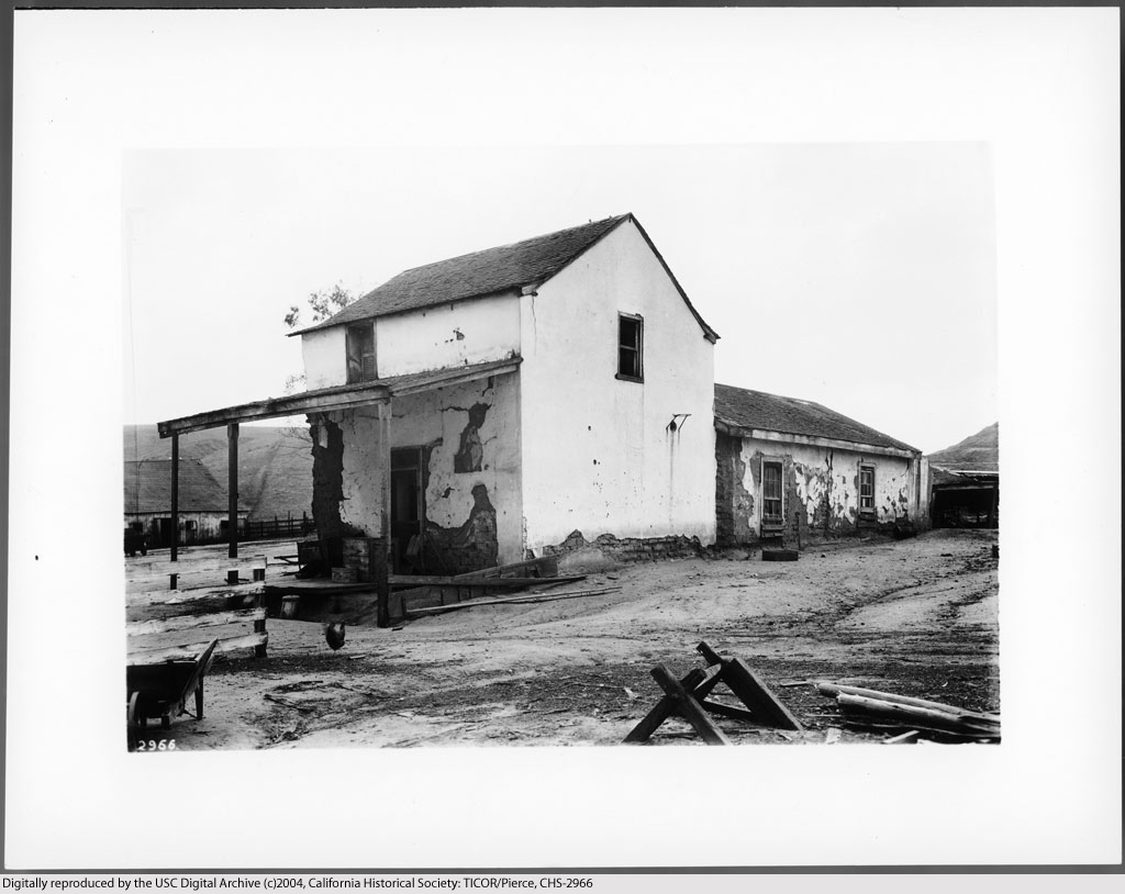
Casa de Sanchez, ca. 1924. At this time, the house was already 130 years old.


Courtesy U.S.C. Digital Library.


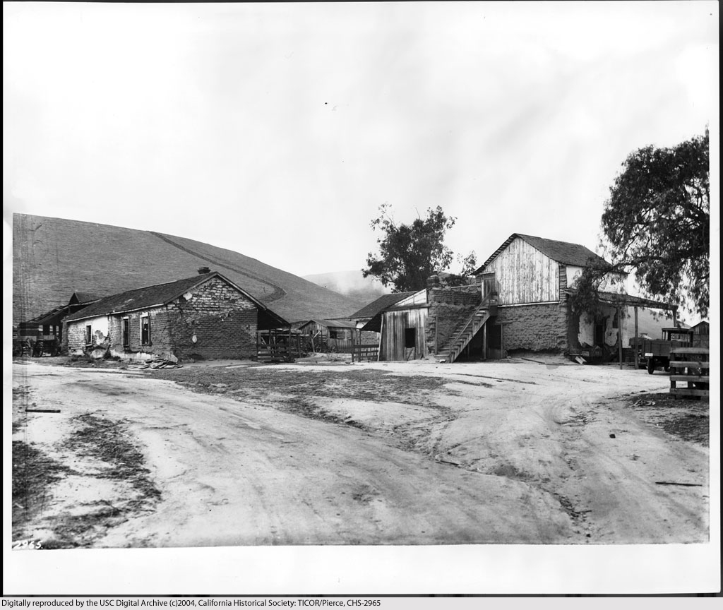
Another view of the Sanchez house (right) in the 1920s. Does the adobe outbuilding at left still survive? A modern aerial view suggests a possibility that it may.


Courtesy U.S.C. Digital Library.


Only a few years later, the two-storey Sanchez house was incorporated into a much larger modern structure that still stands today at 3725 Don Felipe Drive.


Courtesy U.S.C. Digital Library.